Skip to content

Water quality

By Christian Thorsberg, Circle of Blue

The Great Lakes News Collaborative includes Bridge Michigan, Circle of Blue, Great Lakes Now at Detroit PBS, Michigan Public and The Narwhal who work together to bring audiences news and information about the impact of climate change, pollution, and aging infrastructure on the Great Lakes and drinking water. This independent journalism is supported by the Charles Stewart Mott Foundation. Find all the work HERE.


Growing up in the shadow of a coal plant in rural Indiana gives a child a unique relationship with the passage of time. 

As a little girl in the small town of Wheatfield, population 900, Barb Deardorff recognized the months by the height of the cornstalks and beansprouts which grew on her family’s farmland. The years were marked by what loomed beyond these fields — the R.M. Schahfer Generating Station and its ever-rising piles of toxic coal ash, their ascending silhouettes a scourge framed for years by her school bus window. 

“My whole childhood, thirteen years, twice a day to and from school, I was watching the coal ash landfill build up layer by layer,” says Deardorff, now 50 years-old, in her Wheatfield home in June. 

Deardorff’s kitchen today looks out onto a long, flat treeline, above which, just a couple miles away, the flues of that same half-century-old coal plant continue to billow smoke. They stand as readily visible emblems of an old energy era giving way to a new energy revolution that is putting fresh water, clean air, and human health at risk in small Great Lakes communities.

Wheatfield is a microcosm of industrial eras old and new. Having endured for decades the transformational effects of living in the midst of America’s 20th-century coal boom, residents are now left to wonder and worry how the age of artificial intelligence — bolstered by hyperscale data centers and the power plants they depend on — will affect their community.

These concerns are justified. In the past two years, aided by state and federal policy, the tech giant Amazon has invested roughly $29 billion to turn Northwest Indiana into what it calls a new “Silicon heartland,” flush with three energy-intensive data center campuses, one already completed, spanning 2,200 acres. Next door to the Schahfer generating station, Indiana approved two natural gas-fired turbines for construction. Those plants are poised to power the newest Amazon installation — a $7 billion data center — and are estimated to consume roughly 6 billion gallons of water annually from the nearby Kankakee River.
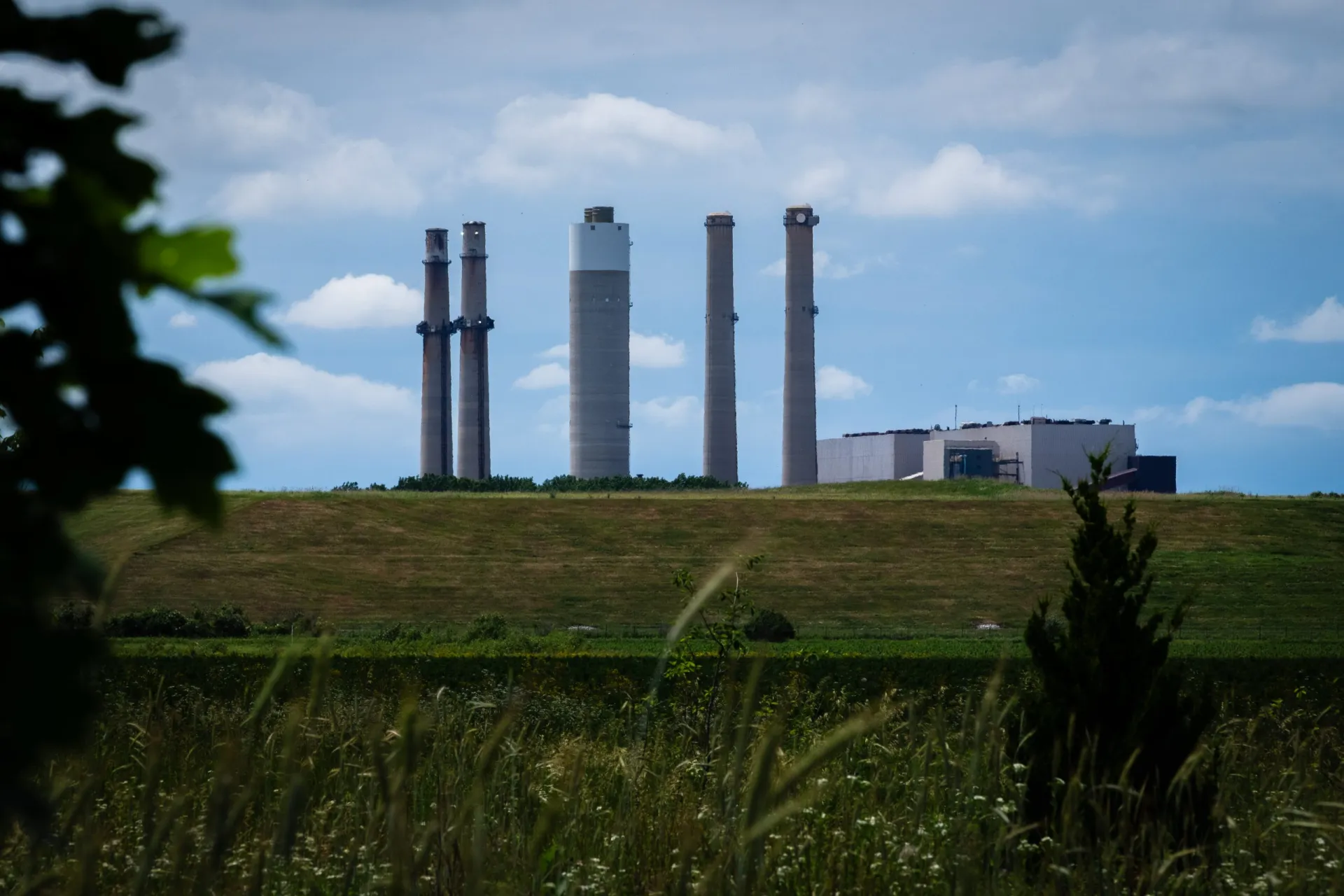
The R.M. Schahfer Generating Station in Wheatfield, Indiana. (Photo credit: Christian Thorsberg / Circle of Blue)

Amazon found a ready ally in the Hoosier state, which has embraced data centers and their thirst for power. Last year, state regulators granted the region’s primary utility first-of-its-kind authority to generate energy just for data centers. And in response to Trump administration directives, officials have re-written state energy policies to keep old coal plants — including Schahfer — operating to supply data centers indefinitely. 

Experts anticipate that by 2040, more than one-fifth of Indiana’s energy needs will come from data centers alone. 

The surge in construction investment and new power supply coincides with a comprehensive weakening of environmental protections on both the local and federal level — a risky proposition in a state that already is home to some of the most polluted waters, largest losses of wetlands, and worst air quality in the country. 

Deardorff has a front row seat to a show of power and technology unlike anything seen before in this region, or across the country. Like other residents of rural communities bullied by data center construction, she says she feels almost helpless. As someone whose conception of time is inseparable from Schahfer, she says she feels suddenly entangled in multiple discouraging realities.

“Everything, everywhere,” she says, “is happening all at once.”
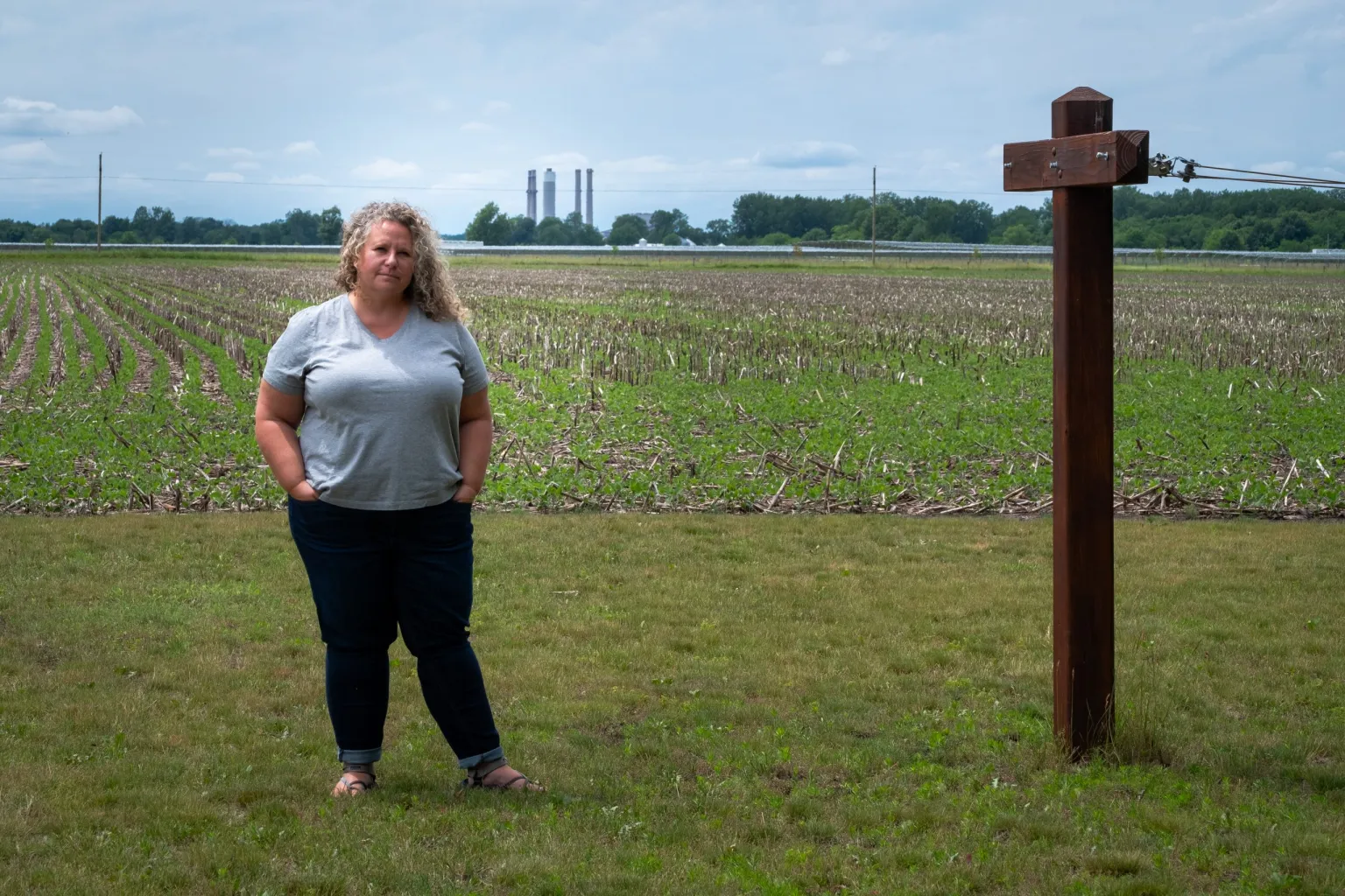
Barb Deardorff, pictured outside her home, with the Schahfer plant behind her in the distance. (Photo credit: Christian Thorsberg / Circle of Blue)

What Was and Is No More

Deardorff has reason to be suspicious of the mammoth display of technology and energy generation under construction around her home. 

She has not known life without the R.M. Schahfer Generating Station as a neighbor. She was an infant when the coal-fired power plant opened its doors in 1976, and has lived next to its operations ever since, watching it become one of the country’s largest single emitters of greenhouse gasses. By one estimate, the plant causes 20 premature deaths each year from drifting soot and smog. And its groundwater, recent testing has shown, is contaminated with carcinogenic heavy metals — an existential threat for the dozens of residents who live within several miles of the facility and rely on shallow private wells as their sole source of drinking water. 

So when Schahfer announced in 2018 that it would close its doors at the end of 2025, celebrations rang out for many. The prospect of life without the plant represented, literally, a brand-new horizon.

“I got emotional, because I thought we outlasted them,” says Deardorff, whose family has lived in Wheatfield for six generations and previously farmed the land where the coal plant sits. “We were here before them, we dealt with them, and I thought we were going to be here after them.”

Residuals of Ash

This dream was short-lived. Not only has a series of 90-day extension orders from the federal government kept Schahfer operational as usual into the present, but the plant’s legacy of waste and health concerns are crescendoing. Deardorff and others worry that the new landscape of data center and natural gas construction and operation could eventually produce more degradation. 

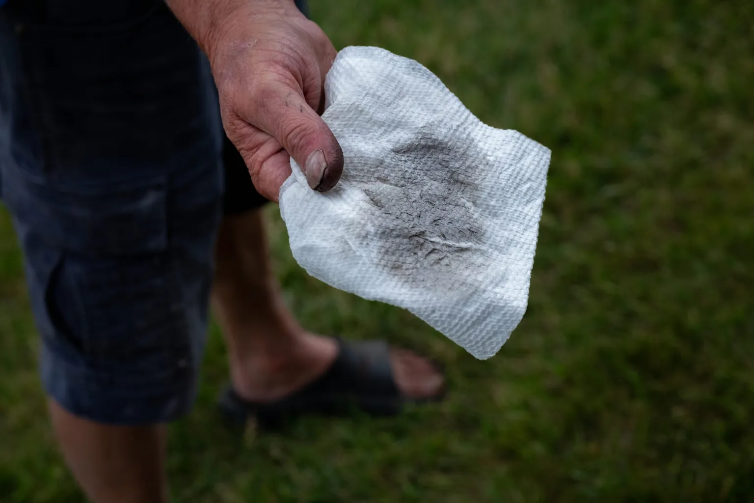
At the Wheatfield home of Chris Hunter, a retired local farmer, coal ash’s stubborn tendency to permeate water and air lays bare. Just hours after severe thunderstorms and tornadoes tore through the town, Hunter’s wife, Cindy, ran a paper towel along the white exterior window sills of their home, located roughly two miles downwind from Schahfer.

Immediately, a dark, sooty film appeared on the pristine white background, the now-darkened paper towel a canvas that distills Wheatfield’s modern story.

“You just get it jammed down your throat,” Hunter says, looking out at the coal plant from his front lawn and thumbing through the wipe. “And we watch it all through our windows.”

In a state known for its high cancer rates — Hoosiers are nearly 12 percent more likely to die from the disease than the average American — Northwest Indiana where Hunter and Deardorff live stands out as a statewide hotspot for incidences of lung, colon, and breast cancers. 

The statistics are made material in Wheatfield, where many residents living in the vicinity of Schahfer share stories of family members and friends who have suffered from poor health. 

Deardorff recalls several neighbors and friends who have been diagnosed with cancer in recent years. Matt Mish, 35, who lives within a half-mile from the coal plant on his grandparents’ old farm, says that his grandmother died of cancer in 2015. 

Hunter says he lost his younger brother at 52 years-old to a rare type of cancer, and his father to liver cancer at 62 years-old. His mother, 90, has lived with Parkinson’s disease for more than two decades. 

“But how are you gonna really prove it,” Hunter asks, “and say it was [the coal plant]?”

All of these residents breathe Wheatfield air, and are among the dozens of people who rely on private wells to draw groundwater from the shallow local water table. Existential concerns for the quality of this supply were raised in 2018, when testing showed that Schahfer’s coal ash landfill had contaminated the plant’s own groundwater with cobalt, arsenic, lithium, radium, boron, and molybdenum in levels above federal thresholds. 

Meanwhile, water samples collected at 107 wells in and around the plant between 2010 and 2019 found that 86 percent had at least one pollutant in excess of federal advisory levels, according to Earth Justice’s Ash Tracker dashboard

“And we only found out about that because a law passed requiring [the plant] to publicly make that data available,” Deardorff says. “Who knows how long they had contaminated the groundwater before then?”

Indra Frank, a doctor and coal ash advisor with the Hoosier Environmental Council, says there is significant concern that the plant’s polluted groundwater will spread through the area’s shallow, flood-prone topography and contaminate wells and ditches that supply water used for drinking, recreation, and irrigation, especially as construction on the natural gas plant and data center begins.

The plant’s own ash-contaminated groundwater, held largely in unlined ponds spanning more than 80 acres, sits at least 15 feet higher than the groundwater that area residents depend on. 

A one-foot-thick wall of slurry, which extends underground to a layer of shale bedrock, is all that separates the plant’s active waste disposal area (WDA) from the rest of the region’s aquifer. This setup, Frank warns, is precarious. Currently, the WDA receives an average of 2.88 million gallons of “bottom ash sluice water, boiler room sump discharge, and stormwater” per day, according to documents published in 2020.

“You’ve got 15 feet of water pressure trying to push that water out from under the slurry wall,” Frank says. 

For a brief period, it was believed that federal intervention would spur remediation at the site. The EPA in 2015 announced a mandate requiring utilities to clean unlined coal ash ponds that were found to be leaking. But the requirement had several loopholes, Frank says, that the coal plant’s owner, energy utility NIPSCO, has exposed to delay any cleanup.  

“They’re claiming that the ash pond is not subject to the rule, because water isn’t visible at the surface of the ponds,” she says. “Some of these ponds, which are 20 feet deep, hold 19 feet of sitting water beneath their solid top layer.”

The slow-walk to addressing its coal ash storage may have paid off for the utility, which last year produced 200,000 tons of ash. In April, the EPA proposed aggressive rollbacks to the 2015 rule, putting Wheatfield’s coal ash piles in a doubly prolonged state of limbo. 

“It would wipe out requirements for half the coal ash in the country, and that includes some of the coal ash at Schahfer,” Frank says. “It can continue to sit there and contaminate groundwater. They could stop monitoring the groundwater for certain sites. It’s pretty, pretty devastating.”

That the Kankakee River runs directly adjacent to the Schahfer plant is another point of vulnerability. No systematic testing of soils or farmland in the area has ever been done, despite Jasper County being home to some 600 farms. Many of these crop fields rely on the Kankakee River for water, and are connected to both each other and the watershed through a series of drainage ditches. This network was created in the 20th century through the mass-draining of a massive wetland ecosystem once known as “the Everglades of the North.” 

As a result of this degradation, most of the area, including some of the coal ash ponds, sit today within 100-year flood zones. Heavy, erratic precipitation made more likely by climate change could exacerbate the movement of contaminated groundwater through farmers’ ditches and crops. 

According to a February report from the Hoosier Environmental Council, based on state data, 270 miles of rivers and streams in Jasper County are impaired. A one-off sample at a local irrigation ditch that runs adjacent to Schahfer, the Stalbaum ditch, was found to contain elevated levels of molybdenum. “That’s consistent with contamination from coal ash getting into that ditch, which runs into the Kankakee River,” Frank says. 

Deardorff grew up swimming in the river, but those days are long over. “I’m concerned about the effluent they emit into it,” she says. “I can see the pipe, I know where it comes out, and I’m never in the water downstream of it.”
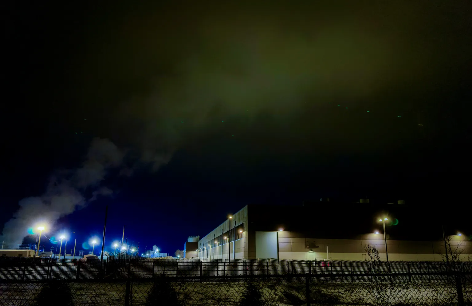
An $11 billion, 1,200-acre Amazon Web Service data center in New Carlisle, Indiana. (Photo credit: J. Carl Ganter / Circle of Blue)

Data Centers’ Indirect Water Use

Concerns about the environmental risks of data centers in Wheatfield center for the time being on water availability. 

On the surface, the new Amazon data center’s estimated yearly water use — between 8 million and 10 million gallons, according to Jasper County Plan Commission documents — is hardly eye-opening, especially for a facility of its size. 

But the much-greater water needs of the two fossil fuel-fired plants operating in its service expose the resource stress the industry indirectly creates. 

In Wheatfield, the Kankakee River is poised to feel the consequences the most.

According to Indiana Department of Environmental Management data, the Schahfer coal plant’s intake well — located in an area of medium-high water stress, according to the World Resources Institute — has the capacity to draw 131 million gallons of water per day from the river. Actual withdrawals from 2022 through 2024 were much less, though not insignificant, according to self-reported data collected by the state: an average of roughly 11.5 million gallons of river water per day, with peak days reaching 25 million gallons of water. 

Much, but not all, of this water is returned to the Kankakee at a higher temperature after being treated on site. And this treatment is crucial and subject to scrutiny: in 2024, which is the most recent data available from the EPA, wastewater stored on-site included 567,763 pounds of chemicals including arsenic, barium, lead, and mercury.

That same year, the coal plant consumed roughly 940 million gallons of river water, according to data collected by the U.S. Energy Information Administration and analyzed by Circle of Blue.

The natural gas turbines are expected to have an even bigger footprint. According to GenCo testimony from this April, the facility plans to draw up to 23 million gallons of water per day from the Kankakee, consuming roughly 16 million gallons of this — amounting to an estimated 5.8 billion gallons of water consumed annually.

The total indirect cost of water, then, sums to nearly 7 billion gallons of water per year — enough water to supply approximately 64,000 American homes for a year — consumed from the Kankakee River in service of electricity production for Indiana’s ‘Silicon Heartland.’


The post The AI Boom Is Prolonging Indiana’s Fossil Fuel Era, With Hidden Costs for Water appeared first on Great Lakes Now.

Original Article

Great Lakes Now

Great Lakes Now

https://www.greatlakesnow.org/2026/07/15/the-ai-boom-is-prolonging-indianas-fossil-fuel-era-with-hidden-costs-for-water/
Circle of Blue

By Isabelle Tavares, Planet Detroit

This article was republished with permission from Planet Detroit. Sign up for Planet Detroit’s weekly newsletter here.


A person standing on the Detroit River shoreline 50 years ago would hesitate to touch the water, according to the Friends of the Detroit River’s McKenzi Waliczek.

The progress made since that era — from industrial dumping ground to a beloved recreational and tourist attraction — framed a boat tour led by the nonprofit that departed from the Detroit Wayne County Port Authority, circled Belle Isle, and highlighted river restoration projects.

An estimated 3.6 million cubic yards of contaminated sediment remains on the U.S. side of the Detroit River, or enough sediment to fill thousands of dump trucks lined up for miles, said Waliczek, director of programs for Friends of the Detroit River.

The price tag for the cleanup is about $1 billion, she said. 

The Great Lakes Legacy Act provides a 65% federal match for nonfederal restoration funding, but the incentive depends on reauthorization of the Great Lakes Restoration Initiative. 

Friends of the Detroit River needs about $350 million in nonfederal matching funds to reach the $1-billion funding goal for the Detroit River cleanup.

The effort secured $10 million last month from an EPA and EGLE partnership.

Detroit River: Critical Great Lakes waterway

As the Samuel D. Buchanan, a boat operated by a second-generation captain, cruised down the Detroit River, passengers took in the views of Milliken State Park, Belle Isle’s Lake Okonoka, the island’s south fishing pier, and Blue Heron Lagoon.

The tour also visited Lakewood East Park and the Harbortown and Harbortown Upstream sediment remediation sites.

“The Detroit River isn’t just water, it’s where people fish to feed their families, where folks learn to kayak and boat, where entire ecosystems depend on what’s happening beneath the surface,” Waliczek said. 

“For over a century, industry powered this region, but it also left behind contaminated sediments, damaged habitats, and shorelines that no longer function naturally.” 

The U.S. shoreline of the Detroit River has lost approximately 97% of its coastal wetlands to human development, according to a 2017 study by the U.S. Fish and Wildlife Service and U.S. Geological Survey. 

“The Detroit River is one of the most biologically important waterways in the Great Lakes,” Waliczek said. 

“Every spring millions of fish move up through this river to spawn, countless birds, reptiles, amphibians, mammals depend on the small amount of habitat that remains and the habitat that we are restoring.” 

The challenge of Detroit River contamination

Contaminants including PCBs, PAHs, and mercury were identified from more than 1,000 sediment samples from the Detroit River, said Sam Noffke, aquatic biology specialist with the Michigan Department of Environment, Great Lakes, and Energy. 

The contaminants persist in the environment and accumulate in the food chain, he said.

As the self-described “contaminated sediment guy,” Noffke has worked on Detroit River remediation “nonstop” for more than a decade, he said. 

Noffke started by examining 40 years of sediment data to get an idea of areas to prioritize for cleanup, he said. 

Members of the boat tour recalled a long list of shoreline industries, such as the Superfund site McLouth Steel in Trenton, and the Uniroyal Tire plant once located west of the MacArthur Bridge to Belle Isle. 

Noffke said disposing of contaminated sediment remains a challenge, as the Pointe Mouillee confined disposal facility is nearing capacity. The facility, located on a small island at the mouth of the Huron River, is expected to run out of space in four years, according to a September 2025 Detroit News report. 

EGLE, the U.S. Army Corps of Engineers, and Environmental Protection Agency are discussing alternatives, such as raising dikes at Pointe Mouillee to increase capacity, creating new confined disposal facility cells, or possibly reusing clean material, Noffke said. 

“That’s a major hurdle we are trying to deal with.”

The 700-acre Detroit River Area of Concern extends the length of the river, from Lake St. Clair to Lake Erie.

Detroit River group kicks off final priority habitat restoration project

The habitat restoration effort spearheaded by Friends of the Detroit River includes 13 completed projects.

The EPA and National Oceanic and Atmospheric Association are some of the Detroit organization’s partners on the restoration projects. 

The habitat projects will be removed from the Area of Concern list within three to four years by addressing two beneficial use impairments related to fish and wildlife habitat, Waliczek said.

Detroit’s Lakewood East Park is the 14th and final priority habitat restoration project in the Detroit River Area of Concern.

The project includes nearly 1 mile of Detroit River shoreline and adjacent canals where the river meets Lake St. Clair. The plans call for removing much of the seawall and restoring the natural shoreline, Waliczek said.

Although surrounded by neighborhoods and hardened shorelines, the Detroit park’s canals, wetlands, and open shoreline provide significant restoration potential, Waliczek said, benefiting fish that migrate between Lake Erie, Lake St. Clair, and the broader Great Lakes system.

Friends of the Detroit River Executive Director Tricia Blicharski said the Lakewood East Park project is scheduled to begin this month, with a three-year timeline. Community engagement and plan review will begin immediately, and construction is expected to start in spring 2027, she said.

‘We all have a role to play’

At Belle Isle, restoration projects at Blue Heron Lagoon and Lake Okonoka are improving fish and wildlife habitat by deepening the lake, creating fish nursery areas and opening previously enclosed water to the Detroit River, said Terry Heatlie, a habitat restoration specialist under contract with NOAA.

One of the tour attendees, Terry Campbell, recalled fishing on Belle Isle with her father. The pier near Blue Heron Lagoon was “always” filled with anglers, she said.

“You ate the fish, and arguably it was more contaminated back then than it is now, but it was a part of how you fed the family in the summertime,” she said.

Detroiter Erma Leaphart, a retired Sierra Club organizer in the Great Lakes program, said she would spend time by the river before the riverwalk was built, chatting with fishermen along the river. 

“I loved just sitting on the river, watching the freighters, waves, the breeze, these guys who were like family, even though I didn’t know them, but I knew them as fishermen,” she said.

Everyone has a stewardship responsibility, Leaphart said.

“We all have a role to play, whether it’s teaching young people about it, whether it’s the stewardship part,” she said. “You have an ongoing responsibility to protect the asset, protect what you’ve done, and protect it for future generations.”

The post Detroit River tour highlights restoration successes, $1-billion cleanup hurdle: ‘We all have a role to play’ appeared first on Great Lakes Now.

Original Article

Great Lakes Now

Great Lakes Now

https://www.greatlakesnow.org/2026/07/10/detroit-river-tour-highlights-restoration-successes-1-billion-cleanup-hurdle-we-all-have-a-role-to-play/

Planet Detroit

By Danielle Kaeding, Wisconsin Public Radio

This article was republished here with permission from Wisconsin Public Radio.


Situated on the shores of the largest body of freshwater in the world by surface area, you wouldn’t think there’d be a battle over water in Superior. But one is brewing over how that water gets to residents’ homes, or more specifically, who brings it there. For more than a century, it’s been piped in by a private company, Superior Water, Light & Power, now a division of Duluth-based Allete, and it’s the only privately owned water utility in Wisconsin. 

Superior Mayor Jim Payne would like to change that.

Paine spoke with WPR’s Robin Washington on “Morning Edition” about the city’s potential acquisition of the utility, for which the city and Superior Water, Light & Power have presented differing cost estimates.

Washington also spoke with Bill Fennessy, a spokesman for the Superior Community Coalition, a residents’ group siding with the utility against the sale.“Not only do we have the only private water utility in Wisconsin, we have the most expensive water in Wisconsin. We have the most expensive water on Lake Superior. And that’s because this is the only place where Lake Superior water is sold at a profit,” he said.

The following interview has been edited for brevity and clarity.

Robin Washington: The city commissioned an independent study that said it would cost $58 million to take over the water utility. Can the city afford it? And would taxpayers be footing the bill?

Jim Paine: The city can absolutely afford it. In fact, we can’t afford not to. The public is paying that cost right now. We’re merely taking over the payments on the existing infrastructure. When we take over the payments, yes, we will have to take out a bond, which we can definitely afford to pay for. But our interest rate will be 3.5 to 4 percent, less than half what we are paying now.

RW: What’s a typical water bill right now, and what would it be after you took it over?

JP: There is no typical water rate in the state of Wisconsin. Everybody’s is different. What we do know is that cities like Ashland, like Wausau, like Waukesha, that have invested hundreds of millions of dollars into their infrastructure, all still have lower rates than the city of Superior. And we know it goes down after we take it over.

RW: Superior Water, Light & Power also commissioned a study, and they also depicted it as independent, which put the purchase price at about $137 million. They also cited startup costs at about $34 million and transaction costs at about $5 million. Are those estimates correct? And regardless, wouldn’t the company as the seller be able to set the price at whatever they wanted?

JP: This process is regulated by state statute. The Public Service Commission of Wisconsin sets the price, and state law determines the process by which they figure that price out. Our study is a true independent study, and it used the same process as the Public Service Commission. 

RW: Couldn’t a study have been sponsored and paid for by both the company and the city to assure independence and fairness? And would you be willing to do one if they said, “OK, we’ll join with you?”

JP: Not only would I be willing to do that, that’s an actual part of the process. The Public Service Commission is the independent body that will provide the true and final number. What happens first is the people of Superior have to decide through a referendum.

RW: Is a referendum planned?

JP: The exact timing is up to the city council. That could be in November or the following April. But we’ll make sure it’s at a regular election so that there will be plenty of time for the public to learn about it.

Editor’s note; The position of Superior Water, Light and Power on the potential acquisition will be expressed in an upcoming story.


The post Superior mayor makes case for takeover of Wisconsin’s only private water utility appeared first on Great Lakes Now.

Original Article

Great Lakes Now

Great Lakes Now

https://www.greatlakesnow.org/2026/07/02/superior-mayor-makes-case-for-takeover-of-wisconsins-only-private-water-utility/

Wisconsin Public Radio

By Vivian La, IPR

This story is made possible through a partnership between Interlochen Public Radio and Grist, a nonprofit environmental media organization.


Researchers from the University of Notre Dame have developed the most comprehensive look yet at how PFAS moves through the food web in the Great Lakes.

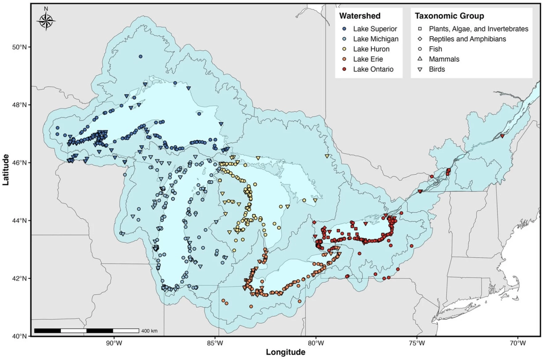
The study published this spring in the Journal of Environmental Quality analyzed 42 years of studies and combined nearly 2,500 samples of algae, fish, birds and other organisms — in what’s called a meta-analysis — to identify trends.

PFAS refers to a group of man-made and long-lasting compounds linked to a range of human health issues. It can enter waterways through landfills, wastewater and industrial facilities.

“What we’re finding is that the food web itself is a vehicle for transferring these chemicals from one organism to another,” said Gary Lamberti, aquatic science professor at Notre Dame and a study co-author. “So it’s a more holistic view than we’ve known before.”

The study identified a dramatic decrease over the last two decades of one PFAS chemical known as PFOS, following a voluntary phase out by industries in the early 2000s.

“If we stop manufacturing these chemicals, they will eventually reduce in concentration in the food web,” Lamberti said. “That’s kind of good news for how we can manage these chemicals.”

Those declines were seen in the lower Great Lakes — Ontario and Erie — likely because these areas are home to the heavy industries that used the chemical.

But there was little to no decline in PFOS in the upper Lakes Superior, Michigan and Huron, most likely because the water bodies are larger that the lower lakes. In contrast to the shallower Lakes Erie and Ontario, water can stay in the upper lakes anywhere from about 60 to 170 years.

The study also confirmed that these chemicals increase in concentration as they travel up the food chain. Algae and plants have the lowest concentration, according to the study, because they grow and die quickly.

A map showing where samples included in the study were taken from the Great Lakes. (Image courtesy of the Journal of Environmental Quality)

But predators like salmon and eagles had the highest concentration because they’re eating a large amount of prey that have a lot of accumulated PFAS.

Potentially dangerous levels of these chemicals in fish have prompted warnings across the state on how much is safe to eat. Michigan has been testing fish for PFAS since 2012.

“If we can understand what the PFAS levels are in the food web, we can better communicate the risk of consuming those potentially toxic food sources,” said Katherine Manz, an environmental health professor at the University of Michigan who was not involved in the study.

But because PFAS chemicals are in everyday products and they’re very hard to avoid, Manz said her best advice is to use less. Online databases can help consumers avoid certain chemicals.

Manz said the study also pointed out some interesting gaps in research on PFAS dynamics, like a lack of data on certain species.

It was easy to find PFAS data on salmon, trout, and some birds, Lamberti said. But information on the “less glamorous” smaller fish, invertebrates or algae was harder.

The study only focused on six of the PFAS chemicals most commonly tested for, but there are more than 15,000 types out there, according to the National Institutes of Health.

Tools to analyze the range of these chemicals are still evolving, said Vernon Lalone, CEO of Traverse City-based startup Wave Lumina that’s developing a rapid testing kit for PFAS in water and soil.

“It’s like a chicken and an egg situation,” said Lalone, who wasn’t involved in the study. “You’ve got to have an analytical method that’s robust and reliable enough to measure these things before you can regulate them at certain limits.”

Lamberti said there’s still plenty of questions about how these chemicals will shift in the lakes as temperatures rise due to climate change, ice formation shifts and as industries introduce new chemicals.

“Anything we put into the Great Lakes will be there for an extremely long time, not only the water, but all the chemicals that it has, so we have to be very cognizant of how we treat the lakes and what we put into them,” Lamberti said.


The post New study traces PFAS in Great Lakes food webs over 40 years appeared first on Great Lakes Now.

Original Article

Great Lakes Now

Great Lakes Now

https://www.greatlakesnow.org/2026/07/01/new-study-traces-pfas-in-great-lakes-food-webs-over-40-years/

Interlochen Public Radio and Grist

By Juanpablo Ramirez-Franco, Keerti Gopal, and Clayton Aldern

This story is a partnership between Grist, Inside Climate News and WBEZ.


No city dealing with a lot of lead pipes spends as much as Chicago does to replace them.

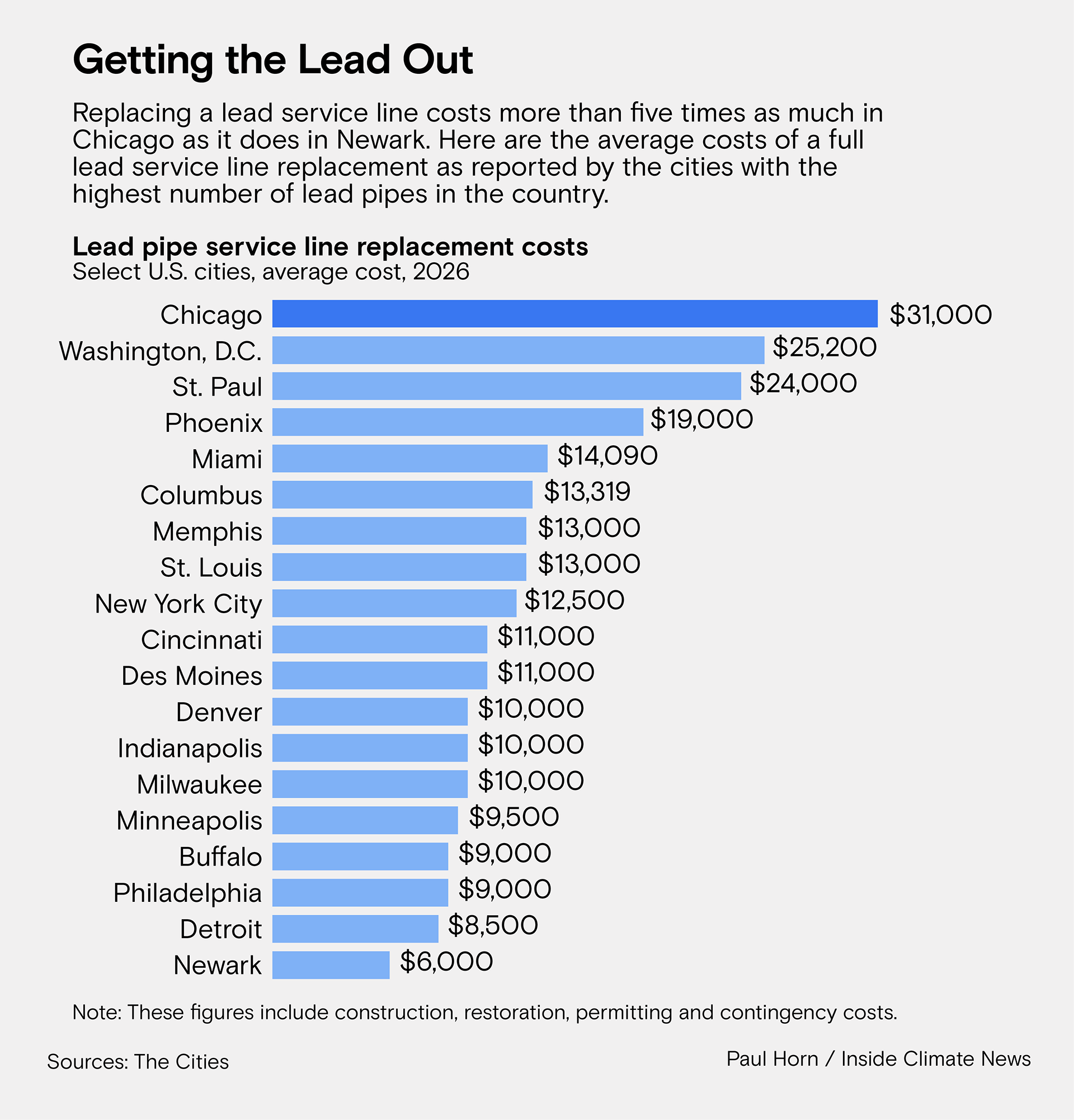
With more than 400,000 lead water service lines, Chicago has the largest known inventory of lead pipes of any city in the country. Officials say replacing each one costs about $31,000 on average — more than six times the Environmental Protection Agency’s national estimate of $4,700 a line.

WBEZ, Grist and Inside Climate News surveyed other cities with the most lead service lines in the country, including Detroit, Milwaukee and New York, about the cost of fully replacing a lead service line. The 18 that responded provided averages between $6,000 and $25,000, with most spending less than half what Chicago does. Engineering firm CDM Smith, which works with cities across the country, pegs the national average at $12,500 per line.

Now, with a federal mandate to remove every lead pipe within roughly 20 years, Chicago is facing a daunting timeline and an astronomical price tag. Replacing the city’s inventory at the current rate will cost more than $12 billion.

“It is absurd,” said Cyndi Roper, a senior policy advocate with the Natural Resources Defense Council’s safe water initiative. “You can’t play victim to your own policies. … You actually can make changes to bring the cost down.”

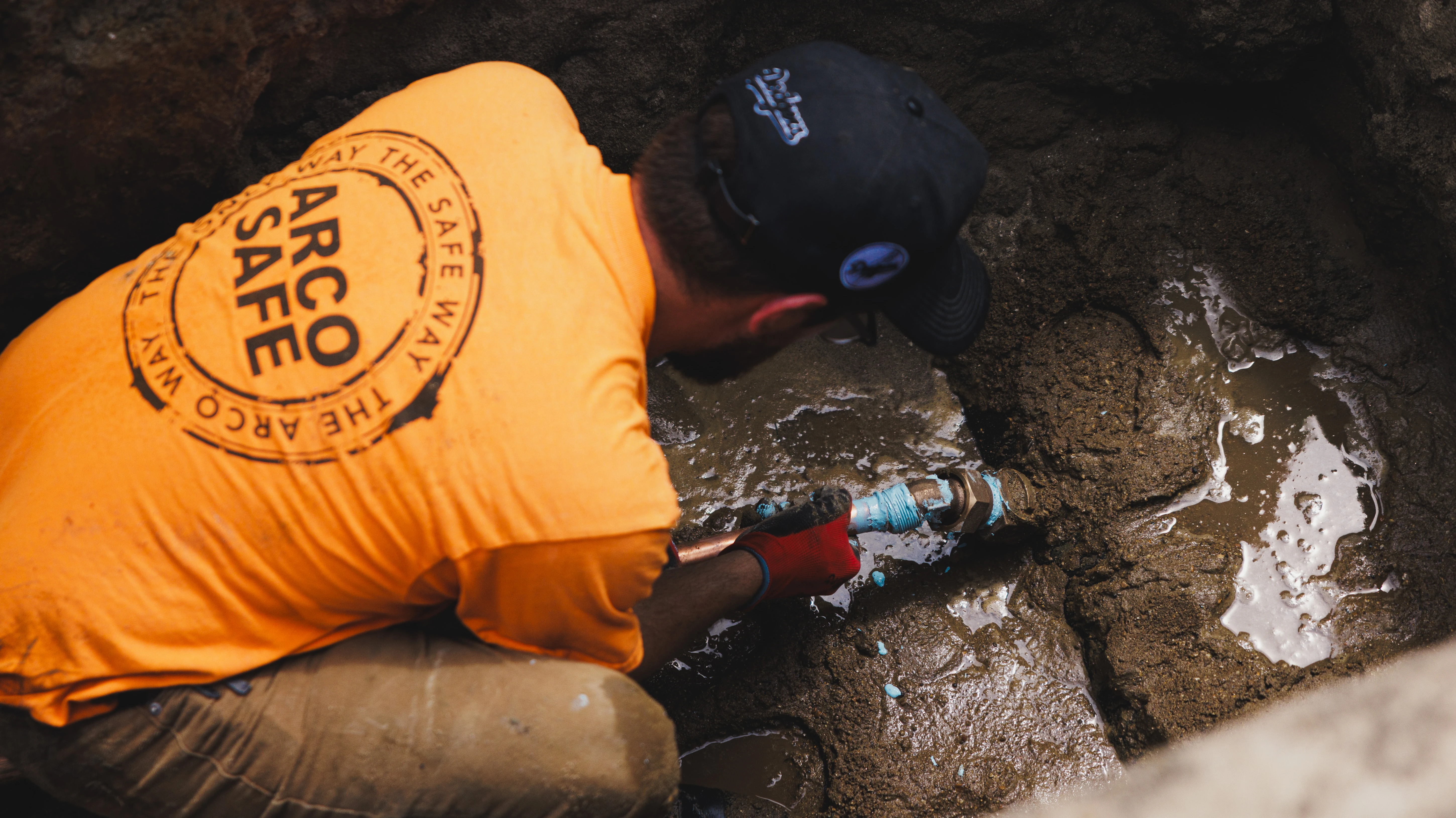
A review over seven months of hundreds of pages of program documents and contracts, plus dozens of interviews with city officials, policy experts, contractors and homeowners, found several key contributors. The most significant include inefficient early contracts, cumbersome permitting requirements, and the city’s reliance on one-off replacements rather than undertaking whole blocks at once.

A glaring lack of clarity from the Department of Water Management, which oversees the city’s replacement program, has also made it difficult to pinpoint the exact reasons for the high cost. Its officials were unable to provide WBEZ, Grist and Inside Climate News with consistent figures for replacement costs and the number of lines replaced or to make clear whether the water department is tracking these costs systematically.

“It seems like the story here is how hard you have to work to get information that’s needed in order to figure out why the costs are so high,” Roper added.

A spokesperson for Mayor Brandon Johnson said in an emailed statement that he is committed to accelerating replacements and minimizing the burden to residents but did not respond to specific questions about the city’s unusually high costs.

“The Johnson administration is working across departments in coordination with local, state, and federal partners to accelerate replacements, streamline processes, and maximize every available dollar so more residents can access safe, reliable drinking water,” the statement said.

Officials with the water department said they see some room to bring expenses down as work ramps up. But they’ve also disagreed with outside experts who say Chicago’s high costs are unreasonable, and they don’t appear to be treating the drastic cost differential with other cities as a high priority to address.

“There’s a lot of people that claim they know lead service line replacement,” said a senior official with the water department who spoke with WBEZ, Grist and Inside Climate News on the condition of not being named. “They don’t know what they’re talking about.”

Illinois U.S. Sen. Tammy Duckworth, who has been working to secure federal funding for lead service line replacements across the state, said she wasn’t aware of the cost discrepancy but hoped the city would be transparent with the public about why costs are so high.

“Cities just need to get their act together and get this done, and we’ve been slow to do this in Chicago,” Duckworth said. “Other cities have moved much faster than us.”

Replacing pipes on an entire block

Chicago replaces lead service lines through several programs, including emergency repairs, capital improvement projects and equity initiatives targeting low-income neighborhoods and daycares.

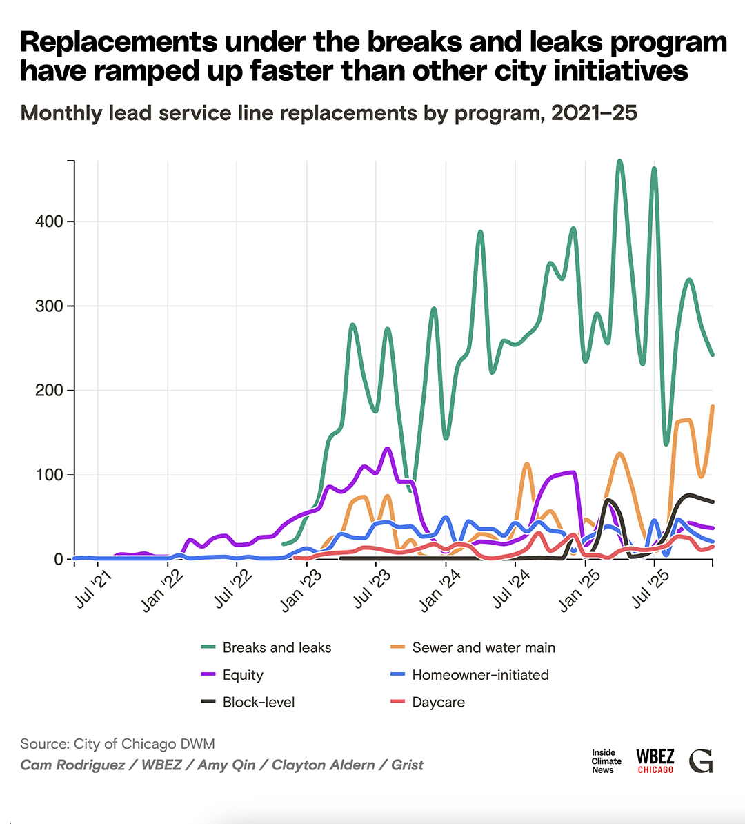
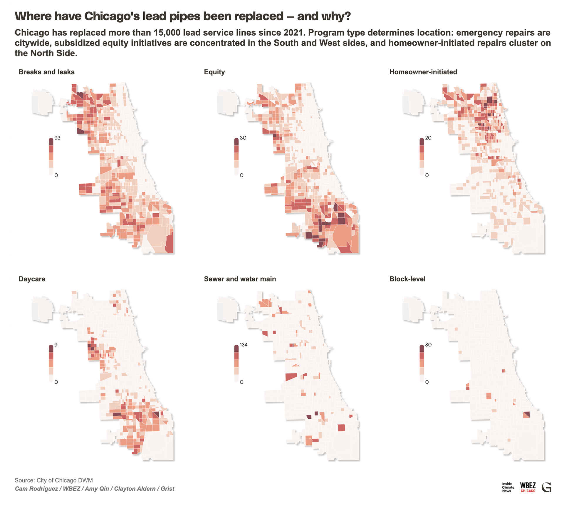
The city also replaces entire blocks of lead pipes at once. But that program accounted for just 3 percent of the approximately 15,000 lines swapped out between 2021 and the end of 2025, according to an analysis of city replacement data by WBEZ, Grist and Inside Climate News. Instead, nearly all of those lines were fixed piecemeal, mostly when crews were sent out to fix leaks and breaks.

Both city officials and experts agree that replacing lead pipes a full block at a time is cheaper. In Milwaukee, per-line costs dropped by nearly $2,000 since implementing a block level program. Chicago officials say they want to ramp up blockwide replacements, but there have been legal and logistical barriers to expanding that program.

In Illinois, property owners control half the service line, and the municipality is responsible for the other. State law forbids partial line replacement because the process can flush more lead into drinking water, and municipalities willing to replace private lines must first get the property owners’ permission. That’s harder and more time-consuming than it may seem, a key reason for the city’s low number of block replacements, according to officials.

Earlier this year, state lawmakers introduced a new bill at the water department’s request to fix that, granting city plumbers access to private lines without the owner’s permission. It passed in May and now awaits Gov. JB Pritzker’s signature.

“We need to accelerate, as much as humanly possible, this process,” said state Sen. Ram Villivalam of Chicago, a co-sponsor of the bill.

Still, it’s not clear how much block-level replacements will actually decrease Chicago’s costs. Water department officials pegged the average per-line cost for block-level work, which they have said is their cheapest program, at approximately $34,000, and the average for one-off replacements at $39,000. Both figures are well above the $31,000 overall average that department officials have cited.

Asked to explain how that could be, the water department did not respond. In her last email to the news organizations in May, water department spokesperson Megan Vidis said she would not answer any more questions on the topic.

Workers replace lead service lines in Chicago’s West Ridge neighborhood. (Photo credit: Anthony Vazquez/Sun-Times)

The toll on homeowners

Any lead pipe a property owner replaces on their own is one the city doesn’t have to pay forBut some homeowners are finding that far harder than they imagined, in part because of the city’s prohibitively expensive and complex permitting process.

Craig Hines and his wife, homeowners in Chicago’s Avondale neighborhood, discovered they had a lead service line last summer when they received a letter from the city. They were immediately alarmed: They cook regularly for young nieces and nephews, and Hines knows there’s no safe level of lead exposure.

They called 14 plumbers looking for a quote. Some refused to take them on or seemed to be trying to dissuade them from doing the work altogether, saying the job would be too expensive. One preliminary quote totaled $25,000. The couple were told permits alone could cost between $5,000 and $7,000.

“These fees seem so exorbitant when it’s like, this was a city screw-up,” Hines said, referring to Chicago’s history of installing lead lines long after the health consequences came to light. “I just cannot believe that the permitting fees are so high to help fix a problem that the city created.”

Replacing a single line can require permits from the water and transportation departments, as well as inspection-related charges, according to the city’s Department of Buildings. The fees vary based on the type of street and size of pipe.

The water department said it waives all its permit fees when the city pays for replacements. But it’s not so simple when property owners want to shoulder the cost. Some qualify for a city program waiving up to $5,000 in fees; others don’t. Water department officials could not provide an average cost for permits, saying it varies by project site.

After more than six months of research — including contacting their alderman, district commissioner and multiple city departments to track down answers about costs — Hines and his wife finally settled on a plumber who knew how to navigate the city’s permit waivers. He quoted them $22,000 for the job, which he said will include permits. They hope their replacement will take place in July.

Ryan Wilson (left) and Alaina Harkness stand next to their new water meter that was installed when they replaced lead water pipes in their home. (Photo credit: Anthony Vazquez/Sun-Times)

Several miles south, Ryan Wilson and his wife, Alaina Harkness, said they didn’t qualify for the fee waiver. They paid nearly $25,000 to replace the lead line at their Hyde Park home last year, but because they also upsized their service line while replacing it, they weren’t eligible for the waiver.

Wilson has worked in urban planning for decades, and even so, he said he found navigating the city’s permitting requirements extremely confusing. They never were able to figure out how much of their final bill was allotted to permits. If Chicago wants to improve citywide replacement efforts, Wilson said, improving the permitting process should be high on the list.

“There’s not a single person to talk to about this,” he said.

Inefficient contracts and funding woes

Water department officials pointed to two key reasons for the high costs. First, they said that the city lacked a firm grasp of costs when launching its replacement program in 2021 and also that its first round of contracts was inefficient. The early contracts also bundled jobs poorly, tasking contractors with work outside their specialization, like having plumbers work on restoration or outreach.

“Early on, the issue was … a lot of unknowns in our contracts,” the water department’s deputy commissioner, Michael Grillo, said in a webinar last fall. “We are trying to be smarter with our contracts that go out, be more specific, eliminate those unknowns.”

Plumbing companies overbid to cover worst-case scenarios in those early contracts, Grillo said. The water department’s Vidis confirmed via email that the city has implemented four new contracts this year focused on improving equitable access for small businesses to replace lead service lines but said the goal of those contracts was not to reduce per-line prices.

Grillo also blamed labor costs for part of the city’s high price tag, but that explanation doesn’t appear to pan out.

The base prevailing wage for a union plumber in the Chicago area is $99.52 per hour. By contrast, it’s about $97 in Minneapolis and roughly $121 in New York City, both of which replace their lead pipes for less than half of Chicago’s costs.

“I have a hard time believing that the prevailing wage would be the cost factor,” said Betony Jones, a senior researcher at the University of California, Berkeley, and former director of energy jobs under the Biden administration.

The city says a lack of robust, flexible funding is compounding the problem. Chicago has to cobble together funding from a patchwork of local and federal sources in the form of grants and low-interest loans, which brings red tape and restrictions.

The Biden-era Infrastructure Investment and Jobs Act delivered a historic $15 billion for lead pipe removal, with Illinois getting about $1.2 billion, according to Duckworth’s office. This month, Duckworth’s office announced a separate $22 million federal grant earmarked for Chicago’s majority-Black Austin neighborhood — where 92 percent of service lines require replacement, according to last year’s lead service line inventory. At Chicago’s price point, the state estimates that $22 million will only replace about 650 lines out of the nearly 17,000 reported in city data for Austin last year.

“Chicago needs to explain where the money is going and justify the cost,” wrote Elin Betanzo, a national drinking water expert who helped uncover the water crisis caused by lead pipes in Flint, Michigan, in an email.

Betanzo, who has done extensive research on cost-saving tactics, said she has not seen a realistic cost breakdown that demonstrates why Chicago is paying as much as it is.

“They need to figure out how to complete the most cost-efficient lead service line replacements in the country, not the most expensive,” she added.

With funding from the Infrastructure Investment and Jobs Act set to run out this year, public health experts have been calling for more local, federal and state dollars to fund replacements, especially in overburdened cities like Chicago.

“It’s a critical part of the infrastructure,” Betanzo said. “It’s that final piece of public health protection.”

Amy Qin and Cam Rodriguez contributed data analysis for this story.


The post Why Is It So Expensive to Replace Lead Pipes in Chicago? appeared first on Great Lakes Now.

Original Article

Great Lakes Now

Great Lakes Now

https://www.greatlakesnow.org/2026/06/30/why-is-it-so-expensive-to-replace-lead-pipes-in-chicago/

WBEZ, Inside Climate News and Grist

By Leah Borts-Kuperman, The Narwhal

The Great Lakes News Collaborative includes Bridge Michigan, Circle of Blue, Great Lakes Now at Detroit PBS, Michigan Public and The Narwhal who work together to bring audiences news and information about the impact of climate change, pollution, and aging infrastructure on the Great Lakes and drinking water. This independent journalism is supported by the Charles Stewart Mott Foundation. Find all the work HERE.


Gathered in an arena in North Bay, Ont., in summer 2024, federal officials told hundreds of concerned citizens how they planned to remediate longstanding contamination of the city’s waterways left behind by the Department of National Defence. A few months later, officials gave a similar presentation to a packed hotel conference room.

For nearly a decade now, residents have known about the contamination. Some have been told not to drink the water from their own wells, and everyone in the city has been warned not to drink water or eat fish from a creek outside town.

The creek is part of a system of waterways where carcinogenic “forever chemicals” run downstream from a military base, emptying into Trout Lake, the source of the city’s drinking water. It sits at nearly double Health Canada’s guideline for PFAS in drinking water, measured in nanograms per litre. 

Health Canada published an “objective” level of 30 nanograms per litre in August 2024 for 25 chemicals in the PFAS family. That’s less than half of what Ontario currently recommends: 70 nanograms per litre, pertaining to just 11 PFAS chemicals. And that’s just a suggestion, not a binding regulation. 

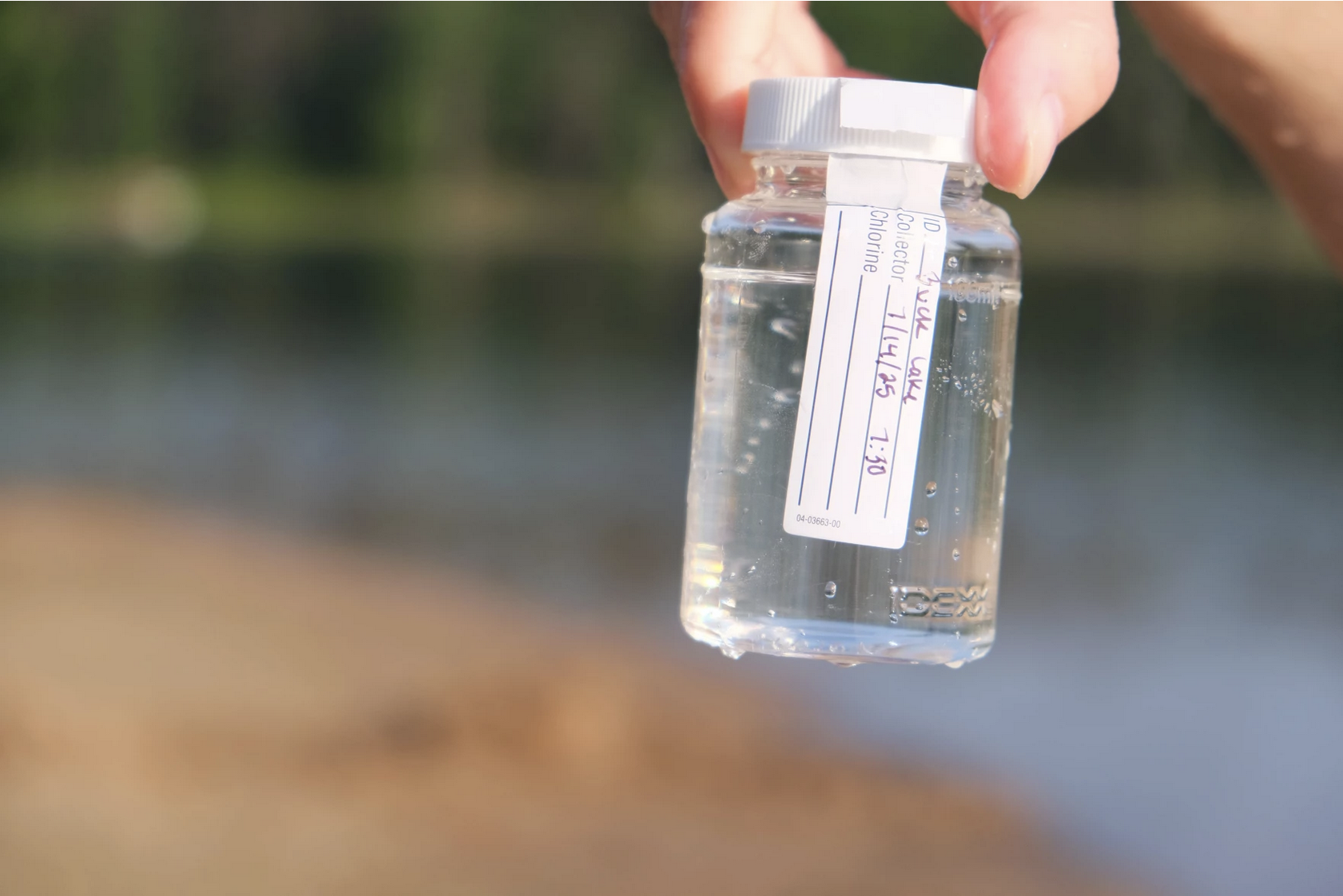
The city did not reply to The Narwhal’s detailed questions regarding the current state of the drinking water supply, but CBC reported in February 2026 that Trout Lake contained around 58 nanograms of PFAS per litre of water.  

Thousands of substances classified as per- and polyfluoroalkyl substances, known as PFAS, are used to make everything from medical equipment to waterproof clothing. They can generate hazardous waste which, if not disposed of carefully, contaminates air, water and soil — where it can remain for 1,000 years, hence their other nickname, “forever chemicals.”

Statistics Canada reports almost all Canadians already have PFAS in their bodies, including in remote regions such as the Arctic and subarctic

In North Bay, the issue is top of mind, with a class-action lawsuit, a lengthy and expensive remediation plan and a new factory importing chemicals from the Teflon-like subgroup of PFAS, called PTFE. And the company behind that factory, Industrial Plastics Canada, is one of the 10 major importers of PTFE in Canada.

While PFAS have been making global headlines for years as an emerging threat to the environment and our bodies, North Bay knows the issue intimately; citizens fear for their water as politicians try to clean up the mess.

Here’s everything you need to know about PFAS in North Bay.

1. North Bay’s PFAS contamination comes from firefighting foam 

From the early 1970s to the mid-1990s, the Department of National Defence used a fire suppression foam containing PFAS to train firefighters across Canada, including near the North Bay Jack Garland Airport. In 2016, after the North Bay Parry Sound District Health Unit learned PFAS had been identified by the Department of National Defence in waterways around the city, it commissioned consulting firm Stantec to assess the impacts on soil and groundwater.

It’s the invisible nature of these chemicals that are part of what makes them so insidious; you can’t see them or smell them, so you don’t know they’re there without testing. 

“When you look at a mine, for example, you can see it and say, ‘That’s obviously disruptive to our ecosystem.’” North Bay-based environmental anthropologist Carly Dokis previously told The Narwhal. “But these things are invisible pollutants, which then tend to attract less public awareness.”

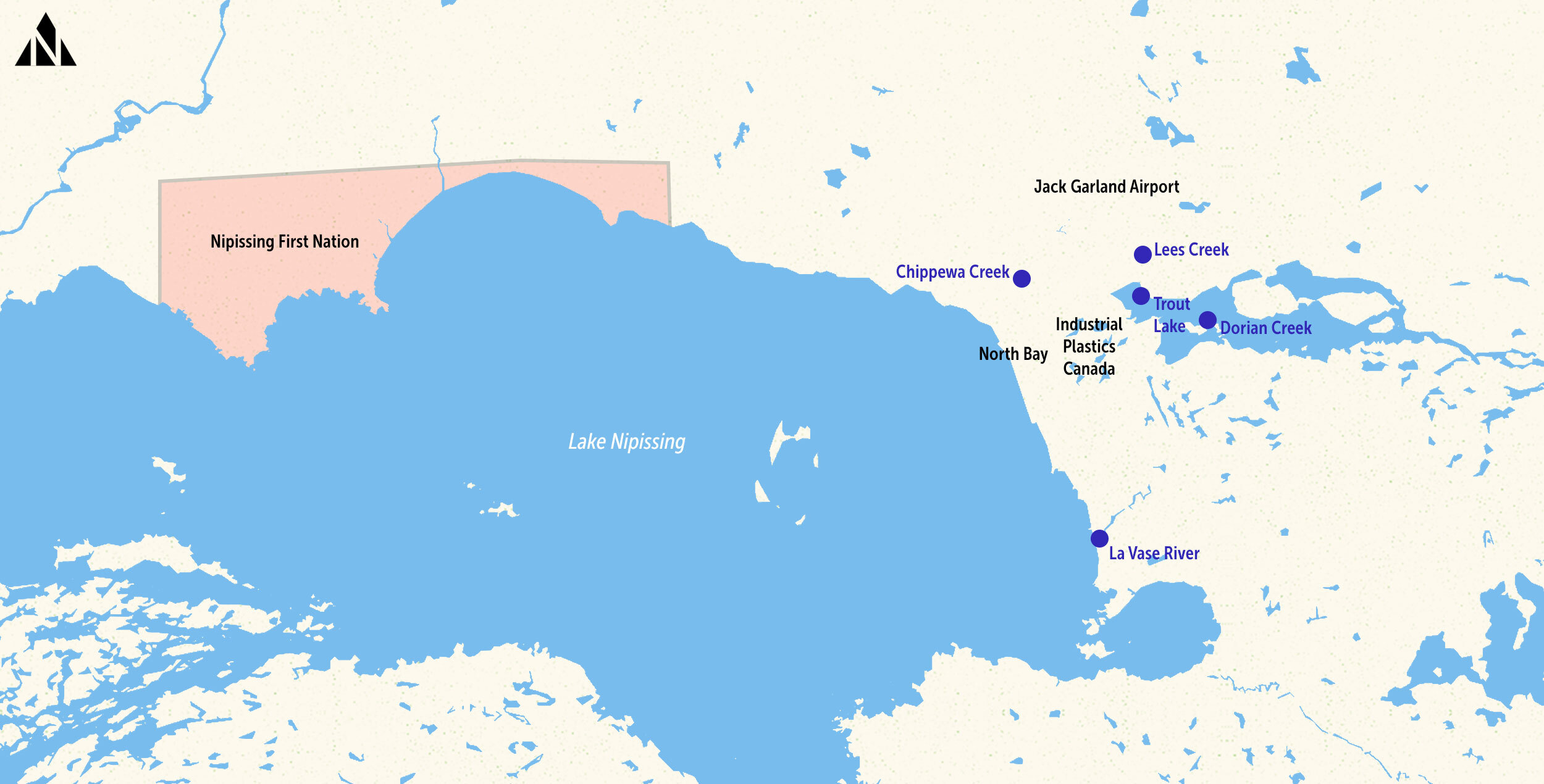
Stantec found PFAS from the foam had contaminated soil, bedrock, groundwater, private wells and several waterways in the region including Trout Lake, Lake Nipissing and Lees, Dorlan, Chippewa and La Vase creeks and surrounding areas.

Long-lasting “forever chemicals” known as PFAS have contaminated surface water, soil, bedrock and groundwater near the Jack Garland Airport, including the municipal drinking water system, private wells and waterways around Nipissing District. (Image credit: Shawn Parkinson / The Narwhal)

In 2025, reporting by the Investigative Journalism Bureau surfaced a report by the Royal Military College showing the Department of National Defence found elevated PFAS levels around the base as far back as 2012. That means the department knew about the contamination for five years before revealing it to the City of North Bay in 2016, and the public in 2017.

2.  PFAS impacts health, environment and property values. Residents are seeking recompense

In late 2025, North Bay citizens filed a proposed class-action lawsuit asking for remediation, safe drinking water and $105 million in damages for residents living within a three-kilometre radius of the 22 Wing Canadian Forces Base and Jack Garland Airport. Some of the people who live closest to the contamination have been receiving bottled water from the government for years, but have had no other opportunity for recourse.

The proposed lawsuit, if certified by the court, would be against the City of North Bay and the Attorney General of Canada, on behalf of the Department of National Defence, focusing on the loss of property value and remediation costs. The case is also seeking punitive damages, contending that National Defence was aware of the contamination long before warning residents.

Not mentioned in the suit is the long list of health concerns associated with “forever chemicals.”

The United States Environmental Protection Agency lists potential health risks of exposure to PFAS, including reproductive problems like infertility, developmental effects in children, increased risk of certain cancers and weakening of the body’s immune system, including reduced vaccine response. The Canadian government says PFAS can be transferred through the placenta during pregnancy, and infants can be exposed through human milk. 

Ecosystems are affected, too. Studies have shown exposure to per- and polyfluoroalkyl substances can stunt plant growth and cause reduced seed germination and ability to photosynthesize. The chemicals can build up in the organs of living creatures throughout the food chain. In the district of Nipissing, that poses a risk to people who hunt, fish and harvest from the land.

“These industrial areas are often surrounded by lower-income buildings and peoples and communities,” Curtis Avery, environment department manager with Nipissing First Nation, told The Narwhal in summer 2023. “We’re the most vulnerable group of people that utilize our lands — the lands are our grocery stores. … If these are being impacted, we need to know.”

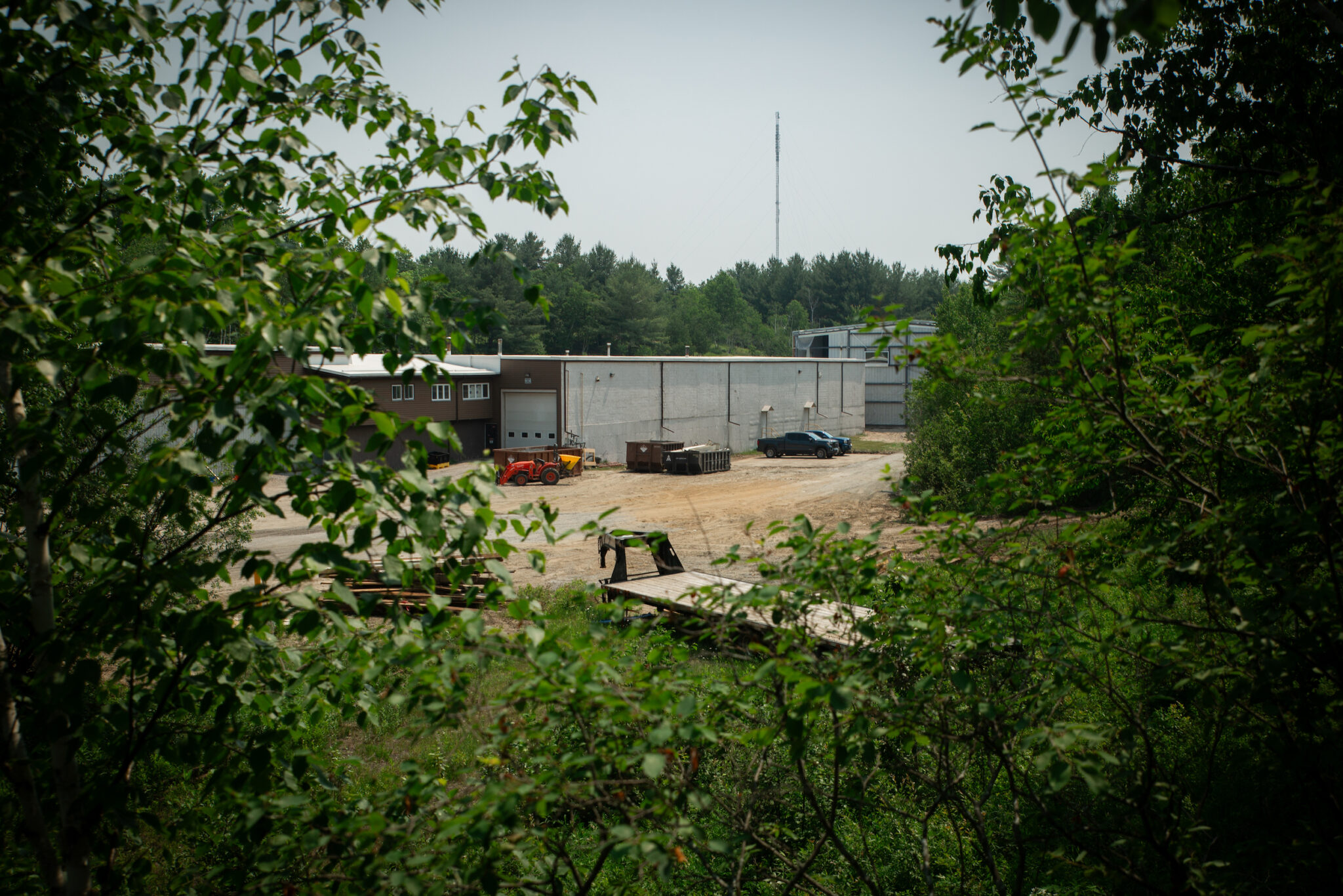
NORTH BAY, Ont. (06/21/23) – Looking down onto the new Industrial Plastics Canada factory site from the top of Wallace Road in North Bay, Ontario. Beautiful forested area, Circle Lake, and important ecosystems for pollinators surround the site. Despite the effect the factory’s PTFE byproducts will have on North Bay’s environment, no assessments were required and the public has little awareness of its construction, due to open July 2023. (Photo credit: Vanessa Tignanelli / The Narwhal)

3. Cost of North Bay clean-up grew five-fold, to more than $100 million

In 2021, the City of North Bay announced plans to begin remediation under a “shared responsibility” agreement between the Department of National Defence and the city. The federal department would cover 97 per cent of the costs, or $19.4 million, and the city would cover the remaining three per cent, at $600,000. But costs have ballooned since then; in December 2025, National Defence announced it would contribute another nearly $100 million to the remediation, with the city’s share rising to more than $3.6 million. The total for the cleanup project has risen to more than $122 million.

The remediation, which began on the ground in 2024, includes excavating and disposing of about 26,000 tonnes of PFAS-impacted soil; injecting activated carbon material into particularly dense patches of PFAS to stop the underground plume from spreading; and installing a filtration system to treat water leaving the site.

“We remain committed to addressing and managing the operational legacy of the Canadian Armed Forces responsibly,” Minister of National Defence David J. McGuinty said in a news release.

As part of the process, a notice went up on the federal Impact Assessment Agency registry on April 28, inviting the public to comment up until June 5 on a proposal to install a 250-metre permeable barrier in the ground to help filter impacted groundwater. A spokesperson for the agency said its role in the project is to offer advice on determining its environmental effects, as well as providing the opportunity to post the project on the registry.

Local organizations, including the environmental group Northwatch, said in a press release that they were concerned about “very limited public engagement over the last ten years since the public disclosure of the contamination,” counting only the two forums in 2024 and 2025, where there was “limited opportunities for the public to ask questions.” 

Northwatch’s project coordinator Brennain Lloyd told The Narwhal about the public notice period, which she said her organization only learned of in a daily bulletin from the Impact Assessment Agency listing multiple assessment notices from across the country.

“To the best of our knowledge there were no local announcements or invitations to comment issued to the many residents and organizations who have identified their interest in this program,” a release from Northwatch reads.

The Department of National Defence did not respond to questions from The Narwhal. 

4. North Bay’s not alone: contaminated military bases affect communities across Canada

Contamination on federal sites is an issue across Canada. There are thousands of contaminated sites listed on the federal contaminated sites inventory, and PFAS are found on more than 100 of them. These include at least 26 National Defence sites including bases in Trenton, Ont., Gagetown, N.B., and Moose Jaw, Sask.

And contaminants don’t stop at the fenceline. Health Canada says some contaminants can travel long distances through soil, water and air: “PFAS can be found in fresh water and drinking water in areas that are far away from where they entered the environment,” according to the department’s website.

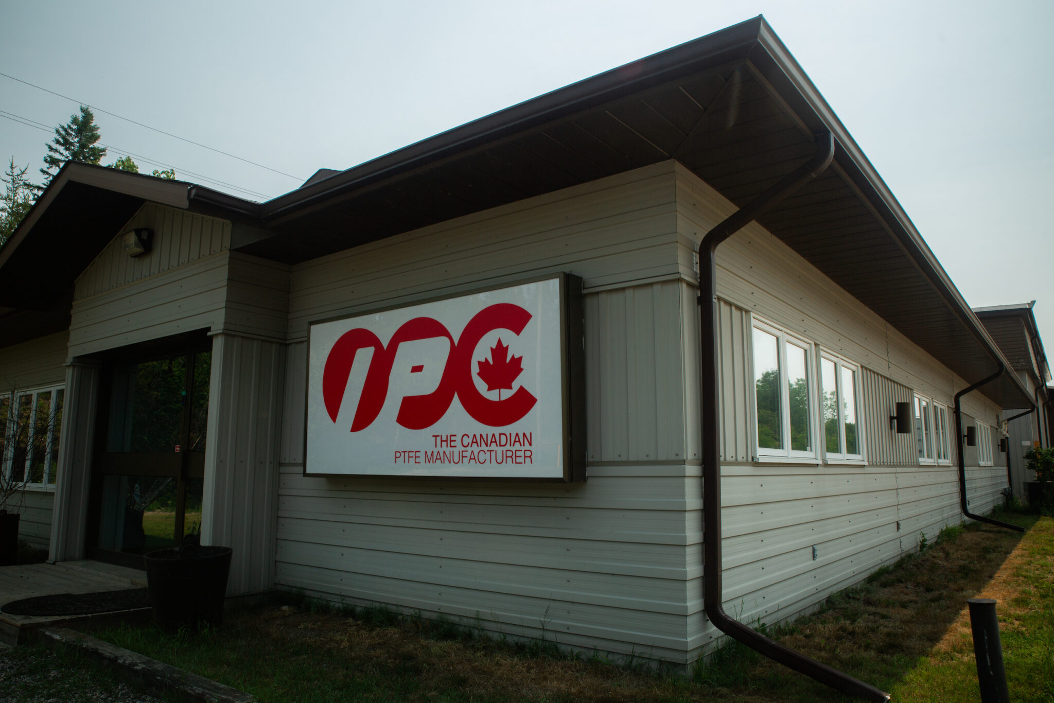
NORTH BAY, Ont. (06/21/23) – The main office building of Industrial Plastics Canada on Wallace Road in North Bay, Ontario, where construction is currently underway for the new factory opening July 2023. The factory plans to manufacture PTFE, Teflon-like chemicals harmful to humans, wildlife and ecosystems, no environmental assessment required. PTFE are commonly known as “forever chemicals,” because they can generate hazardous waste which, if not disposed of carefully, contaminates air, water and soil where it can remain for about 1,000 years. (Photo credit: Vanessa Tignanelli / The Narwhal)

5. Industry is still importing PFAS-class chemicals into North Bay

While the Canadian government no longer uses firefighting foam that contains PFAS, industry continues to bring these substances into the country. In 2023, The Narwhal reported on an international plastics conglomerate that opened its first Canadian location, Industrial Plastics Canada, in North Bay. The company has a presence across Europe as well as in India and China, billing itself as one of the “largest worldwide manufacturers of PTFE products.”

PTFE, or polytetrafluoroethylene, is a Teflon-like product in a subgroup of PFAS known as fluoropolymers, or fluoroplastics. A company spokesperson previously told The Narwhal the use of PTFE at the factory will not produce waste and poses “no risk.” The company also says fluoropolymers aren’t as dangerous as other PFAS and are “considered safe, non-bioaccumulative and non-toxic.” 

But fluoropolymers have been found to be dangerous to human health, according to research published in the peer-reviewed journal Environmental Science & Technology and others.

In 2023, Health Canada released a draft assessment of the state of PFAS in Canada to help decide how to regulate the class of chemicals. In it, the agency cited an industry-funded study that said fluoropolymers should be considered separately from other PFAS as “polymers of low concern.” A Health Canada spokesperson said the agency, along with Environment and Climate Change Canada, “examined information from a wide range of sources,” including scientific journals and reports while preparing the state of PFAS report.

The substances were ultimately excluded from the final report, released in March 2025, in which Health Canada proposed classifying the remaining PFAS chemicals as toxic substances under the Canadian Environmental Protection Act.

The Health Canada spokesperson said in an email that fluoropolymers “have specific properties that differentiates them from other PFAS,” which led to their exclusion from the final report. They added that the exclusion “should not be interpreted as meaning they are or are not of concern,” and that a separate fluoropolymer assessment is currently underway.

The exclusion of PTFE from that classification was a major priority for industry, Rémy Alexandre, toxics project lead at environmental law non-profit EcoJustice, told The Narwhal.

According to data collected by Alexandre, who studied Industrial Plastics Canada’s imports to North Bay, the company brought in almost 207,000 kilograms of PTFE from India and China from July 2025 to May 2026.

This puts the facility on the list of the 10 major importers of PTFE in Canada, alongside U.S.-based chemicals company Chemours, a spinoff of Dupont that has been arguing that the European Union should exempt fluoropolymers from their regulations, too. 

“The decision to site this plant in a community that is an existing hotspot for PFAS raises concerns,” Alexandre told The Narwhal. “And so does the selection of a jurisdiction that isn’t regulating fluoropolymers.”


The post North Bay’s PFAS problem: 5 things to know about a ‘forever chemicals’ hotspot in Ontario appeared first on Great Lakes Now.

Original Article

Great Lakes Now

Great Lakes Now

https://www.greatlakesnow.org/2026/06/30/north-bays-pfas-problem-5-things-to-know-about-a-forever-chemicals-hotspot-in-ontario/

The Narwhal

By Katie Thoresen, WXPR

This story was originally published by WXPR. WXPR is a community-licensed public radio station serving north central Wisconsin and adjacent areas of Michigan’s Upper Peninsula. Listen to their stories here.


The Oneida County Health Department will be testing the water at five public beaches this summer.

As WXPR reported last year, they tested Buck and Boom Lake beaches in Rhinelander, Torpy Park in Minocqua, and the Sugar Camp Public Beach.

This year, they’re adding Maple Lake Beach in Three Lakes.

Testing is done once a week for E. coli.

What is E. coli?

E. coli is a type of bacteria that can make people and animals sick. Symptoms can be mild or severe.

Common symptoms include: diarrhea, abdominal cramps, fever, or nausea and vomiting.

If you have been in the water and think you have an E. coli infection, contact Oneida County Health Department and seek medical attention, if symptoms are severe.

How will I know the E. coli levels?

Testing results will be updated on the Oneida County Health Department website and Facebook page each week.

If there are elevated levels, there will also be yellow advisory signs and red closure signs posted at the beach.

Help prevent E. coli outbreaks in swimming areas

  • Picking up dirty diapers and fecal matter from dogs
  • Do not feed seagulls and other birds
  • Look for birds flying over water recreation areas
  • Check water conditions: if you see algal blooms, avoid the water
  • E. coli levels can be higher after heavy rain because dirty water can wash into lakes and beaches

Are they testing for anything else?

OCHD staff will also monitor the beaches for cleanliness and for blue-green algae blooms.

Conditions can change quickly, so swimmers should be on the lookout if the water looks like pea soup, green or blue spilled paint, or has a green scum layer on the surface.

What is blue-green algae?

Blue-green algae, also known as Cyanobacteria, are a group of photosynthetic bacteria that many people refer to as “pond scum.”

In Wisconsin, blue-green algae blooms generally occur between mid-June and late September.

People and animals can get sick from it. Symptoms range from rashes to vomiting.

To report a blue-green algae bloom or illness, visit Wisconsin Department of Health here, or contact OCHD at 715-369-6111 or email eh@oneidacountywi.gov.


The post Oneida County Health Department to monitor five public beaches for E. coli this summer appeared first on Great Lakes Now.

Original Article

Great Lakes Now

Great Lakes Now

https://www.greatlakesnow.org/2026/06/11/oneida-county-health-department-to-monitor-five-public-beaches-for-e-coli-this-summer/

WXPR

Library

Conservation Kick and Environmental Markets: Project Archive

This project has ended. Archived project materials are available below. 


The Great Lakes Commission launched Conservation Kick in March 2020 to create a water quality marketplace for the Great Lakes Basin. Building on the pioneering vision of the Great Lakes Basin Compact to efficiently and responsibly develop, use and conserve the water resources of the Basin, Conservation Kick aims to keep soil and nutrients out of the Great Lakes and protect drinking water by allowing utilities, industries and businesses, nonprofit organizations and concerned citizens to invest in water quality credits.


Over the past decade the Great Lakes Commission has designed and led watershed-scale water quality trading efforts in Wisconsin’s Fox River Basin and the Western Lake Erie Basin. Conservation Kick takes lessons learned from these efforts to catalyze water quality trading across the Great Lakes Basin. Conservation Kick will expand the universe of credit buyers and reduce the transaction costs that often present a barrier to entry in traditional water quality trading markets.
Conservation Kick was supported by Great Lakes Restoration Initiative funding administered by the U.S. Environmental Protection Agency.

Projects: Erie P Market and Fox P Trade

Erie P Market

From 2016 to 2018, the Great Lakes Commission developed and piloted the Erie P Market to address the excessive runoff of pollution from agricultural land that contributes to the formation of algal blooms and dead zones in the Great Lakes. The project was designed to test water quality trading and stewardship crediting as nutrient reduction tools capable of crossing state and provincial boundaries in the Western Lake Erie Basin.  Click here to learn more about Erie P Market.

Fox P Trade

From 2013 to 2016, in partnership with the Fox-Wolf Watershed Alliance, U.S. Department of Agriculture Natural Resources Conservation Service, and Wisconsin Department of Natural Resources, the Great Lakes Commission developed and piloted the Fox P Trade program with funding from a Great Lakes Restoration Initiative grant. This project was designed to alleviate high nutrient levels and algal blooms in Wisconsin’s Lower Fox River Watershed by establishing a water quality trading market.  Click here to learn more about Fox P Trade.

 
Project Documents

For More Information

Nicole Zacharda
Program Manager, Great Lakes Commission
nzacharda@glc.org

Original Article

Great Lakes Commission

Great Lakes Commission

https://www.glc.org/work/enviromarkets

Laura Andrews

Hello Volunteers! We are still looking for volunteers for the site circled in red on the map for the 2026 season! Do you enjoy being out on the water? Are you interested in seeing how the work we are doing affects water quality? We have an opportunity for you! We are [...]

The post Help us monitor water quality in Lake Winnebago this summer! appeared first on Fox-Wolf Watershed Alliance.

Original Article

Fox-Wolf Watershed Alliance

Fox-Wolf Watershed Alliance

https://fwwa.org/2026/04/22/ww-wq-volunteers-2026/?utm_source=rss&utm_medium=rss&utm_campaign=ww-wq-volunteers-2026

Katie Reed

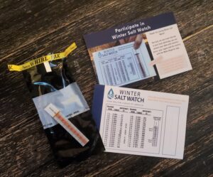
Help Monitor Salt Pollution in the Fox-Wolf River Basin This Winter! Winter brings snow, ice, and slippery sidewalks. Sodium chloride (salt), widely used on roads, parking lots, and sidewalks to keep us safe, can also harm our streams and wildlife when overused. Fox-Wolf is partnering with the Izaak Walton League to gather more data [...]

The post Join Fox-Wolf and Help Monitor for Chlorides(Salt) appeared first on Fox-Wolf Watershed Alliance.

Original Article

Fox-Wolf Watershed Alliance

Fox-Wolf Watershed Alliance

https://fwwa.org/2025/10/23/join-fox-wolf-and-help-monitor-for-chloridessalt-3/?utm_source=rss&utm_medium=rss&utm_campaign=join-fox-wolf-and-help-monitor-for-chloridessalt-3

Jessica Schultz

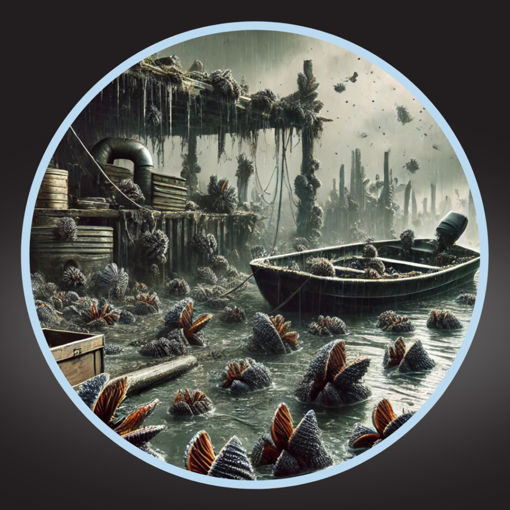
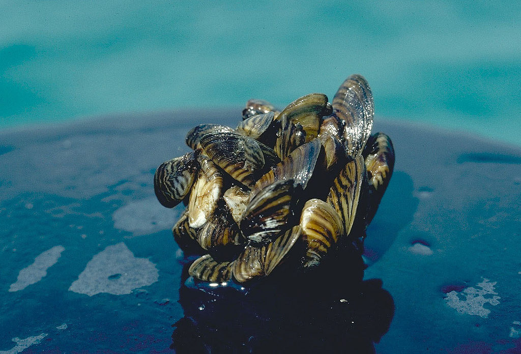
Another Impact of Zebra Mussels Zebra mussel cluster. Photo taken by D. Jude, Univ. of Michigan. Zebra mussels are an invasive species that can reshape entire lake ecosystems. Researchers have discovered that zebra mussels may be increasing mercury levels in popular game fish like walleye and yellow perch. Mercury is a potent [...]

The post How Zebra Mussels Are Changing Fish Contaminants appeared first on Fox-Wolf Watershed Alliance.

Original Article

Fox-Wolf Watershed Alliance

Fox-Wolf Watershed Alliance

https://fwwa.org/2025/08/14/how-zebra-mussels-are-changing-fish-contaminants/?utm_source=rss&utm_medium=rss&utm_campaign=how-zebra-mussels-are-changing-fish-contaminants

Chris Acy

Blue-green algae, also known as cyanobacteria, are responsible for harmful algal blooms. This is because some cyanobacteria can produce toxins that cause adverse health effects for both humans and their pets. While not all blue-green algae produce harmful toxins, those that do can cause rashes, diarrhea, and respiratory problems. Some common toxins produced by [...]

The post Is it safe to swim? Blue-green algae: How to reduce the risks to humans and pets appeared first on Fox-Wolf Watershed Alliance.

Original Article

Fox-Wolf Watershed Alliance

Fox-Wolf Watershed Alliance

https://fwwa.org/2025/06/14/is-it-safe-to-swim-blue-green-algae-and-the-risks-to-humans-and-pets/?utm_source=rss&utm_medium=rss&utm_campaign=is-it-safe-to-swim-blue-green-algae-and-the-risks-to-humans-and-pets

Fox-Wolf Watershed Alliance

When it rains, it runs off. That might sound simple, but what that runoff picks up along the way can have a big impact. Rainwater that falls on your yard or roof is one thing. But when it hits hard surfaces like streets, sidewalks, and driveways, it doesn’t soak in. It travels. Fast. Carrying [...]

The post The Storm Drain Leads Where?! Why What You Do at Home Matters Downstream appeared first on Fox-Wolf Watershed Alliance.

Original Article

Fox-Wolf Watershed Alliance

Fox-Wolf Watershed Alliance

https://fwwa.org/2025/06/02/the-storm-drain-leads-where-why-what-you-do-at-home-matters-downstream/?utm_source=rss&utm_medium=rss&utm_campaign=the-storm-drain-leads-where-why-what-you-do-at-home-matters-downstream

Fox-Wolf Watershed Alliance

‘Forever chemicals’ found nationwide in Canada, CBC map shows

Catch the latest updates on what’s happening with PFAS in the Great Lakes region. Check back for more PFAS news roundups every other week on our website.


CBC News released an interactive map illustrating PFAS hotspots across Canada, revealing widespread “forever chemical” contamination in every province and territory.

Read Now at Great Lakes Now.

Original Article

Great Lakes Now

Great Lakes Now

https://www.greatlakesnow.org/2025/05/forever-chemicals-found-nationwide-in-canada-cbc-map-shows/

Donte Smith

Hundreds of fish killed by manure runoff in Monroe County

By Danielle Kaeding, Wisconsin Public Radio

This article was republished here with permission from Wisconsin Public Radio.

Manure runoff from a dairy farm in Monroe County killed hundreds of fish in nearby waterways, according to the Wisconsin Department of Natural Resources.

The agency first received notice of the spill Saturday from a call to its violation hotline.

Read Now at Great Lakes Now.

Original Article

Great Lakes Now

Great Lakes Now

https://www.greatlakesnow.org/2025/05/hundreds-of-fish-killed-by-manure-runoff-in-monroe-county/

Wisconsin Public Radio

Here’s Why the Water Looks Different This Time of Year Have you looked out at Lake Winnebago lately and thought, “Why is the water so high?” Or maybe in your neighborhood, it looks way too low? You're not alone—and best of all, you're not imagining things! Whether the lake appears to be creeping up [...]

The post Is Lake Winnebago Flooding? Or Is It Low? appeared first on Fox-Wolf Watershed Alliance.

Original Article

Fox-Wolf Watershed Alliance

Fox-Wolf Watershed Alliance

https://fwwa.org/2025/05/21/is-lake-winnebago-flooding-or-is-it-low/?utm_source=rss&utm_medium=rss&utm_campaign=is-lake-winnebago-flooding-or-is-it-low

Fox-Wolf Watershed Alliance

If you fish it, boat it, live near it, or just plain love it—Lake Winnebago is part of your life. It’s a source of joy, pride, and countless summer memories. And believe it or not, one of the best things for this lake is something simple: plants. Yep—those weedy green patches that pop up [...]

The post Why Plants = A Healthier, Happier Lake Winnebago appeared first on Fox-Wolf Watershed Alliance.

Original Article

Fox-Wolf Watershed Alliance

Fox-Wolf Watershed Alliance

https://fwwa.org/2025/04/22/lake-winnebago-aquatic-plants-water-levels/?utm_source=rss&utm_medium=rss&utm_campaign=lake-winnebago-aquatic-plants-water-levels

Dan Beckwith

If you fish it, boat it, live near it, or just plain love it—Lake Winnebago is part of your life. It’s a source of joy, pride, and countless summer memories. And believe it or not, one of the best things for this lake is something simple: plants. Yep—those weedy green patches that pop up [...]

The post Why Plants = A Healthier, Happier Lake Winnebago appeared first on Fox-Wolf Watershed Alliance.

Original Article

Fox-Wolf Watershed Alliance

Fox-Wolf Watershed Alliance

https://fwwa.org/2025/04/22/lake-winnebago-aquatic-plants-water-levels/?utm_source=rss&utm_medium=rss&utm_campaign=lake-winnebago-aquatic-plants-water-levels

Dan Beckwith

A message from Fox-Wolf's Executive Director Fox-Wolf Friends, I want to be open with you about some challenging news. Recently, we learned that the USDA terminated two major Climate Smart grants we were managing. This decision wasn’t based on our effectiveness, results, or any kind of fiscal mismanagement or wrongdoing. Instead, it came [...]

The post A Tough Update—But Our Work Isn’t Finished appeared first on Fox-Wolf Watershed Alliance.

Original Article

Fox-Wolf Watershed Alliance

Fox-Wolf Watershed Alliance

https://fwwa.org/2025/04/22/climate-smart-grant-term/?utm_source=rss&utm_medium=rss&utm_campaign=climate-smart-grant-term

Jessica Schultz

No Mow May is trending again—but is it actually the best move for your lawn and your water? It’s a tempting idea—skip mowing for a month to help bees and early-season pollinators. And yes, it can make a difference. But before you park the mower for May, let’s talk about what really works best [...]

The post No Mow May or Low-Mow Lawn? Here’s What to Know Before You Stash the Mower appeared first on Fox-Wolf Watershed Alliance.

Original Article

Fox-Wolf Watershed Alliance

Fox-Wolf Watershed Alliance

https://fwwa.org/2025/04/16/no-mow-may-vs-low-mow-lawn-care/?utm_source=rss&utm_medium=rss&utm_campaign=no-mow-may-vs-low-mow-lawn-care

Dan Beckwith

An update on the Village of Wrightstown Plum Creek Project! Background In 2021, Fox-Wolf was awarded a grant from Great Lakes Restoration Initiative (GLRI) to install water storage and streambank restoration practices at and near Plum Creek. This project leverages $600,000 in GLRI funding and $200,00 from the Village of Wrightstown to slow [...]

The post Project Update: Plum Creek Restoration Takes Shape appeared first on Fox-Wolf Watershed Alliance.

Original Article

Fox-Wolf Watershed Alliance

Fox-Wolf Watershed Alliance

https://fwwa.org/2025/03/31/project-update-plum-creek-restoration-takes-shape/?utm_source=rss&utm_medium=rss&utm_campaign=project-update-plum-creek-restoration-takes-shape

Katie Woodrow

The Winnebago Water Level Assessment Team provides a collaborative opportunity for stakeholder representatives and experts to develop realistic and achievable water level recommendations and related goals that reasonably balance the top priorities of multiple system users and the health of the lakes. Meeting details: Date: Feb. 19, 2025 Time: 9:00 am - 11:00 am [...]

The post WWLAT MEETING: Feb. 19, 2025 appeared first on Fox-Wolf Watershed Alliance.

Original Article

Fox-Wolf Watershed Alliance

Fox-Wolf Watershed Alliance

https://fwwa.org/2025/02/25/wwlat_2025_02_19/?utm_source=rss&utm_medium=rss&utm_campaign=wwlat_2025_02_19

Katie Reed

Help Protect Our Waters: Fox-Wolf’s Chloride Monitoring Program Did you know that just one teaspoon of salt can permanently pollute five gallons of freshwater? Unlike other pollutants, chloride from road salt doesn’t break down—it stays in our waterways, impacting aquatic life and even our drinking water. That’s why the Fox-Wolf Watershed Alliance is continuing [...]

The post Protecting Our Waters: Fox-Wolf’s Chloride Monitoring Program appeared first on Fox-Wolf Watershed Alliance.

Original Article

Fox-Wolf Watershed Alliance

Fox-Wolf Watershed Alliance

https://fwwa.org/2025/01/31/chloride-monitoring/?utm_source=rss&utm_medium=rss&utm_campaign=chloride-monitoring

Fox-Wolf Watershed Alliance

In Wisconsin, winter means snow, ice, and inevitably, salt. De-icing salt is a common sight on sidewalks, parking lots, and driveways, helping to prevent slips and falls during the coldest months. However, this winter staple comes with an environmental cost: our local rivers, lakes, and streams are suffering from the overuse of salt. Why [...]

The post The Hidden Cost of Winter Salt: Protecting Wisconsin’s Waterways appeared first on Fox-Wolf Watershed Alliance.

Original Article

Fox-Wolf Watershed Alliance

Fox-Wolf Watershed Alliance

https://fwwa.org/2024/12/19/the-skinny-on-salt-2/?utm_source=rss&utm_medium=rss&utm_campaign=the-skinny-on-salt-2

Fox-Wolf Watershed Alliance

Celebrate Wisconsin’s Lakes and Rivers with These Thoughtful Gifts

Know someone whose heart belongs to Wisconsin’s lakes and rivers? Whether they’re paddling down the Wolf River, fishing on Lake Winnebago, or simply soaking up the peace of a quiet shoreline, this guide is packed with thoughtful, water-inspired gifts they’ll love. And the best part? Many of these ideas also support the health of the waterways we all treasure.

Let’s dive in!

For the Adventurer: Gifts for the Active and Outdoorsy

1. Underwater Drone

Let’s start off with the coolest (and most expensive) item on our list! Imagine exploring beneath the surface of Lake Winnebago or capturing the beauty of aquatic life in the Wolf River. An underwater drone lets the freshwater fan in your life see the water from an entirely new perspective, making their next trip to the water unforgettable.

a yellow submersible drone
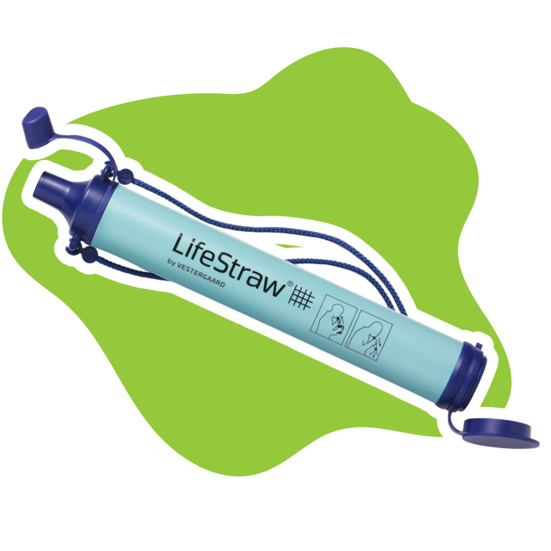
a lifestraw against a green background

2. LifeStraw Personal Water Filter

For the camper, hiker, or paddler, this lightweight filter is a lifesaver. It ensures access to clean drinking water anywhere—as long as there’s water nearby.

Pair the Lifestraw with a Wisconsin trails map for the ultimate adventurer’s gift!

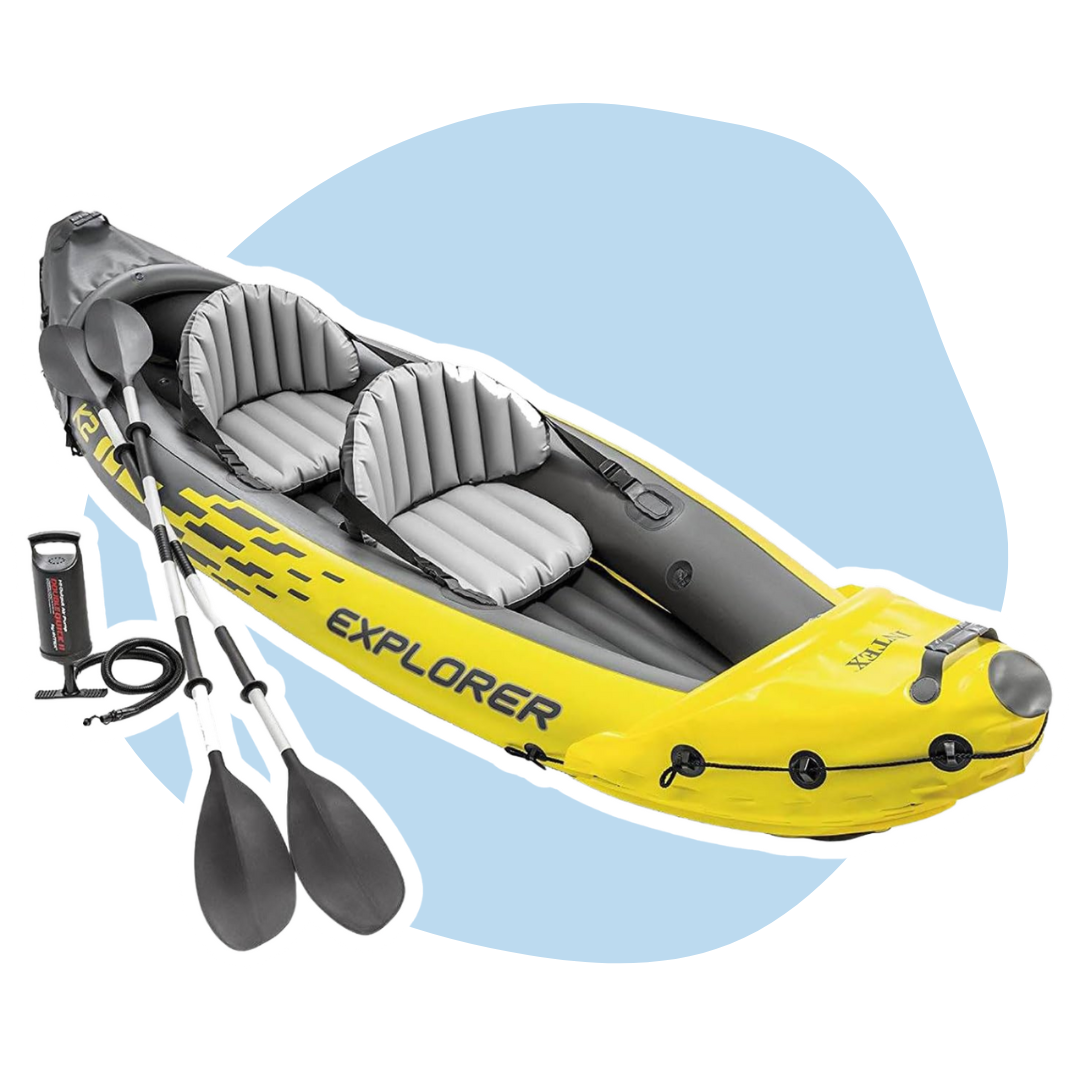
3. Inflatable Kayak

Perfect for paddling enthusiasts who love exploring waterways like the Little Wolf River or Shawano Lake. Inflatable kayaks are easy to transport, set up, and store—ideal for spontaneous adventures.

Paddling Wisconsin: A Guide to the State’s Best Paddling Routes goes great with this gift!

a yellow inflatable kayak with oars in front of a light blue background

For the Home: Relaxation and Freshwater-Inspired Decor

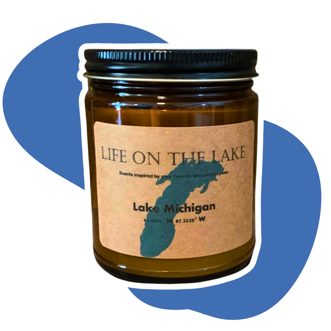
a wisconsin lake candle in front of a blue background

4. Wisconsin Lakes Candle

Bring the outdoors inside with a candle inspired by the calming scents of Wisconsin’s iconic lakes. Whether they’re reminiscing about a peaceful day on the Waupaca Chain or a day at Bay Beach on the shores of Lake Michigan, this gift is sure to spark warm memories.

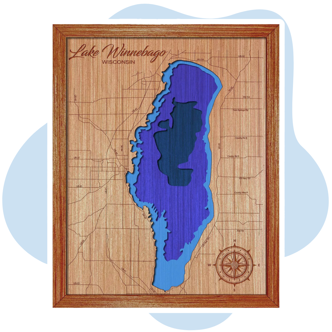
5. Wisconsin Lakes Depth Map

This intricate 3D map of your favorite Wisconsin lake is more than just decor—it’s a stunning celebration of Wisconsin’s freshwater connections. A perfect gift for someone who cherishes the beauty of Lake Winnebago, Wilson Lake, and beyond!

a depth map of Lake Winnebago
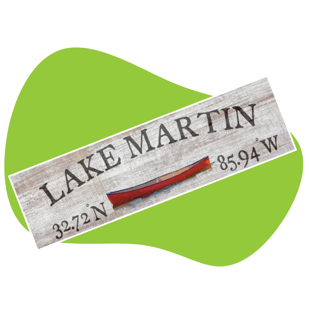
a custom lake sign sign reading lake Martin with coordinates

6. Custom Lake Name Sign

Celebrate a favorite lake with a beautifully crafted wood sign featuring its name and coordinates. Whether it’s Lake Butte des Morts or Partridge Lake, this keepsake is a heartfelt way to honor their connection to the water.

7. Personalized Wisconsin Fishing Journal

For anglers who love casting a line in the Fox River or Shawano Lake, this journal lets them log their best catches and memorable days on the water.

a leather journal in front of a blue background

For the Watershed: Eco-Friendly and Impactful Gifts

the few-wolf watershed alliance logo

8. Donation to the Fox-Wolf Watershed Alliance

Give the gift of clean, thriving waters by donating to the Fox-Wolf Watershed Alliance in their name. This thoughtful gesture supports conservation efforts in beloved waterways like the Wolf River, Fox River, and Lake Winnebago.

Better yet – why not get them a Fox-Wolf membership?

9. Shower Flower

For the water lover who has everything – get them a show flower! Help them save water with this unique product that collects shower water while it warms up. Perfect for watering plants or household tasks, it’s an easy way to conserve and reduce waste!

a shower flower against a green background

Stocking Stuffers and Budget-Friendly Finds

A Lake Winnebago coaster

10. Wisconsin Lake Map Coasters

For the water lover who has everything – get them a show flower! Help them save water with this unique product that collects shower water while it warms up. Perfect for watering plants or household tasks, it’s an easy way to conserve and reduce waste!

11. Wisconsin Native Fish Species Poster

Brighten up their home with a colorful, educational print that highlights fish species found in Lake Winnebago and nearby waterways. It’s perfect for anglers or nature enthusiasts.

a wisconsin native species fish poster
a rain barrel spigot

12. DIY Rain Barrel Kit

Help them make the most of nature’s resources with a rain barrel kit. Ideal for gardeners who want to collect rainwater, especially in areas near Oshkosh or Fond du Lac, close to Lake Winnebago.

Celebrate and Protect Wisconsin’s Waters

From the calm beauty of Lake Butte des Morts to the rushing currents of the Fox River, our waterways bring joy, adventure, and connection to so many. This holiday season, give gifts that reflect your loved one’s passion for freshwater—and support the critical work of the Fox-Wolf Watershed Alliance in protecting these beautiful resources.

Get Involved!

What’s your favorite memory from Wisconsin’s lakes or rivers? Share it on social media using #FoxWolf #WorthProtecting. Let’s celebrate the places that bring us peace and joy—and work together to protect them for future generations.

Happy holidays, and thank you for making waves with your gift-giving this year!

The post The Ultimate Gift Guide for Freshwater Fans appeared first on Fox-Wolf Watershed Alliance.

Original Article

Fox-Wolf Watershed Alliance

Fox-Wolf Watershed Alliance

https://fwwa.org/2024/11/26/freshwater-gift-guide/?utm_source=rss&utm_medium=rss&utm_campaign=freshwater-gift-guide

Dan Beckwith

FREE Salt Watch kit available from at the training thanks to the Izaak Walton League!

The training will cover monitoring process. However, for more information, check out this video explaining the monitoring process from the Izaak Walton League:

The post Join Fox-Wolf and Help Monitor for Chlorides(Salt) appeared first on Fox-Wolf Watershed Alliance.

Original Article

Fox-Wolf Watershed Alliance

Fox-Wolf Watershed Alliance

https://fwwa.org/2024/10/28/join-fox-wolf-and-help-monitor-for-chloridessalt/?utm_source=rss&utm_medium=rss&utm_campaign=join-fox-wolf-and-help-monitor-for-chloridessalt

Alyssa Reinke

Meet the Monsters Haunting the Waters of the Fox Valley and Green Bay

Forget Michael Myers—the real monsters this Halloween are lurking beneath the surface of the Fox-Wolf Watershed! As you plan your spooky adventures, whether you’re trick-or-treating in the Fox Valley or Green Bay, meet the environmental threats that haunt our lakes and rivers. These villains won’t be defeated with a hockey mask or kitchen knife, but with a little teamwork, we can keep our waters monster-free and Halloween fun watershed-friendly. 🎃

Just as Michael Myers stalks Laurie Strode, these environmental villains silently threaten our waterways. From slimy algae to invasive zebra mussels, these monsters might be out of sight, but they’re dangerously real. Let’s meet them—and learn how to fight back!

The Phosphorist

“Possessing Waters, Spewing Green Goo!”

Where It Strikes: Fox River, Lake Winnebago, Green Bay

The Phosphorist is here—an evil force that takes control of lakes and rivers, just like a demonic possession in The Exorcist. It uses phosphorus from fertilizers, grass clippings, and animal waste as its unholy fuel, spreading thick, green algae blooms that choke the life out of every waterway it touches. Under the Phosphorist’s grip, fish gasp for oxygen, plants wilt, and the once-beautiful waters are transformed into slimy, stinking nightmares.

Like a possessed soul, the lake becomes corrupted—its clear waters replaced by murky, algae-filled sludge. And just like an exorcism gone wrong, the Phosphorist keeps returning after every storm, bringing new blooms and foul odors. Unless the right steps are taken, this toxic force will haunt our rivers and lakes forever.

How to Fight It:

  • Use fertilizers only when necessary, and keep grass clippings away from storm drains.
  • Support watershed-friendly practices with help from the Fox-Wolf Watershed Alliance.

Clingers

The horde just keeps coming!

Where It Strikes: Lake Winnebago, Fox River, Wolf River

Clingers are like the Clickers from The Last of Us—unstoppable, relentless, and spreading wherever they can latch on. These zombie-like zebra mussels invade lakes and rivers, clinging to boats, docks, and water pipes with an iron grip. Once they infest a waterway, they multiply fast, draining the nutrients that fish and plants need to survive. With fewer native species thriving, the water becomes too clear—making the perfect environment for harmful algae to grow.

Just like in a post-apocalyptic world, the Clingers creep silently from lake to lake, hitching rides on boats and fishing gear. Their jagged shells litter beaches, cutting into bare feet, while colonies clog water pipes and infrastructure. Without action, the Clingers will spread through the Fox-Wolf Watershed, turning vibrant ecosystems into lifeless wastelands faster than a horde of Clickers on the move.

How to Fight It:

Lampires

The Bloodsuckers of the Watershed

Where They Strike: Great Lakes, Rivers, and Streams near Green Bay

Beware the Lampire—a sea lamprey terror lurking in rivers and lakes, feeding on fish like a vampire of the deep. With its suction-cup mouth full of sharp teeth, it clamps onto its prey and drains their blood, leaving them too weak to survive. This invasive creature has slithered into the Great Lakes and waterways near Green Bay, turning once-thriving ecosystems into watery graveyards. Just like the infamous Nosferatu, it sneaks in silently, looking creepy and leaving destruction in its wake—making it harder for native fish to survive.

How to Fight It:

  • Back programs like the Great Lakes Fishery Commission that work to manage the sea lamprey invasion.
  • Follow fishing rules—some fish species help control the spread by feeding on lamprey larvae.
  • Get involved in watershed conservation efforts to stop these aquatic vampires from expanding their reach.

Floody Krueger

A Nightmare on Every Street!

Where It Strikes: Parking Lots, Streets, and Sidewalks

Freddy haunts dreams with terror, Floody haunts streets and waterways with polluted runoff. As rain pours down, stormwater gathers oil, fertilizer, pet waste, and trash, sweeping it all into nearby rivers and lakes. Fish and plants suffer in his toxic nightmare, while algae thrive on the chaos. If this waterborne slasher isn’t stopped, his sludge-filled trail will make rivers too dangerous for swimming and fishing—turning every trip to the lake into a horror story.

How to Fight It:

Trashenstein

“It’s ALLLITTER!”

Where It Strikes: Beaches, Parks, and Shorelines

Like Frankenstein’s monster, Trashenstein is cobbled together from every discarded bottle, wrapper, and bag. With every piece of trash, it surges back to life—“It’s aliiive!”—growing larger and more destructive. Trashenstein clogs rivers, traps animals in plastic, and turns parks into horror scenes that even Victor Frankenstein would fear. The more litter left behind, the harder it is to stop this monster from rampaging across shorelines and waterways.

How to Fight It:

  • Don’t litter—cut off Trashenstein’s lifeline.
  • Join area clean-up efforts to dismantle the monster bit by bit.

Tips for Fox-Wolf Friendly Trick-or-Treating in the Fox Valley and Green Bay

Halloween is about more than costumes and candy—it’s also a chance to protect the environment! As you head out for trick-or-treating in Green Bay or the Fox Valley, follow these simple tips to keep the fun Fox-Wolf friendly.

1. Use Reusable Trick-or-Treat Bags

Swap plastic bags for reusable ones that can hold more candy and last longer. Plus, no more worrying about your bag ripping halfway through the night! Using reusable bags also keeps stray plastic out of the environment. Win-win!

2. Stick to Neighborhood Routes

Staying close to home isn’t just more fun—it helps the environment, too! Driving less means fewer pollutants like oil, gas, and tire particles washing into rivers and lakes when it rains. Bonus: It’s a great way to meet neighbors and see more decorations!

3. Walk, Bike, or Scoot

Why take the car when you can stroll, pedal, or roll? Walking or biking with friends means fewer emissions, cleaner air, and more candy time! And the best part? The adventure is just as sweet as the treats.

4. Bring a Cleanup Bag for Litter

Keep the streets looking great by bringing along a small bag to pick up any stray wrappers or bottles you find. A cleaner neighborhood means less litter ending up in storm drains—and cleaner rivers and lakes for everyone to enjoy.

5. Spread the Word

Share these simple tips with friends, family, and neighbors. When everyone pitches in, the impact really adds up! A small effort from each of us makes our water cleaner and our Halloween so sustainable-it’s scary!

Keep Our Watershed Safe and Monster-Free This Halloween

Whether you’re trick-or-treating in the Fox Valley or Green Bay, Halloween can be about more than just spooky fun. Every action you take—from picking up trash to planting rain gardens—helps protect the Fox-Wolf Watershed from real environmental monsters.

Together, we can banish Flooddy Krueger, Trashenstein, and all the other monsters from our rivers and lakes. This Halloween, let’s enjoy the fun while making a difference for the environment. 🎃

Photo Credit: Yuliya Karshirina, Kelly Reyer, T. Lawrence (NOAA)

Questions? Comments? Contact Chris Acy, the AIS Coordinator covering Brown, Outagamie, Fond du Lac, Calumet, and Winnebago Counties at (920) 460-3674 or chris@fwwa.org!

Follow the Fox Wolf Watershed Alliance on our Fox-Wolf Watershed Alliance Facebook page or @fox_wolf_watershed_alliance on Instagram! You can also sign-up for email updates at fwwa.org.

The Fox-Wolf Watershed Alliance is an independent nonprofit organization that identifies and advocates effective policies and actions that protect, restore, and sustain water resources in the Fox-Wolf River Basin.

This Halloween, let’s have fun while doing a little good for the watershed! With just a few small changes, you can enjoy trick-or-treating and help protect our beautiful rivers, lakes, and parks. Here’s how you and your friends can make a difference:

The post Trick or Treating in the Fox Valley & Green Bay: Beware the Monsters Threatening Our Watershed appeared first on Fox-Wolf Watershed Alliance.

Original Article

Fox-Wolf Watershed Alliance

Fox-Wolf Watershed Alliance

https://fwwa.org/2024/10/18/trick-or-treating-fox-valley-green-bay-monsters-watershed/?utm_source=rss&utm_medium=rss&utm_campaign=trick-or-treating-fox-valley-green-bay-monsters-watershed

Chris Acy

Communications Specialist – Full-Time

The Communications Specialist is a key part of the team of the Fox-Wolf Watershed Alliance (Fox-Wolf). The Communications Specialist works cooperatively with staff to develop and implement strategies for communications that will increase the visibility of the organization, watershed recovery initiatives, and projects.

The successful applicant will bring skills in writing, graphic design, creativity, and time management. Key duties include managing digital and print communications, developing content, establishing communication calendars and processes, and tracking metrics.

While reporting directly to the Executive Director, the Communication Specialist will work closely with Recovery Area Directors and all program staff to build support for organizational initiatives.

Full Position Description

To apply, email resume and cover letter to jessica@fwwa.org.

The post Communications Specialist appeared first on Fox-Wolf Watershed Alliance.

Original Article

Fox-Wolf Watershed Alliance

Fox-Wolf Watershed Alliance

https://fwwa.org/2024/02/05/communications/?utm_source=rss&utm_medium=rss&utm_campaign=communications

Jessica Schultz

This fall, travelers along the Highway 41 cooridor in Brown County were greeted with a conservation message flashing on digital billboards along their route:

At Fox-Wolf, we’re invested in making impacts to water quality from all sources – residential, commercial, municipal, and agricultural.  We partner with people and organizations from across all these sources to reduce the amount of the phosphorus and sediment that’s delivered to our local waters and downstream through the Fox River and into the bay of Green Bay.  Collectively, these impacts lessen the “green” (algae) in Green Bay.

That’s why education and outreach is key!  Each of us has an opportunity to contribute in our own way.  By sharing how our local farmers are investing in water quality by adopting conservation practices, our communities can see how agriculture is doing its part as well.

Cover crops planted in the fall keep soil in place throughout the winter

Cover Crops Keep Fields Green in the Fall and Water Blue in the Spring

As you drive by the many agricultural fields in the greater Fox Cities area, you may notice a variety of colors peeking out from the snow.  Some fields are still have green bits of vegetation, some have bits of corn stalks left poking from the ground, and some are bare soil.  In traditional farming, after the fall harvest of row crops, such as corn or soybeans, the soil surface of a field will be left bare until the next crop is planted and a new plant canopy is established. Here in Wisconsin, that next planting may be 5-7 months away. That’s a long time for the bare soil to be vulnerable to erosion caused by rainfall, snowmelt, or wind. For that reason, conservation-minded farmers utilize cover crops to have vegetation established and growing in the fall months and remain in place during the winter.

In the spring, cover crops are terminated and left on the surface as residue for conservation tillage or are incorporated into the soil.  Properly planned and executed, cover crops will protect soil during this vulnerable period. This topsoil is full of nutrients such as phosphorous and nitrogen, so by keeping soil in place, these nutrients are kept on the land where they benefit crops and prevented from running into waterways where they contribute to degraded water conditions and algal blooms.  Keeping soil in place also keeps pesticides, herbicides, and manure out of nearby streams, rivers, and lakes.

Cover crops do more than just improve water quality.  As a benefit to the farmer, cover crops can also:

  • Slow runoff from rainfall and snowmelt, reducing soil loss due to erosion
  • Increase soil organic matter, leading to improvements in soil structure that benefits plant growth
  • Increase soil quality by improving the biological, chemical, and physical soil properties
  • Store nutrients from manure until the following years’ crop can utilize them
  • Reduce or mitigate soil compaction as deep tap roots are able to grow in fall and spring
  • Provide a natural means of suppressing soil diseases and pests and serve as a mulch to assist in suppressing weeds
  • Provide high-quality material for grazing livestockand can provide food and habitat for wildlife, beneficial insects, and pollinators

Thank you conservation farmers!

The post Billboard Campaign Educates on Cover Crops appeared first on Fox-Wolf Watershed Alliance.

Original Article

Fox-Wolf Watershed Alliance

Fox-Wolf Watershed Alliance

https://fwwa.org/2024/01/26/kof_billboard/?utm_source=rss&utm_medium=rss&utm_campaign=kof_billboard

Katie Woodrow

If you would like to attend the Jan. 31, 2024 meeting either in-person or virtually, please RSVP to Katie Reed at katherine@fwwa.org or 920-851-6472 by 1/29/24. Thank you!

The Winnebago Water Level Assessment Team provides a collaborative opportunity for stakeholder representatives and experts to develop realistic and achievable water level recommendations and related goals that reasonably balance the top priorities of multiple system users and the health of the lakes.

Meeting details:
Date: January 31, 2024
Time: 9:00 am – 11:00 am
Facilitator: Katie Reed, Winnebago Waterways Program Coordinator, Fox-Wolf Watershed Alliance, katherine@fwwa.org, (920)851-6472 & Jim Wickersham, Winnebago Waterways Program Director, jim@fwwa.org 
Where: Virtual and In person options – In Person at Fox-Wolf Watershed Alliance office in Appleton & Virtual Option (see agenda for details)

CLICK HERE for the meeting agenda

Check back here for the meeting notes and presentation slides after the meeting

To visit the WWLAT website for other meeting notes and updates, CLICK HERE.

Winnebago Waterways is a Fox-Wolf Watershed Alliance recovery initiative. Contact us at wwinfo@fwwa.org

The post WWLAT MEETING: Jan. 31, 2024 appeared first on Fox-Wolf Watershed Alliance.

Original Article

Fox-Wolf Watershed Alliance

Fox-Wolf Watershed Alliance

https://fwwa.org/2024/01/22/wwlat_2024_01_31/?utm_source=rss&utm_medium=rss&utm_campaign=wwlat_2024_01_31

Katie Reed

Released Goldfish Grow to Monstrous Size, Destroy Habitat

Original Story: Livia Albeck-Ripka, The New York Times

Inside a fishbowl, the goldfish — a species of carp native to East Asia, bred for aesthetic delight and traditionally believed to bring good fortune — is hardly more than home décor. Usually just a few inches long, it is among the easiest of pets to keep.

But released into the wild, the seemingly humble goldfish, freed from glass boundaries and no longer limited to meager meals of flakes, can grow to monstrous proportions. They can even kill off native marine wildlife and help destroy fragile and economically valuable ecosystems.

“They can eat anything and everything,” said Christine Boston, an aquatic research biologist with Fisheries and Oceans Canada.

Over the past several years, Ms. Boston and her colleagues have been tracking invasive goldfish in Hamilton Harbour, which is on the western tip of Lake Ontario, about 35 miles southwest of Toronto. The bay has been decimated by industrial and urban development as well as by invasive species — making it among the most environmentally degraded areas of the Great Lakes.

Their study, published last month in the Journal of Great Lakes Research, could help pinpoint goldfish populations for culling, said Ms. Boston, who is the lead author. “We found out where they are before they start spawning,” she said. “That’s a good opportunity to get rid of them.”

The fast-growing female goldfish, Ms. Boston noted, can also reproduce several times in one season. “They have the resources,” she added, “and they can take advantage of them.”

Goldfish were first spotted in Hamilton Harbour in the 1960s, but largely died off in the 1970s because of industrial contamination. In the early 2000s, their population appeared to recover. Goldfish can tolerate a wide range of water temperatures, reach sexual maturation quickly, and can eat nearly anything, including algae, aquatic plants, eggs and invertebrates, Ms. Boston said.

The feral goldfish are also destructive, uprooting and consuming plants that are home to native species. They help spawn harmful algal blooms by consuming the algae and expelling nutrients that promote its growth, Ms. Boston said, creating conditions that are intolerable to native fish.

To track the goldfish, the researchers captured and sedated 19 of the larger adults and surgically implanted tags the size of AA batteries into their bellies. The tags, which sent signals to acoustic receivers around the bay, provided researchers with a map of their locations.

Eight of the fish died, but the remaining 11 led Ms. Boston and her colleagues to find that the fish tended to spend the winter in deep waters and moved to shallower habitats by spring, where they prepared to spawn.

Some options for removing the goldfish, she said, include capturing them with specialized nets deployed beneath winter ice, or using “electro fishing,” which involves stunning the fish with an electrical current and scooping them from the water. Both techniques, she added, would avoid killing the native fish.

Nicholas Mandrak, a professor of biological sciences at the University of Toronto Scarborough, said that while goldfish were introduced to North America in the late 1800s, the wild population had begun to “dramatically increase” in the past two decades. Their spawning explosion, he said, resulted partly from people in densely-populated areas releasing pets in urban ponds.

Climate change may play a role, because of the goldfish’s capacity to adapt to warming and poorly oxygenated waters, he added.

“There are literally millions of goldfish in the Great Lakes, if not tens of millions,” Dr. Mandrak said.

Despite the threat, he added, environmental managers tend to forget the goldfish. “They just assume, ‘It’s been there for 150 years — there’s nothing we can do about it.’”

The problem is not unique to Canada. In Australia, a handful of unwanted pet goldfish and their offspring took over a river in the country’s southwest. Feral goldfish have flooded waterways in the United Kingdom, and, in Burnsville, Minn., the discovery of football-size creatures in a lake in 2021 led officials to beg their constituents: “Please don’t release your pet goldfish into ponds and lakes!”

People wrongly believe that because goldfish are “small and cute” they won’t pose a problem when released into the wild, said Dr. Ricciardi. “It’s the ‘Free Willy’ syndrome.”

Goldfish, he added, are just a small part of a vast invasion of non-native species whose outcomes can be unpredictable, and in some cases, are worsened by climate change.

“Under human influence, beasts are moving faster farther in greater numbers, reaching parts of the planet they could never reach before,” he said. “We’re talking about the redistribution of life on Earth.”

Anthony Ricciardi, a professor of invasion ecology at McGill University in Montreal, noted that not all invasive goldfish become supersized, but even the small ones are problematic, outpacing native fish populations and damaging the environment.

Their football-shaped bodies can swell to a size that makes them too large a meal for predators — up to about 16 inches long. “A fish would have to have a really big mouth to eat it,” she said.

Photo Credit: Vincent Tullo (New York Times), Fisheries and Oceans Canada, Great Lakes Laboratory for Fisheries and Aquatic Sciences

Questions? Comments? Contact Chris Acy, the AIS Coordinator covering Brown, Outagamie, Fond du Lac, Calumet, and Winnebago Counties at (920) 460-3674 or chris@fwwa.org!

Follow the Fox Wolf Watershed Alliance’s Winnebago Waterways Program on our Winnebago Waterways Facebook page or @WinnWaterways on X! You can also sign-up for email updates at WinnebagoWaterways.org.

Check out the Keepers of the Fox Program at https://fwwa.org/watershed-recovery/lower-fox-recovery/

Winnebago Waterways and Keepers of the Fox are Fox-Wolf Watershed Alliance programs. The Fox-Wolf Watershed Alliance is an independent nonprofit organization working to protect and restore water resources in the Fox-Wolf River Basin.

Reporting invasive species is a first step in containing their spread. Maintaining and restoring our waters and landscapes can reduce the impacts even when we don’t have other management options to an invasive species.

The post Once They Were Pets. Now Giant Goldfish Are Menacing the Great Lakes. appeared first on Fox-Wolf Watershed Alliance.

Original Article

Fox-Wolf Watershed Alliance

Fox-Wolf Watershed Alliance

https://fwwa.org/2024/01/16/once-they-were-pets-now-giant-goldfish-are-menacing-the-great-lakes/?utm_source=rss&utm_medium=rss&utm_campaign=once-they-were-pets-now-giant-goldfish-are-menacing-the-great-lakes

Chris Acy

Fox-Wolf Watershed Alliance is implementing conservation projects to protect our waters for future generations. Help us prioritize future restoration projects and strengthen funding requests by telling us how you enjoy the lakes!

Please be specific – we are interested in the areas you use the most (we are looking to improve your spots, not steal them!). The map will be made public but your name will not be tied to the points you add.

To get started, please click the button “Take the Survey Now!” or use the QR Code on the right.

Once on the map, click the “Edit” icon located on the upper left corner underneath the search bar. The icon looks like a list with a pencil. Select the type of activity that you would like to add, then click on the map where you do this activity to add it.

Add as many points as you’d like, keeping in mind we are interested in the areas most important to YOU. Adding an area that covers a whole lake is not as helpful as adding three points of the areas you fish the most and the boat launch you use to access it.

If you enjoy our waters in a way not listed, please select the most similar activity or select “other”, and add a description of the activity in the notes.

Thank you for your help and participation!

Contact Katie R with any questions or concerns at katherine@fwwa.org

Winnebago Waterways is a Fox-Wolf Watershed Alliance recovery initiative. Contact us at wwinfo@fwwa.org

The post Tell us where and how you use the waterways! appeared first on Fox-Wolf Watershed Alliance.

Original Article

Fox-Wolf Watershed Alliance

Fox-Wolf Watershed Alliance

https://fwwa.org/2024/01/15/recreationsurvey/?utm_source=rss&utm_medium=rss&utm_campaign=recreationsurvey

Katie Reed

Project Overview

In 2020, the Wisconsin Department of Natural Resources (WDNR) developed a Total Maximum Daily Load (TMDL) for the Upper Fox and Wolf River (UFW).  A TMDL is a calculation of the maximum amount of a pollutant that a body of water can absorb and still meet water quality.  The TMDL was utilized in the creation of the EPA’s Nine Key Elements (9KE). Within the 9KE there is a requirement for reductions in pollution to meet water quality goals.  The goals within this plan are to reduce Total Phosphorus (TP) which also relates to the reduction of Total Suspended Solids (TSS) such as erosion and flooding.

Approximately 34% of the reduction from the TMDL needs to come from the Winnebago Waterways Recovery Area with 51% of that reduction assigned to agriculture.  Alteration in farming practices and structural changes will help make reductions.

Currently, a missing piece in the TMDL and draft 9KE plan is streambank erosion. Streambank erosion is lumped in with agricultural loading estimates and required reductions in the TMDL. In some watersheds, we anticipate streambank erosion being a significant contributor to the total TMDL agricultural load. We need to inventory the streambanks in each HUC12 so that we can estimate potential TP/TSS reductions that could come from stabilizing streambanks to stop streambank erosion and to prioritize project locations. Stabilizing streambanks would be paired with efforts to increase infiltration on the land to reduce the volume and rate of flow that damages streambanks during storm events.

For this project, we will begin by completing streambank inventories in the four highest loading HUC12s located within the WWRA. The pollutant load from these HUC12s significantly contributes to water quality impairments of the streams within each HUC12, the Winnebago Lakes, and Lake Michigan. In addition to providing loading estimates from streambank erosion, this project also seeks to identify and prioritize potential locations for future restoration projects to help reduce nutrient loading and protect or enhance existing habitat. Going forward, this project will serve as a template for completing future streambank inventories for the remaining 28 HUC12s located in the WWRA.

Target HUC12 Subwatersheds in the 2023 Streambank Erosion Inventory

HUC12 to be Inventoried                                HUC12 Code                                Stream Miles

Town of Dale-Rat River                                      040202022102                                         60

Eldorado Marsh-Fond Du Lac River                 040302020204                                         63

Lake Poygan – Willow Creek                             040302022006                                          88

Pipe Creek – Frontal Lake Winnebago            040302020303                                          91

Project Timeline

In the Spring of 2023, a method was developed using GIS to determine streambanks to be physically inventoried as they are representative of the HUC12 they are located in. The method developed has been recorded in SOP#1: Streambank Erosion Inventory Desktop Review so it can be duplicated.

Fieldwork was accomplished in the summer of 2023. Streambank information from the desktop review was utilized to complete a physical inventory of these sections.

December 2023 – February 2024: Streambank Inventory Data Analysis was developed along with the extrapolation. These tools will allow an estimation of sediment loss and load & phosphorus loss and load for an entire watershed.

Project Funding & Partners

Winnebago Waterways is a Fox-Wolf Watershed Alliance recovery initiative. Contact us at wwinfo@fwwa.org

The post Prioritizing stabilization projects using streambank erosion inventories in the Fox-Wolf River Basin appeared first on Fox-Wolf Watershed Alliance.

Original Article

Fox-Wolf Watershed Alliance

Fox-Wolf Watershed Alliance

https://fwwa.org/2024/01/11/streambank-inventory/?utm_source=rss&utm_medium=rss&utm_campaign=streambank-inventory

Katie Reed

As we come to the conclusion of the Fox Farmer Conservation Champions grant, the outcomes of this initiative to promote sustainable farming practices are becoming increasingly evident. The collaboration between Fox-Wolf Watershed Alliance, Outagamie County Land and Water Conservation Department (LWCD), and local producers have not only yielded successful results but have also fostered trust and a shared commitment to the journey toward enhanced soil health.

Despite the conclusion of the grant this winter, the enthusiasm among local farms remains palpable. The prospect of experimenting with new ideas and implementing previously successful strategies underscores the enduring commitment of producers to soil health practices.  And producers beyond those enrolled in the grant project are on board.    Due not in a small part to the influence of the project’s farmers, many surrounding farms are installing cover crops with and without cost-share payments. The commitment the participating farms have to soil health practices has been one of the project’s most noted successes. This commitment is shown by both expanding soil health practices on acres outside those under contract and continuing practices on acres that no longer receive cost share from this grant or others. Soil health practices are beyond the minimum requirement of cover crops and no-til and are being incorporated as part of each farm’s operation.  At first, the different practices seemed challenging or an extra step, for example buying seed or finding someone to drill in cover crop directly after harvest.  With each year, the farms were able to better manage these challenges or “extra steps.”  Now planting cover crop, for example, is almost fully incorporated into their mindsets.

A triumph of this initiative lies not only in tangible outcomes such as acres implemented but in the relationships and trust woven between farms and project staff. The willingness of producers to confront challenges head-on, coupled with their commitment to learning and adaptation

paints a vivid picture of the great work our these and other local farmers are undertaking. Thanks to funding and investments in planning resources, producers are empowered to navigate obstacles, forging a resilient path rather than abandoning sustainable practices. The harmony between producers and project staff reflects a shared dedication to the soil health journey.

As we wrap up this Great Lakes Restoration Initiative project that started back in 2019, the success stories and lessons learned from this collaborative venture resonate as a model to replicate in other grant projects. The commitment to innovation and adaptability by the producers and the strong relationships established between producers and project staff have demonstrated the need for conservation staff to support producers in adopting soil health practices. With each growing season, agricultural conservation work across the basin shows that by sowing the seeds of collaboration and sustainability, the harvest reaped is one of resilience, prosperity, and environmental stewardship.

These efforts are possible through a GLRI grant focused on:

  • Continuing to build on conservation momentum in the Plum and Kankapot subwatersheds by providing support to producers by Outagamie County Land Conservation Department staff
  • Working with Conservation Champions to overcome the hurdles of consistent implementation of cover crops, no-till, and low disturbance manure injection and
  • Tracking successes and challenges and communicating best practices to other local producers

Questions? Want to learn more? Contact the Lower Fox River Watershed Program Director, Katie Woodrow, at katie@fwwa.org

Questions? Contact us:

Basin Agriculture Coordinator: Justin Loehrke, 920.841-6938 or justin@fwwwa.org

Climate Smart Agriculture Project Manager: Katie Woodrow, 920.915.5767 or katie@fwwa.org

To receive periodic updates on these projects as well as many others, please subscribe to our newsletters: CLICK HERE

The post Sowing Success: Fox Farmers Wraps Up appeared first on Fox-Wolf Watershed Alliance.

Original Article

Fox-Wolf Watershed Alliance

Fox-Wolf Watershed Alliance

https://fwwa.org/2023/12/19/fox-farmers-wraps-up/?utm_source=rss&utm_medium=rss&utm_campaign=fox-farmers-wraps-up

Katie Woodrow

The species spotlighted this month is Great Blue Lobelia (Lobelia siphilitica)! Also known as Blue Cardinal Flower, Great Blue Lobelia is a perennial wildflower native to Wisconsin that grows well along streams, springs, swamps, meadows and other places with sufficient moisture. This species grows up to 4 feet tall, with a leafy stalk on which blue/purple tubular flowers bloom in July – October. Great Blue Lobelia requires moist to wet soil and partial to full sun, and is resistant to deer browsing. This plant has a wide distribution in North America, found in wet ground from Main to Colorado and into Canada, and south to North Carolina and Texas.

The seedlings of Great Blue Lobelia are very tiny at first, before growing into the clump forming wildflower. This plant usually blooms in its first year. Seeds in October – November and in optimal conditions, this plant may self-seed, but is not overly prolific. It is not very drought tolerant, and requires moist soil.

Great Blue Lobelia is a great plant for shoreline plantings. Along with other native species, its roots are great for capturing and slowing down stormwater runoff, and for holding on to soil which helps prevent erosion. In addition, Great Blue Lobelia attacks hummingbirds and native bee species!

Image Credit: Aaron Carlson; www.wisflora.herbarium.wisc.edu; CC BY-SA 3.0

H. Zell; CC BY-SA 3.0

Winnebago Waterways is a Fox-Wolf Watershed Alliance recovery initiative. Contact us at wwinfo@fwwa.org

The post Species Spotlight: Great Blue Lobelia appeared first on Fox-Wolf Watershed Alliance.

Original Article

Fox-Wolf Watershed Alliance

Fox-Wolf Watershed Alliance

https://fwwa.org/2023/10/27/species-spotlight-great-blue-lobelia/?utm_source=rss&utm_medium=rss&utm_campaign=species-spotlight-great-blue-lobelia

Katie Reed

The Winnebago Water Level Assessment Team provides a collaborative opportunity for stakeholder representatives and experts to develop realistic and achievable water level recommendations and related goals that reasonably balance the top priorities of multiple system users and the health of the lakes.

Meeting details:
Date: September 27, 2023
Time: 1:00 pm to 3:30 pm
Facilitator: Katie Reed, Winnebago Waterways Program Coordinator, Fox-Wolf Watershed Alliance, katherine@fwwa.org, (920)851-6472 & Jessica Schultz, Executive Director, Fox-Wolf Watershed Alliance, jessica@fwwa.org
Location: Fox-Wolf Watershed Alliance office in Appleton (see agenda for address)

CLICK HERE for the meeting agenda

CLICK HERE for the meeting notes and presentation slides

To visit the WWLAT website for other meeting notes and updates, CLICK HERE.

Winnebago Waterways is a Fox-Wolf Watershed Alliance recovery initiative. Contact us at wwinfo@fwwa.org

The post WWLAT MEETING: Sept. 27, 2023 appeared first on Fox-Wolf Watershed Alliance.

Original Article

Fox-Wolf Watershed Alliance

Fox-Wolf Watershed Alliance

https://fwwa.org/2023/10/02/wwlat_2022_09_29-2/?utm_source=rss&utm_medium=rss&utm_campaign=wwlat_2022_09_29-2

Katie Reed

When making conservation plans, producers and conservation professionals alike want to know the impact that farm practices have on our local water.  Through work funded by Great Lakes Restoration Initiative, Fox-Wolf Watershed Alliance and Outagamie County have developed a Farm Progress Report to tell the story of conservation, one farm at a time.

The Farm Progress Report utilizes data from SNAP+, a program widely used by Wisconsin farmers, to generate modeled soil and phosphorus loss on each field based on soil type, phosphorus test results, and field management (tillage, manure management, crop cycle, etc).

This information is then compiled to create per field and per farm loss data, which is compared to the local conservation goal of 1 lb per acre per year of phosphorus loss and 0.5 tons per acre per year of soil loss.  This information is visualized in the Farm Progress Report through simple to read graphs that include the annual average compared to the community goal as well as tables that list the top ten fields to improve.

The Farm Progress Report has two purposes:

  1. Farm Knowledge: For farmers to understand the impact of their current farm practices on water quality, the goals for the community, and how they can make changes on their farm to improve their phosphorus and soil loss
  2. Communication: Farmers can utilize the Farm Progress Report to communicate with their local communities to show the positive impact they are having as well as to their processors to show that they have adopted conservation practices that may meet the processor’s environmental standards

A Farm Progress report was generated for each producer participating in the GLRI grant project and Fox-Wolf Watershed Alliance and Outagamie County LWCD met with each farm, along with their agronomist.  The Farm Progress Report was presented to each farm with an explanation of where the data was derived from, the community goal, and where their current farm practices compared to the goal.  Feedback was solicited from the producer and their agronomist on the information presented and the response was positive.  Producers understood the how the data was derived, how their on-field practices generated that data, and were interested in the potential of using the Farm Progress Report to communicate the great work they are doing to meet conservation goals in their watershed.

Further work will need to be done to streamline the data collection and input process and to ensure that the SNAP+ system is used consistently across the basin.  Overall, the Farm Progress Report was well received by farmers and they expressed interest in continuing to use it to watch their progress toward improving water quality.  Fox-Wolf Watershed Alliance intends to continue developing the report and promoting its widespread adoption to producers outside of this project.

Questions? Contact us:

Basin Agriculture Coordinator: Justin Loehrke, 920.841-6938 or justin@fwwwa.org

Climate Smart Agriculture Project Manager: Katie Woodrow, 920.915.5767 or katie@fwwa.org

To receive periodic updates on these projects as well as many others, please subscribe to our newsletters: CLICK HERE

The post Farm Progress Report – A Tool to Tell the Conservation Story appeared first on Fox-Wolf Watershed Alliance.

Original Article

Fox-Wolf Watershed Alliance

Fox-Wolf Watershed Alliance

https://fwwa.org/2023/09/29/farm-progress-report/?utm_source=rss&utm_medium=rss&utm_campaign=farm-progress-report

Katie Woodrow

This month’s species spotlight shines light on a native lamprey species of the Winnebago System: Chestnut Lampreys (Ichthyomyzon castaneus). There are other native species of lamprey in the Winnebago System too. These are the Silver, American Brook, and Northern Brook lampreys. Chestnut and silver lampreys are parasitic as adults, feeding on fish. However, this usually does not kill the fish. Despite the scary looking sucker disks, native lampreys are an important part of the ecosystem.

Chesnut Lamprey (young) Photo Source: Cal Yonce/USFWS

However, there is a non-native lamprey species to be aware of too: the sea lamprey. The sea lamprey is an aquatic invasive species has not invaded the Winnebago System, but is present in the Great Lakes. If the sea lamprey were to invade the Winnebago System, it is likely they would cause major issues for the ecosystem. We must work hard to keep this aquatic invasive species out of the Winnebago System. Though a bit creepy looking, the chestnut lamprey (and Silver, American Brook, and Northern Brook lampreys) are native to this region.

Chestnut lampreys are parasitic as adults but not as larvae. The adult chestnut lamprey attaches to a fish, then scrapes a hole in the body and sucks out blood and tissue fluids for nutrients. After feeding on a fish for several days, the lamprey drops off. Usually, the fish is not killed directly by the attack, but may die due to infections from the wound.

Chestnut lampreys have a skeleton made of cartilage with no true vertebrae. They technically do not have a jaw. This makes lampreys different from eels, which have a bony skeleton and jaws. Lamprey bodies are long and cylindrical. Chestnut lamprey adults range in length from 5-11 inches. The mouth of adult chestnut lampreys is as wide or wider than the head, and contains sharp teeth that each have two points (bicuspid). Along their back, chestnut lampreys have one continuous fin. Adults are usually dark brown, gray, or olive-green on the top, with a lighter coloration of yellow or tan on the stomach. During spawning, they can appear blue-black. Younger lampreys tend to be lighter in color.

The native range of the chestnut lamprey is as far north as the Hudson Bay in Canada and as far South as the Gulf of Mexico. The Mississippi and Missouri River networks help with this large range, as the lampreys move with their host fishes.

Chestnut Lamprey (bottom; native) vs. Sea Lamprey (top; non-native; NOT found in Lake Winnebago)

Photo Source: Bobbie Halchishak/USFWS

Chestnut lampreys spawn in late spring when the water temperature is about 50ۧ°F. Chestnut lampreys stay in the larval phase for 3 – 7 years. Chestnut lamprey larva do not have eyes. When they hatch, chestnut lampreys move downstream and bury themselves at the bottom of the water body they’re living in. For the next few years, they filter feed on tiny algae particles and tiny organisms before beginning to develop their sucking disk. This disk develops teeth which allows for parasitic feeding. Once Chestnut Lampreys are adults, they can suck blood and other nutrients from host fish. Chestnut lampreys can feed on many different fish species including carp, trout, pike, sturgeon, catfish, sunfish, and paddlefish. They live another one to two years as adults, for a total lifespan of about 6 – 9 years.

Chestnut lampreys are primarily nocturnal, meaning they are most active at night. This is often why we don’t see them unless they are attached to fish we catch! During the day, they rest under rocks and along river banks. Adult chestnut lampreys are not known to have predators, but the larval lampreys are preyed upon by burbot and brown trout.

Though we tend to think of parasites as “bad”, they play an important role in the ecosystem including helping to remove weaker fish from the population. The lamprey population may become large when they have plenty of fish to feed on, but then decrease as host populations decrease. This cycle is normal in the ecosystem. Aquatic invasive species like the sea lamprey are a cause for concern because they interfere with normal population dynamics.

Winnebago Waterways is a Fox-Wolf Watershed Alliance recovery initiative. Contact us at wwinfo@fwwa.org

The post Species Spotlight: Chestnut Lamprey appeared first on Fox-Wolf Watershed Alliance.

Original Article

Fox-Wolf Watershed Alliance

Fox-Wolf Watershed Alliance

https://fwwa.org/2023/08/25/species-spotlight-chestnut_lamprey/?utm_source=rss&utm_medium=rss&utm_campaign=species-spotlight-chestnut_lamprey

Katie Reed

Amendment to Clean Water Act improves Great Lakes through critical observation, collaboration

From fishing to enjoying a summer day at the beach, the Great Lakes provide enjoyment, comfort and a sense of home to the region. But these bodies of water were not always secure, as the lakes and connecting rivers were considered dangerous due to high pollution spots. 

The Great Lakes region has seen some of the most historic river fires.

Read Now at Great Lakes Now.

Original Article

Great Lakes Now

Great Lakes Now

https://www.greatlakesnow.org/2023/08/amendment-to-clean-water-act-improves-great-lakes-through-critical-observation-collaboration/

Jada Vasser

“It’s a good thing”: Fishflies in Great Lakes region signify healthy water

Summertime calls for good vibes, much-needed time in the sun and a creature many aren’t fans of — fishflies. 

These insects are no stranger to the Great Lakes region. Fishflies, also known as mayflies, spend most of their lives in the water and are only seen on land once they enter their adult stage.

Read Now at Great Lakes Now.

Original Article

Great Lakes Now

Great Lakes Now

https://www.greatlakesnow.org/2023/07/fishflies-great-lakes-signify-healthy-water/

Jada Vasser

Our wonderful water quality monitoring volunteers have kicked off the 2023 monitoring season!

Volunteers are monitoring sites located throughout the Winnebago Waterways Recovery Area. During the growing season, volunteers monitor once a month for physical, chemical, and biological data as part of the Winnebago Waterways Water Quality Monitoring Program. Their hard work and effort results in data that allows us to monitor the water quality from month to month and year to year. Already this season, they’ve faced dry, rainy, and smoky/hazy conditions. Thank you for all you do water quality monitoring volunteers!!

Read more about the Winnebago Waterways Water Quality Monitoring Program by clicking here!

Winnebago Waterways is a Fox-Wolf Watershed Alliance recovery initiative. Contact us at wwinfo@fwwa.org

The post Water Quality Monitoring Season off to a good start! appeared first on Fox-Wolf Watershed Alliance.

Original Article

Fox-Wolf Watershed Alliance

Fox-Wolf Watershed Alliance

https://fwwa.org/2023/06/29/ww-wq-volunteers-2023-season-start/?utm_source=rss&utm_medium=rss&utm_campaign=ww-wq-volunteers-2023-season-start

Katie Reed

This month’s species spotlight highlights Wisconsin’s largest and only aquatic salamander: the mudpuppy (Necturus maculosus)! This brown or grayish salamander typically has dark spots and deep red, feathery gills. These salamanders have a finned tail too. Mudpuppies can grow up to 16 inches (1.33 feet) long!

Mudpuppy – USFWS National Digital Library

The skin of mudpuppies is very slimy, though the rumors that mudpuppies are poisonous are not true. It is still best to avoid touching them and leave them be if you find one because they have sensitive, permeable skin.

Habitat & Diet

Mudpuppies live their whole lives in the water of lakes and rivers. They prefer areas with large flat docks and will live in underwater holes. Mudpuppies eat aquatic invertebrates (animals in the water without a backbone) such as worms and insect larvae. They will also eat small fish and other amphibians.

Behavior & Population Info

Mudpuppies breed in late fall and spawn in June. Eggs hatch in July or August. It is estimated mudpuppies can live up to 20 years old.

Mudpuppies are typically nocturnal, meaning they are most active at night. They may be more active during the day if the live in murky/muddy water but are tricky to spot and study. Currently, Wisconsin’s mudpuppy populations have not been extensively studied, so it is unknown how the species’ population is faring in Wisconsin. Their status is listed as common, but have recently been listed as a species of special concern in Minnesota, and are threatened in Iowa and Illinois. It is known that mudpuppies in Wisconsin are the only host of the Salamander Mussel, a state threatened species. In the winter, mudpuppies may be a common bycatch during the ice-fishing season, and in 2022 the Wisconsin DNR asked for help documenting mudpuppy observations. Mudpuppies are active year round, even under winter ice!

Mudpuppy – iNaturalist – thismia – CC BY-SA 4.0

Winnebago Waterways is a Fox-Wolf Watershed Alliance recovery initiative. Contact us at wwinfo@fwwa.org

The post Species Spotlight: Mudpuppy appeared first on Fox-Wolf Watershed Alliance.

Original Article

Fox-Wolf Watershed Alliance

Fox-Wolf Watershed Alliance

https://fwwa.org/2023/06/28/species-spotlight-mudpuppy/?utm_source=rss&utm_medium=rss&utm_campaign=species-spotlight-mudpuppy

Katie Reed

Nessel: $10B PFAS settlement with 3M doesn’t resolve Michigan’s claims

By Kelly House Bridge Michigan

The Great Lakes News Collaborative includes Bridge Michigan; Circle of Blue; Great Lakes Now at Detroit Public Television; and Michigan Radio, Michigan’s NPR News Leader; who work together to bring audiences news and information about the impact of climate change, pollution, and aging infrastructure on the Great Lakes and drinking water.

Read Now at Great Lakes Now.

Original Article

Great Lakes Now

Great Lakes Now

https://www.greatlakesnow.org/2023/06/nessel-10b-pfas-settlement-with-3m-doesnt-resolve-michigans-claims/

Bridge Michigan

GIS Analyst – Full-Time

In support of Fox-Wolf Watershed Alliance (Fox-Wolf)’s mission, the GIS Analyst is responsible for providing technical support to further the awareness of Fox-Wolf’s work to advance water quality. Duties include but are not limited to a wide range of work including: needs assessments, database design, application design, data development, software development and installation, cartographic mapping, user training, acceptance testing, rollout support, and technical support. The successful candidate will utilize project management principles to manage projects within time, scope and budget, work effectively with partners, and coordinate tasks with multi-faceted project teams. We are looking for a self-motivated, independent and detail-oriented individual who is passionate about the mission of Fox-Wolf.

This position reports to the Winnebago Waterways Director and will work on the following tasks:

● Design, monitor, and maintain the structure and integrity of the Fox-Wolf GIS database

● Own GIS data creation (compilation, editing, conversion of non-spatial data, digitization) and data management

(organization and structure, quality control) tasks

● Work closely with program directors to create systems to collect, analyze, and visualize a variety of data metrics to

show progress in implementation of water quality efforts

● Facilitate partner Land and Water Conservation Department staff in tracking and reporting adoption and

environmental and financial outcomes resulting from the adoption of climate smart agricultural practices

● Maintain and build relationships with conservation partners by providing training and support for conservation staff

● Support the Lower Fox Director in managing the Climate Smart Commodities grant project including standardized data collection, management, and reporting


Full Position Description

To apply, email resume and cover letter to jessica@fwwa.org

The post GIS Analyst appeared first on Fox-Wolf Watershed Alliance.

Original Article

Fox-Wolf Watershed Alliance

Fox-Wolf Watershed Alliance

https://fwwa.org/2023/06/26/gis-analyst/?utm_source=rss&utm_medium=rss&utm_campaign=gis-analyst

Sharon Cook

The Fox-Wolf Watershed Alliance is growing! Join Us!

The Fox-Wolf Watershed Alliance is currently seeking the right person to join our team as Agriculture Outreach Coordinator!

Ag Outreach Coordinator – Full-Time

In support of Fox-Wolf Watershed Alliance’s mission, the Ag Outreach Coordinator is responsible for providing outreach support to further the awareness of Fox-Wolf’s work to advance water quality through agricultural initiatives and supporting the Climate Smart Commodities grant project. This position requires a motivated individual with an ability to develop outreach materials that connect with their intended audience. We are looking for a self-motivated, independent and detail-oriented individual who is passionate about the mission of Fox-Wolf.

This position reports to the Lower Fox Director and will work on the following tasks:

● Engage members of the public in water quality efforts to increase community knowledge of water quality issues and the impact of agriculture

● Work closely with Fox-Wolf agriculture team to further the adoption of soil health practices across the region

● Support partner Land and Water Conservation Department staff in tracking and reporting adoption and environmental and financial outcomes resulting from the adoption of climate smart agricultural practices

● Maintain and build relationships with conservation partners by providing training and support for conservation staff, documenting partner achievements, and promoting the importance of boots on the ground

● Support the Lower Fox Director in managing the Climate Smart Commodities grant project including data collection and management and commodity market development


Full Position Description

To apply, email resume and cover letter to jessica@fwwa.org

The post Now hiring! Agriculture Outreach Coordinator appeared first on Fox-Wolf Watershed Alliance.

Original Article

Fox-Wolf Watershed Alliance

Fox-Wolf Watershed Alliance

https://fwwa.org/2023/06/21/ag-outreach-coordinator/?utm_source=rss&utm_medium=rss&utm_campaign=ag-outreach-coordinator

Sharon Cook

Library

Strengthening Our Water-Based Economy: Project Archive

This project has ended. Archived project materials are available below.

The GLC is supporting research, disseminating information, and collaborating with regional leaders to quantify the economic value of Great Lakes water resources, the return on investments in environmental restoration and water-related infrastructure, and the ecosystem benefits and services generated by the Great Lakes. These and related efforts are aimed at advancing the “Blue Economy” and ensuring that businesses, communities and agriculture are able to leverage our region’s abundant water resources to support strong economies and a high quality of life for residents.

The GLC will support the work of the Conference of Great Lakes and St. Lawrence Governors and Premiers’ regional economic task force, and collaborate with other partners such as the Council of Great Lakes Industries and the Great Lakes Metro Chambers Coalition, to advance policies, programs and funding to strengthen water-related infrastructure, industries and commerce and facilitate a cooperative approach to improve regional economic performance and competitiveness.

Learn More about Strengthening Our Water-Based Economy

The Great Lakes and the abundant freshwater resources they provide fueled our region’s early development and economic growth. Waterfront areas historically served as centers of economic activity and the Great Lakes and St. Lawrence River provided a maritime transportation system that facilitated the efficient movement of goods and commodities, supporting industries such as manufacturing, steel production, agribusiness and power generation. Recreational boating and other water-based activities drive a vibrant tourism and outdoor recreation sector centered on the Great Lakes and their tributaries.

Currently, many Great Lakes coastal communities are working to restore and reclaim degraded or under-utilized waterfronts and leverage them to support economic development, recreation and other purposes. The Great Lakes Restoration Initiative (GLRI) is accelerating this process, particularly in the Areas of Concern.

Regional leaders have recognized the potential of fresh water and the “Blue Economy” to promote economic growth, attract and retain talent, support water-dependent industries, and sustain a high quality of life in the Great Lakes region. Numerous reports in recent years have showcased challenges and opportunities for the binational U.S.-Canadian Great Lakes regional economy, the potential to leverage the region’s unique freshwater resources, and the need to build on clusters of economic activity. The Great Lakes governors and premiers have created a regional economic task force to tackle long-term challenges, including promoting cross-border trade, supporting key economic sectors and boosting regional productivity.

The Great Lakes Commission is collaborating with regional leaders to strengthen the economy and promote the Great Lakes region as a global center for research and development of technologies to utilize and manage freshwater resources. Some specific areas for collaborative research include quantifying the economic value of Great Lakes water resources, the return on investments in environmental restoration and water-related infrastructure, and the ecosystem benefits and services generated by the Great Lakes. Other Commission activities are supporting efforts to strengthen the Great Lakes maritime transportation system, clean up degraded or underutilized waterfront areas, and revitalize coastal communities.

For More Information

Eric Brown
Senior Advisor for External Relations, Great Lakes Commission
734-971-9135
ebrown@glc.org

Original Article

Great Lakes Commission

Great Lakes Commission

https://www.glc.org/work/waterfront

Laura Andrews

Library

Revitalizing Waterfront Communities: Project Archive

This project has ended. Archived project materials are available below.

Many Great Lakes coastal communities are working to restore and reclaim degraded or under-utilized waterfronts and leverage them to support economic development, recreation and other purposes. The Great Lakes Restoration Initiative is accelerating this process, particularly in the Areas of Concern. As these and other areas are cleaned up, communities are starting to consider how to build on successful remediation and restoration to advance economic and social revitalization in waterfront areas. This is part of a broader recognition among regional leaders of the potential of fresh water and the “Blue Economy” to promote economic growth, attract and retain talent, support water-dependent industries, and sustain a high quality of life in the Great Lakes region.

Learn More about Revitalizing Waterfront Communities

The Great Lakes Commission is well suited to develop tools and support strategies to revitalize waterfront communities and strengthen the “Blue Economy” through research, policy development, information exchange and technology transfer, and stakeholder collaboration. The GLC supports programs, such as the Coastal Zone Management Program as implemented by the states, that facilitate healthy and sustainable coastal development, and advocates for policies and legislation that strengthen state leadership; promote the exchange of best practices; emphasize sustainability and resiliency to impacts from climate change; and balance multiple benefits such as recreation, fish and wildlife, commercial navigation, and water-dependent industries.

Waterfront areas in the Great Lakes historically have been centers of economic activity for coastal communities, supporting industries with fresh water, energy, and access to waterborne networks for shipping raw materials and finished goods. The industrial era left a legacy of contamination and habitat degradation in many shoreline areas and the decline in heavy industry in the Great Lakes region has left many waterfronts vacant or underutilized.

Many coastal communities are working to clean up and reclaim waterfront areas and align them with new plans for economic development, public access, recreation, habitat restoration and other uses, along with continued support for commercial navigation. Progress in cleaning up and restoring degraded shorelines has accelerated significantly in recent years with support from the Great Lakes Legacy Act, the Great Lakes Restoration Initiative (GLRI) and other state, provincial and federal programs, particularly in Areas of Concern designated under the Great Lakes Water Quality Agreement.

Multiple state, provincial and federal programs support healthy and sustainable coastal development, including the GLRI, Coastal Zone Management Act, National Sea Grant College Program, and brownfields redevelopment programs. Some recent proposals have focused on promoting economic clusters, particularly those that depend on fresh water, and assisting communities in developing waterfront areas, balancing multiple uses, and strengthening resiliency to impacts from climate change.

The Great Lakes Commission’s work supports waterfront community revitalization by improving water quality, restoring degraded shorelines, enhancing valuable fish and wildlife resources, repairing water infrastructure, promoting commercial navigation, and facilitating collaboration and information exchange among policymakers and local leaders. The GLC will continue to identify and support opportunities to strengthen federal and state policies, programs and funding; facilitate state leadership; promote the exchange of best practices; emphasize sustainability and resiliency to impacts from climate change; and balance multiple benefits such as recreation, fish and wildlife, commercial navigation, and water-dependent industries.

For More Information

Eric Brown
Senior Advisor for External Relations, Great Lakes Commission
734-971-9135
ebrown@glc.org

Original Article

Great Lakes Commission

Great Lakes Commission

https://www.glc.org/work/waterfront

Laura Andrews

The Fox-Wolf Watershed Alliance is growing! Join Us!

The Fox-Wolf Watershed Alliance is currently seeking the right person to join our team as Winnebago Waterways Director!

Winnebago Waterways Director – Full-Time
The Winnebago Waterways (WW) Director is part of the management team of the Fox-Wolf Watershed Alliance (Fox-Wolf). The WW Director is responsible for advancing the mission of Fox-Wolf throughout the Winnebago Waterways Recovery Area. The successful Director will bring skills in partnership development, revenue generation and project management to advance watershed restoration goals. In addition to being responsible for the administration and advancement of the strategic plan of the Winnebago Waterways Recovery Effort, the key duties include regional coordination, overseeing program staff, working with the organization’s management team to advance organization-wide fundraising, marketing, and community outreach efforts.

While reporting directly to the Executive Director, the Development Director will work closely with other Directors and all program staff to build support for organizational initiatives.

Full Position Description

To apply, email resume and cover letter to jessica@fwwa.org

The post Now hiring! Winnebago Waterways Director appeared first on Fox-Wolf Watershed Alliance.

Original Article

Fox-Wolf Watershed Alliance

Fox-Wolf Watershed Alliance

https://fwwa.org/2023/05/26/wwdirector/?utm_source=rss&utm_medium=rss&utm_campaign=wwdirector

Sharon Cook

It’s May in the Winnebago area, which means everyone’s favorite mother’s day tradition is back: Lake Flies (Chironomids)! These non-biting midges typically hatch around Mother’s Day in late May, though this time frame can shift depending on winter conditions. A second, smaller hatch of lake flies often occurs in late summer.

Lake flies seen around Lake Winnebago are a collection of different midge species, the most numerous likely Chironomus plumosus, also known as the buzzer midge. During the large May hatch, you can easily tell how this species got their common name – there is a low hum from the sheer number of the midges.

Alexsuchy - CC BY-SA 4.0

These flies have wing lengths around 6 mm, and bodies as long as 13 mm. When they emerge to create mating swarms, adults live for only 3 – 11 days. Since they do not have functional mouthparts, they do not bite or even eat! The location and size of swarms are highly dependent on the wind, and are often concentrated on areas that contrast with the background. Females lay masses of eggs on the water surface, which then absorb water and sink to the lake bottom. These eggs hatch shortly after and become midge larvae. The larvae undergo 4 stages, the first of which is free swimming. During the following three stages, the larvae make and live in a tube, collecting food at the bottom of the lake. Then the lake flies emerge in May or late summer and start the cycle over again.

Many species eat lake fly larvae and adults are therefore very important for the food web in Lake Winnebago. In fact, lake fly larvae help support the sturgeon population and contribute to our large self-sustaining lake sturgeon population. Other fish species eat the larvae stages and birds including purple martins and warblers eat the flying adults. Though the large hatching event can be a nuisance for us, they are critical for the food webs of the Winnebago Lakes. Remember, though they can be very annoying, they only last about 2 weeks! Their impact on the rest of the system lasts for much longer.

Winnebago Waterways is a Fox-Wolf Watershed Alliance recovery initiative. Contact us at wwinfo@fwwa.org

The post Species Spotlight: Lake Flies! appeared first on Fox-Wolf Watershed Alliance.

Original Article

Fox-Wolf Watershed Alliance

Fox-Wolf Watershed Alliance

https://fwwa.org/2023/05/25/species-spotlight-american-white-pelican-2/?utm_source=rss&utm_medium=rss&utm_campaign=species-spotlight-american-white-pelican-2

Katie Reed

EPA wants Native American tribes to implement water quality standards equivalent to the Clean Water Act’s requirements

By Lester Graham, Michigan Radio

The Great Lakes News Collaborative includes Bridge Michigan; Circle of Blue; Great Lakes Now at Detroit Public Television; and Michigan Radio, Michigan’s NPR News Leader; who work together to bring audiences news and information about the impact of climate change, pollution, and aging infrastructure on the Great Lakes and drinking water.

Read Now at Great Lakes Now.

Original Article

Great Lakes Now

Great Lakes Now

https://www.greatlakesnow.org/2023/05/epa-native-american-tribes-implement-water-quality-standards-clean-water-acts-requirements/

Michigan Radio