A decade ago, a blue-green algae bloom had never been reported on Lake Superior. Now, half a dozen blue-green algae blooms have been reported this summer across Lake Superior, including one that formed recently in Superior.  Read and hear the full story by Wisconsin Public Radio.

Original Article

Great Lakes Commission

Great Lakes Commission

https://www.glc.org/dailynews/20210920-algae

Jill Estrada

A major voice has chimed in regarding the potential placement of wind turbines in Lake Erie. During its September meeting, the New York State Conservation Council went on record as calling for a “permanent moratorium on offshore industrial wind turbine development in any Great Lakes waters.”. Read the full story by the Observer.

Original Article

Great Lakes Commission

Great Lakes Commission

https://www.glc.org/dailynews/20210920-turbines

Jill Estrada

I Speak for the Fish: No petting for these cats

I Speak for the Fish is a new monthly column written by Great Lakes Now Contributor Kathy Johnson, coming out the third Monday of each month. Publishing the author’s views and assertions does not represent endorsement by Great Lakes Now or Detroit Public Television.

Read Now at Great Lakes Now.

Original Article

Great Lakes Now

Great Lakes Now

https://www.greatlakesnow.org/2021/09/i-speak-for-the-fish-catfish/

Kathy Johnson

Three grants totaling more than $334,000 were awarded to Wisconsin Sea Grant to support the state’s commercial fishing and aquaculture industries, particularly in the areas of career development and resilience planning.

Sharon Moen, Eat Wisconsin Fish outreach specialist. (Photo: Marie Zhuikov)

Recently, NOAA Sea Grant announced federal funding to aid the sustainable growth of the U.S. seafood industry. One of the efforts focuses on the long-term impacts of the COVID-19 pandemic on seafood resources. Wisconsin Sea Grant has been awarded $186,000 in funding through that competition, meant to increase the resilience of the seafood sector to respond to future disruptions. The project has a two-year time span and was one of 13 awarded nationally by NOAA Sea Grant. Sharon Moen, Wisconsin Sea Grant’s Eat Wisconsin Fish outreach specialist, is the project lead.

A second recently announced grant of $98,000 was awarded through NOAA Sea Grant and NOAA Office of Sustainable Fisheries (more specifically, through the “Food from the Sea” Careers Program).

The work funded by this grant enables the Michigan and Wisconsin Sea Grant programs to collaborate on building the framework for a Great Lakes commercial fisheries apprenticeship program over the next six months. Project leads for this effort are Titus Seilheimer, Wisconsin Sea Grant fisheries specialist, and Lauren Jescovitch, a Michigan Sea Grant extension educator in the Upper Peninsula. Moen will also be a key player. Together, the team will assess apprenticeship program needs among both tribal and nontribal fishers. The implementation phase of the apprenticeship program will be funded by the two-year grant.

Titus Seilheimer, fisheries outreach specialist.

A third grant of $50,000 enables the Eat Wisconsin Fish initiative to continue to grow its outreach potential over the next year. Moen leads this project.

“It is exciting that NOAA Sea Grant selected these three Wisconsin proposals for funding,” said Moen. “Food fish—both wild-caught and farm-raised in the U.S.—is an important part of our economy and food security. This funding will enable us to build on our efforts to help commercial fishers and fish farmers thrive in a challenging environment.”

The commercial fishing side of the projects focuses on developing the Great Lakes region’s first-ever apprenticeship program in fishing and fish processing. “Commercial fisheries across the country are graying as the older generation gets older, but who will take the wheel to keep these fisheries going?” said Seilheimer.

Continued Seilheimer, “Our work will build the framework for an apprenticeship program to train the next generation of commercial fishers. We will learn from tribal and state fishers about the needs and wants for a new training program. We hope to build an apprenticeship program that will provide an experienced workforce for tribal and commercial fisheries for years to come to support sustainable Great Lakes fisheries.”

Clarence Pratt of the Red Cliff Fish Co. shows a vacuum-sealed package of lake trout from Lake Superior that has just been processed. (Photo: Bonnie Willison)

While the pandemic has been tough all-around, noted Moen, “It has had a disproportionate impact on Indigenous commercial fishers.” One partner in this project is the Red Cliff Band of Lake Superior Chippewa, which operates the Red Cliff Fish Co. The fish market prioritizes local retail sales and supplying Lake Superior fish to Native American elders.

While other states have apprenticeship programs focused on commercial fishing and fish processing, Moen said this one will focus on needs specific to the Great Lakes.

The aquaculture side of the projects will include efforts to inform fish consumers and the general public about fish-farming methods.

“Aquaculture in the U.S. has come a long way in the last several decades, and public perceptions have not kept up with reality,” said Moen. “Regulations in the U.S. as a whole are quite strict, and even more so here in Wisconsin, which should give consumers confidence that they’re choosing a safe product that has been raised responsibly. It pays to check labels or ask at the fish counter when you’re shopping.”

Moen and Seilheimer will carry out the funded activities along with members of Sea Grant’s science communication and education teams.

At their core, the three grant-funded projects are responding to challenges faced by Wisconsin fish farms and commercial fishers, from pandemics to workforce issues. “In the end,” said Moen, “We want to create a stronger food network and food systems so that when future disruptions happen, we’ll be better prepared.”

Those interested in learning more about these projects may contact Sharon Moen or Titus Seilheimer.

The post Wisconsin Sea Grant awarded $334,000 to support state’s commercial fishing and aquaculture industries first appeared on Wisconsin Sea Grant.

Original Article

News Releases | Wisconsin Sea Grant

News Releases | Wisconsin Sea Grant

https://www.seagrant.wisc.edu/news/wisconsin-sea-grant-awarded-334000-to-support-states-commercial-fishing-and-aquaculture-industries/?utm_source=rss&utm_medium=rss&utm_campaign=wisconsin-sea-grant-awarded-334000-to-support-states-commercial-fishing-and-aquaculture-industries

Jennifer Smith

Enbridge ordered to pay $3M for Line 3 groundwater leak

ST. PAUL, Minn. (AP) — Minnesota regulators have ordered Enbridge to pay more than $3 million for allegedly violating state environmental law by piercing a groundwater aquifer during construction of the Line 3 oil pipeline.

The state Department of Natural Resources said Enbridge, while working near Clearbrook in January, dug too deeply into the ground and pierced an artesian aquifer, which resulted in a 24 million gallon groundwater leak.

Read Now at Great Lakes Now.

Original Article

Great Lakes Now

Great Lakes Now

https://www.greatlakesnow.org/2021/09/ap-enbridge-pay-line-3-groundwater-leak/

The Associated Press

Great Lakes Breakdowns: There’s a thin line between affordable and not for boat tows

When the COVID-19 pandemic struck, millions of Americans suddenly found themselves out of work or working remotely, their recreational options severely limited with the closure of bars, eateries, gyms and countless public spaces.

So what better way to spend time with family while remaining socially distanced than buying a boat and hitting the water?

Read Now at Great Lakes Now.

Original Article

Great Lakes Now

Great Lakes Now

https://www.greatlakesnow.org/2021/09/great-lakes-boat-tow-affordable-expensive/

James Proffitt

THIS WEEK: Still Time to Support Freshwater Future + Emergency Petition on Behalf of Benton Harbor, MI Residents + Chicago Mayor’s Lead Line Replacements Far from Goal + Boil Advisories in Ontario Disproportionately Occurring Among Native Communities + Freshwater Voices Newsletter – Summer Issue Now Available Online


Still Time to Support Freshwater Future 

It’s not too late to donate to our Walk, Paddle, and Roll Fundraising Campaign. Through September, Freshwater Future staff and board have been raising awareness and funds by walking, paddling, biking, swimming, and other activities around the Great Lakes. We need YOUR support to reach our campaign goal of $10,000 to help make sure that community groups across the Great Lakes have the tools and resources they need to help make their water sources safer and cleaner. Click here to donate today!


Emergency Petition on Behalf of Benton Harbor, MI Residents

Benton Harbor, MI is finally receiving attention after three years of inaction on the high lead levels in the city’s drinking water. Last week, Freshwater Future was among a large contingency of organizations that filed an emergency petition with the U.S. Environmental Protection Agency (USEPA) on behalf of Benton Harbor residents to provide immediate alternate safe drinking water sources, better education and outreach efforts to city residents, and ensure actions are taken to address corrosion of the pipes. While Gov. Whitmer’s recent announcement of $20 million to replace lead lines in Benton Harbor is a good solution in the long-term; the five-year timeline doesn’t address immediate concerns as the city continues to test high for lead in drinking water.


Chicago Mayor’s Lead Line Replacements Far from Goal

Mayor Lightfoot of Chicago, admired for her strong position on water security and safety, is sliding behind her lead line replacement goal of 650 for 2021, only replacing 3 lead lines thus far. Chicago’s estimated cost per lead line replacement far exceeds other cities at $27,000, while Denver’s totaled $10,000 and Detroit’s has been $5,000. The city has stated that it will hire outside contractors to speed up the replacement, but protecting public health, especially our youth from lead exposure, deserves action sooner rather than later.


Boil Advisories in Ontario Disproportionately Occurring Among Native Communities

While many Canadians consider access to safe drinking water to be a given; this is not the reality for many First Nations communities across Canada. Boil water advisories disproportionately impact First Nations communities. There are currently more than 40 boil water advisories on water systems that support First Nations communities in Ontario. Some of these advisories have been in place for over 25 years. Boil water advisories have significant, long-term impacts on the physical and mental health of multiple generations of First Nations people. While subsequent federal governments have made efforts to address this crisis, there is still much that needs to be accomplished to address decades of systemic inequity, insufficient funding and inadequate planning and implementation.


Freshwater Voices Newsletter – Summer Issue Now Available Online

The most recent issue of our Freshwater Voices Newsletter is now available online. Click here to access a full pdf version of Voices highlighting people and projects making an impact around the Great Lakes Region. If you would like a print version of the newsletter mailed to you, just send a request to leslie@freshwaterfuture.org.

Original Article

Blog – Freshwater Future

Blog – Freshwater Future

https://freshwaterfuture.org/freshwater-weekly/freshwater-future-weekly-september-17-2021/

Alana Honaker

In Illinois, a group of conservationists, officials and community members will gather this weekend to mark the groundbreaking for the eventual restoration of Powderhorn Lake, which will be connected to Wolf Lake, creating a link extending all the way to Lake Michigan. Read the full story by the Chicago Tribune.

Original Article

Great Lakes Commission

Great Lakes Commission

https://www.glc.org/dailynews/20210917-powderhorn

Laura Andrews

In Flint, Michigan, the city’s plan to blend an increased amount of water from Genesee County with its primary supply from the Great Lakes Water Authority has been postponed because of repairs needed due to settling of a newly constructed connector line to the county system. Read the full story by MLive.

Original Article

Great Lakes Commission

Great Lakes Commission

https://www.glc.org/dailynews/20210917-flint

Laura Andrews

It’s 7 o’clock on a Tuesday morning. As you decide what kind of cereal to have, you accidentally splash a bit of almond milk onto your cotton pajama top. The last thing on your mind is a pair of satellites orbiting Earth over 400 miles away. 

And yet, those satellites are a part of your morning routine. They tell farmers how much water their almond trees need to thrive and reveal how soil once used for cotton is now used for fruit.  

The Landsat series of satellites has been watching our planet for nearly 50 years, capturing changes on land and making that information freely available to users around the world. Currently, Landsat 7 and 8 are in orbit and collectively sending back 30-meter resolution images on an 8-day cycle.  

In a week, a new era will begin. Landsat 9 is slated to launch on September 27, 2021 from Vandenberg Space Force Base in Lompoc, California. It will enter Landsat 7’s current orbit and largely replicate Landsat 8’s capabilities to provide a seamless continuation of data. Landsat 7 will lower its orbit, ending its 22-year sojourn of capturing images around Earth.   

The Landsat mission is a partnership between NASA and the USGS. The former is in charge of building and launching Landsat 9 and the latter operates the satellite and distributes data for its estimated 7-year service life. 

The Landsat mission is especially useful for teasing out land changes that could contribute to climate change, like deforestation, and that are caused by climate change, like intense wildfire burn scars. Landsat also sees drought conditions, tracks retreating icesheets, monitors vegetation, observes permafrost and pinpoints viable habitats. Landsat 9 will continue to provide information about natural and economic resources for scientists to study and land managers to act. 

“As the global population surpasses eight billion people, it will be important to effectively manage land to sustain life on Earth,” David Applegate, the acting director of USGS, said. “Landsat 9 will pair with Landsat 8 to greatly improve our understanding of what is driving changes to our lands, surface waters, and coasts, and how we can sustainably manage it,” Applegate said.  

Launching a legacy 

Landsat 9 logo.

(Public domain.)

Almost exactly 55 years ago on Sept 21, 1966, William Pecora, the 8th director of the USGS, and Stewart Udall, a former Secretary of the Interior, announced Project EROS: An Earth Resources Observation Satellite Program.  

“EROS is a program aimed at gathering facts about the natural resources of Earth from Earth-orbiting satellites carrying sophisticated remote sensing observation instruments,” Udall said in a press release.  

Once the program received funding, it charged NASA to build the first satellite. NASA worked with contractors to build the satellite’s sensors and systems, including Virginia Norwood, an engineer at Hughes Aircraft Company in El Segundo, CA. Many in the industry call Norwood the “Mother of Landsat” because of her pivotal work in developing a sensor able to scan the landscape, line by line, in rapid succession, as the satellite orbited Earth. The first Landsat launched from Vandenberg on July 23, 1972 and sent back an image within a few days.  

Landsat 9 continues the mission’s endeavor to scan the landscape, albeit with more advanced sensors. It will carry the Operational Land Imager 2, which will capture images of Earth in visible, near infrared and shortwave-infrared light, and the Thermal Infrared Sensor 2, which will measure the heat (or brightness) of Earth’s surfaces. Both instruments’ predecessors are aboard Landsat-8.  

“Exciting as it is, Landsat 9’s launch is not an end, but a beginning,” Kevin Gallagher, the associate director for Core Science Systems at USGS, said. For even before Landsat 9 was fully built, NASA and USGS started considering possibilities for the next generation of satellite, called Landsat Next. Landsat Next’s design will be driven by a thorough and peer-reviewed user requirements process managed by USGS. 

Scanning for Science 

Landsat’s nearly 50-year record has transformed our understanding of regional, national and global-scale agriculture, forestry, urbanization, hydrology, disaster mitigation and other changes in land use.  

For example, Landsat reveals connections between farmers’ decisions and climate. “Their decision on what, when and how to irrigate crops can impact climate,” Matt Schauer, a scientist contractor to the USGS, said. He used Landsat data to measure evapotranspiration, a measure of evaporation and transpiration that includes plants’ breathing, as a proxy for water use.  

Landsat 8 and 9 will capture nearly 1,500 new scenes a day to support the USGS Landsat archive. Landsat 9, like its predecessor, will also image all global landmasses and nearshore coastal regions, which were not routinely collected prior to Landsat 8. 

“The more Landsat the better,” Schauer said. Landsat 9 data will be freely available for download through the USGS Earth Resources Observation and Science Center.  

Mapping ice 

Landsat image of ice caps in northern Savernaya Zemlya, Russian Arctic Islands (80 degrees N.). The scene shows zones of melting on the ice caps. The largest ice cap is about 80 km across. Image courtesy of Julian Dowdeswell, Scott Polar Research Institute, Cambridge, UK.

(Public domain.)

Landsat has a long history of mapping Antarctica and Greenland’s ice sheets. The multispectral scanner sensors on Landsats 1, 2 and 3 collected some of the earliest satellite images of coastal and interior Antarctica in the 1970s. By comparing nearly 50-year-old Landsat images to those collected more recently, scientists can pinpoint differences. “A growing archive of Landsat images allow us to see how quickly icesheets are changing,” Theodore Scambos, Senior Research Scientist at the Earth Science Observation Center at University of Colorado, said. 

Landsat 9 offers an advanced capability to measure the amount of light reflected off the landscape, which will allow scientists to further characterize the exact brightness of snow and track ice motion and temperature, Scambos said. “Looking at a pair of Landsat images we can see the surface of a glacier and note how it’s changed in 2 to 3 years,” Scambos said. Melting of glaciers and ice sheets will be the biggest contributors to sea level rise this century.  

Using Landsat 8 and 9, researchers can also map where the ice is melting and track the formation of meltwater ponds on the surface – both phenomena indicate how glaciers have retreated.  

Tracking permafrost changes 

Erin Trochim, a professor at the University of Alaska, Fairbanks, is aggregating datasets from the Landsat archive to track global surface water. In particular, she’s interested in seeing how surface water in the northern hemisphere compares to permafrost, which is permanently frozen ground and critical to the Arctic.  

Trochim used Google Earth Engine to process 30 years' worth of Landsat data. This cloud-based tool connected her to a supercomputer, which meant she could do simple processing of the entire Landsat archive in minutes.   

“We identified water and found areas that have changed from water to land between 1984 and 2018,” Trochim said. She also created an app to better visualize those changes and found that more water is taking over land than vice versa.   

Even though Trochim examines water from a 400-mile perspective, she likes to bring it back to the landscape by visualizing a boat filled with fish on the Yukon River. “In these huge studies, it’s easy to forget what it’s like to actually live on the river,” she said. “We want to be able to give people on the ground answers to their questions about changes they’re seeing.” 

Changing seasons 

Tidal marsh, Pacific Northwest

(Credit: Lennah Shakeri, USGS. Public domain.)

Kevin Buffington, an ecologist at USGS, examined Landsat’s long record and learned how climate variability affects the the growing season for tidal marsh plants in the Pacific Northwest. “The changes are subtle and only reveal themselves with a long-term dataset, like Landsat’s,” Buffington said.   

Tidal marshes sit at the interface between ocean and freshwater. As climate change brings warmer temperatures, tidal plants are likely to bloom earlier than they have historically during their growing season. Furthermore, the plants depend on plenty of rainfall to limit salt buildup in the soil. Landsat images through time revealed that with more rain, the plants became greener.   

“Tidal marshes exist in a unique environment with a small margin for survival,” Buffington said. As climate change brings sea level rise and more frequent and intense drought conditions, these ecosystems could be compromised.  

Finding climate refugia 

Similar to tidal marshes, playa wetlands are also at risk from drought brought on by climate change. Playa wetlands are seasonal, or ephemeral, wetlands that form in closed basins and stay dry most of the year. Jennifer Cartwright, an ecologist at USGS, and colleagues used Landsat data to track when playa wetlands were inundated even during intense droughts. Land managers can use that information to more effectively conserve and restore playas as the climate changes.  

Cartwright studied Landsat images of playas in the Sheldon-Hart Mountain National Wildlife Refuge Complex in southern Oregon and northern Nevada from 1985 to 2015. “Each playa pixel in the satellite images was coded as inundated or not,” Cartwright said. “That information allowed us to track how playa inundation responded to climate variability including droughts.” 

Of the 153 playas she examined, only 4% were inundated for at least two months in each of the 5 driest years. “Under extreme droughts, a few playas could still hold water, making them potentially important habitat for local and migratory species,” Cartwright said.  

Tracking a vole 

The Amargosa vole (Microtus californicus scirpensis) is an endangered mammal isolated to the wetlands associated with the Amargosa River.

(Credit: Bureau of Land Management. Public domain.)

The Amargosa vole has a very limited distribution. In fact, it’s so limited its global range is a remnant wetland in the Mojave Desert that's only about a mile and a half long. Moreover, its bulrush habitat is highly fragmented and occurs in patches that in total make up less than 25 hectares (about 60 acres or 45 football fields).  

“By all traditional measurements, the vole should have gone extinct,” Robert Klinger, an ecologist at the USGS, said. “But it’s been with us for tens of thousands of years.”  

Klinger studies and tracks the vole using Landsat’s vegetation moisture data that show how the vole’s habitat of bulrush has been getting drier. Furthermore, the plant’s moisture level has gotten more variable, making it less reliable as a viable habitat. 

Without Landsat, Klinger wouldn’t have been able to track how bulrush has changed over the past 30 years, he said. “Landsat data has helped us brainstorm ideas for water management agencies to consider to ensure water continues to flow into the vole's habitat,” Klinger said. 

The vole, which fits in a human hand, is not only a cute critter. It's also an example of an animal that has managed to exist despite many big fluctuations in climate. “It’s a great case study on how species that appear to be most prone to extinction are able to survive,” Klinger said. However, even the vole may not be able to withstand droughts if they become more extensive and severe. 

Understanding fire 

Left: Landsat Surface Reflectance RGB composite; Right: U.S. Landsat Burned Area (BA) Science Product Example.

BA products are being produced by the USGS and will become available in late 2018. 

(Public domain.)

“We use Landsat derived products every week to help us analyze everything from changes in vegetation cover to species distributions to the size and severity of wildfires in the west,” Justin Welty, a biologist at USGS, said.  

He’s using multiple Landsat derived products including LANDFIRE, short for Landscape Fire and Resource Management Planning Tools, is a shared program between the wildland fire management programs of the U.S. Department of Agriculture Forest Service and U.S. Department of the Interior that provides remote sensing products to support researchers and land managers. The Landsat program produces imagery that is the foundation for LANDFIRE's vegetation and disturbance data layers. 

Welty also relied on the Monitoring Trends in Burn Severity (MTBS) tool, which is an interagency program whose goal is to consistently map the burn severity and extent of large fires across all lands of the United States from 1984 to present. MTBS data are generated by leveraging other national programs including the Landsat satellite program, jointly developed and managed by the USGS and NASA.  

Lastly, he uses the Rangeland Condition, Monitoring, Assessment, and Projection (RCMAP) tool, which uses Landsat data to model percent vegetation cover of eight fractional vegetation components in the western U.S. for every year from 1985 to 2020. 

“The impacts of climate change will continue to cause changes in vegetation, wildfires, and species distributions. To mitigate the impacts of climate change, we need products that track and analyze those changes in near real time over massive landscapes. The Landsat satellites provide us access to a suite of products at this landscape level that help us look at the past, present, and future,” Welty said. 


Original Article

USGS News: Region 3: Great Lakes Region

USGS News: Region 3: Great Lakes Region

https://www.usgs.gov/news/Landsat9Launch

egoldbaum@usgs.gov

Amercian white pelicans take flight off Cat Island in lower Green Bay. Image credit: Amy Wolf, University of Wisconsin Green-Bay

When Amy Wolf and Bob Howe with the University of Wisconsin-Green Bay bring new research partners or students out to the restored Cat Island chain in lower Green Bay on Lake Michigan, their reactions are memorable.

“To see people’s expressions when they enter the midst of thousands of loud, often smelly and sometimes defecating birds is pretty amazing and gratifying,” said Wolf, biology professor with the Department of Natural and Applied Sciences.

This avian abundance is relatively new, made possible by habitat restoration projects in the bay coupled with pollution remediation and control. For instance, the number of American white pelicans nesting has increased from about 250 in 2005 (State of the Bay report), to more than 3,000 now.

Wolf and Howe are coordinating a small army of students and government agency researchers to count and observe the behavior of birds that eat fish (piscivorous birds) in the lower Green Bay area around Cat Island, an area that Howe likens to the “Serengeti of Lake Michigan” due to the sheer abundance of wildlife. With two years of funding through Wisconsin Sea Grant, they are working to gain basic information about populations of pelicans, cormorants, terns, egrets, herons and gulls in the lower bay, including information about what the birds eat and where they spend their time.

Double-crested cormorants and American white pelicans on Cat Island. Image credit: Amy Wolf, University of Wisconsin-Green Bay

Howe, professor and director of the Cofrin Center for Biodiversity, explained, “We want to know what impact these large numbers of fish-eating birds have on the lower Green Bay ecosystem in general, and specifically on the fishery, which is so important for public recreation and commercial harvesting.”

Every two weeks during the spring and summer, Howe, Wolf, UW-Green Bay research specialist Erin Giese, and a team of undergraduate and graduate students surveyed all the piscivorous birds from southern Door County down to the DePere Dam on the Fox River, and then up the lakeshore to Oconto, Wisconsin. Graduate students Jacob Woulf and Brandon Byrne flew drones down the Cat Island causeway to count the thousands of birds there. Additionally, the students conducted firsthand observations of what the birds eat, where they catch fish and what other bird species they associate with.

In concert with the bird surveys, Howe said the U.S. Fish and Wildlife Service is conducting fish surveys in the lower bay.

“We’re learning about what kinds of fish these birds are taking and where they’re taking them,” he said. “We’re really excited about this information so far.”

They are also tracking double-crested cormorants with two types of technologies: one uses the cellular phone network and the other uses radio telemetry. For the cellular tracking, the birds are fitted with a lightweight harness that contains a solar-powered transmitter. The device provides information about a bird’s position every hour, even if it leaves Green Bay.

Birds with the radio transmitters are tracked through special towers stationed around Green Bay and in a growing network across eastern North America. They plan to track pelicans next year.

Preliminary findings

The researchers are only beginning to crunch numbers from their first season of data, but Howe and Wolf already have preliminary findings to share.

In terms of tracking, they’ve found that some of the cormorants move much farther than they anticipated. Wolf said, “They hang around Cat Island, they feed around Cat Island, but they definitely range widely; one bird flew 75 kilometers south to Lake Butte Des Morts and returned to Green Bay during the same day. Another went over 110 kilometers north toward Gills Rock, where it stayed for days before returning to lower Green Bay.”

Their feeding observers have noted that the cormorants and pelicans are foraging with each other. Howe suspects their social nature might be why they are the dominant piscivorous species in the Green Bay system. “Social foraging behavior might give them a leg up on exploiting the fish in the lower bay.”

Howe said their counting surveys have provided a good estimate of how many piscivorous birds are in lower Green Bay. By mid-summer 2021, well over 4,000 pelicans and 2,000 cormorants were present.

“We know that a pelican can eat up to three pounds of fish per day. A cormorant can eat about a pound of fish per day. You start doing the math and realize that these birds take tens of thousands of pounds of fish every week. They’re significantly shifting the biomass from one place to another,” Howe said.

Pelicans congregate near recreational fishing boats in Green Bay. Image credit: Bob Howe, University of Wisconsin-Green Bay

They’ve also noted that pelicans, and cormorants to a lesser extent, have developed a relationship with recreational fishermen. The birds hang around the boats and feed on fish that the fisherman don’t want and throw overboard.

“The pelicans have learned there’s free food there,” Howe said. “We didn’t anticipate this relationship and it’s very obvious from the data that we’re seeing.”

They expect their research will be helpful for agencies working on management decisions about the abundance of piscivorous birds, including gulls.

Additional partner agencies aiding the project include the Wisconsin Department of Natural Resources, the U.S. Fish and Wildlife Service, Bird Studies Canada, the U.S. Army Corps of Engineers, the U.S. Department of Agriculture’s Wildlife Services Program, Brown County Port Authority and Mississippi State University. The research team has also received cooperation and support from landowners and marinas along the shores of lower Green Bay.

The bird banding crew on Cat Island. The person in the center is holding a cormorant. Image credit: Bob Howe, University of Wisconsin-Green Bay

The post Researchers investigate the impact of water birds on Green Bay first appeared on Wisconsin Sea Grant.

Original Article

News Releases | Wisconsin Sea Grant

News Releases | Wisconsin Sea Grant

https://www.seagrant.wisc.edu/news/researchers-investigate-the-impact-of-water-birds-on-green-bay/?utm_source=rss&utm_medium=rss&utm_campaign=researchers-investigate-the-impact-of-water-birds-on-green-bay

Marie Zhuikov

US: Wolves may need protections after states expand hunting

BILLINGS, Mont. (AP) — The Biden administration said Wednesday that federal protections may need to be restored for gray wolves in the western U.S. after Republican-backed state laws made it much easier to kill the predators.

The U.S. Fish and Wildlife Service initial determination that the region’s wolves could again be in peril — after decades spent restoring them — will kick off a year-long biological review.

Read Now at Great Lakes Now.

Original Article

Great Lakes Now

Great Lakes Now

https://www.greatlakesnow.org/2021/09/ap-wolves-protections-states-expand-hunting/

The Associated Press

U.S. Sen. Gary Peters led a group of Senate Democrats in calling on party leadership to include funding for Great Lakes port infrastructure in an infrastructure bill. Democrats in Congress are hoping to pass a $3.5 trillion budget plan before the end of the year. Read the full story by The Holland Sentinel.

Original Article

Great Lakes Commission

Great Lakes Commission

https://www.glc.org/dailynews/20210915-infrastructure

Patrick Canniff

Concerns are flaring over a pipeline that carries crude oil and natural gas from western Canada. Enbridge, a Canadian company, owns the 645-mile line constructed nearly 70 years ago. The line starts in Superior, WI and ends at the southernmost point of Lake Huron. Read the full story by National Public Radio.

Original Article

Great Lakes Commission

Great Lakes Commission

https://www.glc.org/dailynews/20210915-enbridge-oil

Patrick Canniff

The City of London, Ontario says residents in the city’s southeast end might notice a slight odor and discoloration to their tap water due to an “inversion” in parts of Lake Erie due to seasonal changes in temperature and sunlight. These cause different layers of water to mix in a way that provides challenges for the water treatment process. Read the full story by Global News.

Original Article

Great Lakes Commission

Great Lakes Commission

https://www.glc.org/dailynews/20210915-water

Patrick Canniff

An interim report commissioned by federal regulators indicated that the sudden loss of soil strength under saturated conditions most likely caused the static liquefaction failure of the Michigan Edenville and Sanford dams during steady rain in May 2020 to collapse last year. Read the full story by Detroit Free Press.

Original Article

Great Lakes Commission

Great Lakes Commission

https://www.glc.org/dailynews/20210915-dam-collapse

Patrick Canniff

As a part of Governor Whitmer’s $200 million proposed expansion of a state Clean Water Plan through the Michigan Department of Environment, Great Lakes and Energy is the removal lead service lines across the state, including in Benton Harbor, MI which has had six straight lead exceedances. Read the full story by Water & Wastes Digest.

Original Article

Great Lakes Commission

Great Lakes Commission

https://www.glc.org/dailynews/20210915-lead

Patrick Canniff

After reports that the 2021 rice crop is about the worst the northern Great Lakes has ever seen, two University of Wisconsin-Madison’s Lake Trout Station scientists studied some of the impacts, which may be due to 5-6 years of unusually high water, competition with pond lilies which benefit from the longer growing seasons, and increases in swan and geese populations. Read the full story by WXPR-FM – Rhinelander, WI.

Original Article

Great Lakes Commission

Great Lakes Commission

https://www.glc.org/dailynews/20210915-rice

Patrick Canniff

The first, fully-electric road ferries to sail in North America are now on their way from Damen Shipyards in Galati, Romania to Lake Ontario to begin operations. Ordered by the Ontario Ministry of Transportation, the Amherst Islander II and Wolfe Islander IV, 68 and 98 metres in length respectively, represent a new generation of zero-emission large ferries. Read the full story by Ship Insight.

Original Article

Great Lakes Commission

Great Lakes Commission

https://www.glc.org/dailynews/20210915-ferries

Patrick Canniff

A University of Regina professor led an international study published in the journal Nature that looks at the impact of warming waters on dissolved oxygen and algae prevalence. The study used lake data with longstanding records across the northern hemisphere, including two sites in Ontario. Read the full story by the Ontario Out of Doors.

Original Article

Great Lakes Commission

Great Lakes Commission

https://www.glc.org/dailynews/20210915-fish

Patrick Canniff

For Nicole Ward, Wisconsin Sea Grant’s current J. Philip Keillor Great Lakes Fellow, returning to Madison for this opportunity has brought her academic journey full circle.

Keillor Fellow Dr. Nicole K. Ward (Submitted photo)

Ward earned her bachelor’s degree in biology from the University of Wisconsin-Madison just over a decade ago, then left the Badger State for graduate studies in Idaho and Virginia. Yet Ward was eager to get back to the Upper Midwest and work on Great Lakes topics—making the Keillor Fellowship, which began June 1, an excellent fit for the newly minted Ph.D.

She is based at the Wisconsin Department of Natural Resources (DNR) Office of Great Waters, where she works closely with Madeline Magee, monitoring program coordinator, and Cherie Hagen, the Lake Superior Basin supervisor. Ward is also active in the Great Lakes Working Group of the Wisconsin Initiative on Climate Change Impacts (WICCI).

Broadly speaking, her focus is on incorporating climate change resilience planning into the DNR’s Great Lakes projects. The three main projects she’s associated with are:

  • The WICCI Great Lakes Working Group report, expected to be published online in late September. The report summarizes climate change effects on Great Lakes ecosystems and covers some potential solutions.
  • Great Lakes coastal wetlands: assessing the condition and resiliency of Wisconsin’s coastal wetlands in the face of climate change. This, in turn, could inform the prioritization of wetlands for restoration or protection.
  • Developing climate adaptation resources and information for DNR Office of Great Waters staff to ensure climate resiliency is built into all projects involving the Great Lakes and Mississippi River.

The range of duties draws upon Ward’s passion for freshwater ecosystems, but also allows her to grow her skillset. “I’ve worked in multiple other types of freshwater ecosystems, like rivers, streams, lakes and reservoirs, but this will add to my repertoire through working on the Great Lakes and coastal wetlands,” she said.

Nicole K. Ward explores some of Wisconsin’s waters by canoe. (Photo: Titus Seilheimer)

A native of Rochester, Minnesota, Ward spent three years with the Minnesota DNR working on native mussels and stream ecology after earning her bachelor’s degree.

Those years with the Minnesota DNR set her future direction in motion: “It was while snorkeling and scuba diving in the streams and rivers of Minnesota that I began seeing the effects of land management and decision-making that were far removed from the stream itself,” she said. “I had an ‘aha moment’ while working there, when I decided I needed to learn more about how people make environmental decisions, and how those decisions may change in response to changing ecosystems. The ever-changing and complex Great Lakes Basin is really the perfect place to apply my skills in understanding feedbacks between ecosystem change and human decision-making.”

After a master’s degree at the University of Idaho in water resources, doctoral work in biological sciences at Virginia Tech followed. There, she examined land use and climate change over the course of 31 years in the Lake Sunapee watershed in New Hampshire.

During her time at Virginia Tech, she also worked with a local lake association to co-produce an online, interactive data visualization tool for communicating with landowners about lawn management practices. She collaborated with a social psychologist to develop the tool and gauge its effectiveness.

This points to another area of interest: science communication and finding effective strategies for connecting with varied audiences. One of the key things she learned from working with the psychologist, Ward said, was that “Simple messaging is better. While you see that in the literature, this experience was a really direct, personal reality check of just how simple you need to keep things if engaging with a particular audience for the first time about a topic.”

The human dimension of environmental decisions is a throughline in her work. Said Ward, “A foundational part of how I think about myself as a scientist is to fully recognize that people make environmental decisions based on much more than just scientific evidence. Water issues are never actually about the water, they’re about the underlying values and priorities of people, and people have more shared values than we often recognize.”

The post Keillor Fellow to integrate climate change planning into Great Lakes and coastal wetlands projects first appeared on Wisconsin Sea Grant.

Original Article

News Releases | Wisconsin Sea Grant

News Releases | Wisconsin Sea Grant

https://www.seagrant.wisc.edu/news/keillor-fellow-to-integrate-climate-change-planning-into-great-lakes-and-coastal-wetlands-projects/?utm_source=rss&utm_medium=rss&utm_campaign=keillor-fellow-to-integrate-climate-change-planning-into-great-lakes-and-coastal-wetlands-projects

Jennifer Smith

Q&A: Climate, equity and diversity top priorities for new national non-profit executive

Manish Bapna believes that, as a country, we are at a critical juncture with climate change and the time to act is now.

“We have a once-in-a-generation opportunity to overcome the climate crisis and build a healthier, more equitable and more vibrant world,” Bapna said in a statement on his appointment in August as president and CEO of the non-profit Natural Resources Defense Council.

Read Now at Great Lakes Now.

Original Article

Great Lakes Now

Great Lakes Now

https://www.greatlakesnow.org/2021/09/natural-resources-defense-council-climate-equity-diversity-qna/

Gary Wilson

What Makes a Region: A look at three definitions of the Great Lakes

Beyond the obvious proximity to the five Great Lakes, what makes a region? The Midwest has its own stereotypes – the Rust Belt has become a popular term for northern post-industrial cities – but perhaps the draw of the Earth’s bounty of freshwater is more meaningful?

Aside from the cultural influence of the lakes, the Great Lakes region is a combination of environmental science, politics and economy.

Read Now at Great Lakes Now.

Original Article

Great Lakes Now

Great Lakes Now

https://www.greatlakesnow.org/2021/09/map-region-definitions-great-lakes/

Alex Hill

Four years ago, NOAA’s Great Lakes Environmental Research Laboratory (GLERL) and the Cooperative Institute for Great Lakes Research (CIGLR) began providing an Experimental Lake Erie Hypoxia Forecast Model to warn stakeholders of low-oxygen upwelling events that can cause water quality … Continue reading

Original Article

NOAA Great Lakes Environmental Research Laboratory

NOAA Great Lakes Environmental Research Laboratory

https://noaaglerl.blog/2021/09/14/from-safe-drinking-water-to-sustainable-fisheries-noaa-glerls-experimental-lake-erie-hypoxia-forecast-is-even-more-useful-than-anticipated/

Gabrielle Farina

Teachers in the Rivers2Lake Summer Institute receive basic canoeing instruction from Luciana Ranelli of the Lake Superior National Estuarine Research Reserve. Image credit: Marie Zhuikov, Wisconsin Sea Grant

Teachers from northern Wisconsin and northern Minnesota received firsthand experience in their watershed recently, thanks to the Rivers2Lake Education Program run by the Lake Superior National Estuarine Research Reserve (Reserve).

Six teachers took part in a weeklong Rivers2Lake Summer Institute where they traveled the upper reaches of the St. Louis River, trapping water bugs in nets, learning how to test water quality and developing a relationship with the river and Lake Superior. They are gathering ideas and techniques to share with their students with the Reserve’s help.

This is the ninth year of the program, which has been funded in part by Wisconsin Sea Grant for four of those years. One activity during the institute involved a short canoe trip around Pokegama Bay in Superior, Wisconsin. The teachers learned why the area is important.

Ryan Feldbrugge, education specialist with the Reserve. Image credit: Marie Zhuikov, Wisconsin Sea Grant

“Pokegama is our reference site,” said Ryan Feldbrugge, education specialist with the Reserve. “It’s an example of an undisturbed or minimally disturbed ecosystem.”

Feldbrugge explained how the Reserve monitors conditions in the area with a meteorological station and water quality equipment. “The idea is to have baseline data so we can track how the wetlands are changing and how the plant communities are changing so that we can do stewardship or restoration efforts if that’s what’s needed.”

Luciana Ranelli, Reserve education coordinator, said the quiet, protected bay is also a good place for students to explore the St. Louis River Estuary. “You could imagine your tiny tikes or older students here, doing what we are doing,” she said to the teachers. Plus, a new boat launch developed by the Reserve, city of Superior and the Wisconsin Coastal Management Program provides easier access and vault toilets.

During that recent canoe trip, the teachers battled wind past the meteorological station and learned about purple loosestrife, a pretty but invasive plant scattered along the bay’s shores. Feldbrugge said the Reserve has been working closely with the Wisconsin Department of Natural Resources for several years to rear and release beetles that feed exclusively on loosestrife. They are slowly making progress in controlling the plant in the estuary.

Two guests joined the teachers: Noah Pinnsonault, a research and monitoring technician for the Reserve, and Megan Hogfeldt, a water resources specialist with the city of Superior. Once out of the wind, the teachers rafted their canoes together to hear Pinnsonault describe work he’s doing to address damage by the emerald ash-borer beetle, which destroys black ash trees, a prevalent tree species in the estuary. He’s determining survival rates for alternative tree species that were planted in 2015. These include hackberry, northern white cedar and red maple.

“In really low-lying sites, black ash is basically the only thing that will grow there. So, we’re trying to figure out what besides the ash will work. If we can’t save the black ash, we need to at least preserve the ecosystem function and keep it forested, otherwise, everything will change,” Pinnsonault said.

Megan Hogfeldt, a water resources specialist with the city of Superior. Image credit: Marie Zhuikov, Wisconsin Sea Grant

Once back on shore, Hogfeldt described the stormwater control work she does for the city, while Reserve staff loaded the canoes on their trailer. “If you haven’t been through Superior, the city has about seven streams that go through it. We’re always interacting with water in Superior and Duluth,” Hogfeldt said.

She offers several programs that teachers and their classes can participate in, such as storm drain art, a stream monitoring program and an adopt-a-storm drain program.

After the institute completes, the Reserve offers teachers continued support to integrate Lake Superior science, history, research and stewardship into their classrooms.

“The effects have been transformative,” Ranelli said. “Teachers appreciate the sustained support through the school year, and students in Rivers2Lake classrooms have improved learning and enhanced engagement. We’re proud to support local teachers and students in learning about their watershed.”

For at least two teachers on the paddle, this wasn’t the only time they’ve been on the water with Reserve staff. Melissa Hepokoski from Cooper Elementary School and Jasmine Haroldson from Northern Lights Elementary attended an Outdoor Learning Clinic for two days last summer.

In her teacher institute evaluation, Haroldson offered, “The presenters were an amazing asset – so knowledgeable and excited! The nonthreatening, supportive community that was built in just four days will be so beneficial to me. I now have a huge library of resources — people and print — at my fingertips.”

For information about the Reserve’s work with Rivers2Lake students, please see this previous story.

Educators Melissa Hepokoski, Shawn Stewart and Jasmine Haroldson enjoyed their paddle time on Pokegama Bay. Image credit: Marie Zhuikov, Wisconsin Sea Grant

The post Rivers2Lake Program continues connecting teachers and students to the Lake Superior Watershed first appeared on Wisconsin Sea Grant.

Original Article

News Releases | Wisconsin Sea Grant

News Releases | Wisconsin Sea Grant

https://www.seagrant.wisc.edu/news/rivers2lake-program-continues-connecting-teachers-and-students-to-the-lake-superior-watershed/?utm_source=rss&utm_medium=rss&utm_campaign=rivers2lake-program-continues-connecting-teachers-and-students-to-the-lake-superior-watershed

Marie Zhuikov

The Great Lakes, which are receiving an estimated 22 million pounds (10,000 metric tons) of plastic debris annually from the U.S. and Canada are in need of a wide range of innovative solutions to tackle the plastic problem. Read the full story by MLive.

Original Article

Great Lakes Commission

Great Lakes Commission

https://www.glc.org/dailynews/20210913-plastic

Theresa Gruninger

For $350 million, rather than build a copy of the purpose-built Mackinaw, it may make more national security sense to procure a robust ocean-going icebreaker, able to serve beyond the Great Lakes, supporting the Coast Guard in increasingly contested Arctic and Antarctic waters. Read the full story by Forbes.

Original Article

Great Lakes Commission

Great Lakes Commission

https://www.glc.org/dailynews/20210913-icebreaker

Theresa Gruninger

Samples of a microbial mat at the bottom of a 75-foot-deep sinkhole off the north shore of Middle Island, near Rockport State Recreation Area in the waters of Thunder Bay National Marine Sanctuary in Lake Huron, answers a question scientists have asked for decades about the rise in Earth’s oxygen levels. Read the full story by The Alpena News.

Original Article

Great Lakes Commission

Great Lakes Commission

https://www.glc.org/dailynews/20210913-sinkhole

Theresa Gruninger

A recent fish kill along a 25-mile stretch of Lake Erie from Cleveland east to Perry, Ohio, is being blamed on oxygen-depleted water being blown toward shore and suffocating those fish that could not escape. Read the full story by The Plain Dealer.

Original Article

Great Lakes Commission

Great Lakes Commission

https://www.glc.org/dailynews/20210913-fish-kill

Theresa Gruninger

Scientists have long hypothesized that storms would have strong impacts on water temperature and water column mixing, however, a recent study found that wind and rainstorms do not cause major temperature changes in lakes. Read the full story by Sault Online.

Original Article

Great Lakes Commission

Great Lakes Commission

https://www.glc.org/dailynews/20210913-inlandlakes

Theresa Gruninger

On Monday, the container ship Peyton Lynn C, which loaded in Antwerp, Belgium, passed through the locks in Massena and Iroquois, Ontario, on her way upriver on the St. Lawrence heading for the Great Lakes. In her wake, her owners believe, may be a new era in regards to a shipping method for the international waterway. Read the full story by Watertown Daily Times.

Original Article

Great Lakes Commission

Great Lakes Commission

https://www.glc.org/dailynews/20210913-shipping

Theresa Gruninger

Staff Directory  |  

Kate Truitt – GIS Specialist

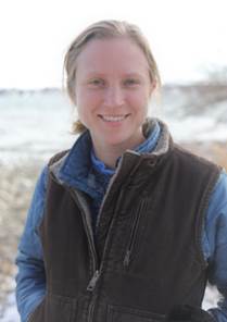
Kate Truitt is a GIS Specialist working on the GLC’s Area Contingency Planning Project. In this role, she assists in mapping and data development for the Inland Sensitivity Atlas for the EPA.

Prior to coming to the Commission, Kate worked for Ducks Unlimited for one year as a GIS intern working to update the U.S. Fish and Wildlife’s (USFWS) National Wetland Inventory (NWI). She holds a bachelor’s degree in earth science and a GIS Certificate from the University of Michigan-Dearborn.


Contact

For media inquiries, please contact Beth Wanamaker, beth@glc.org.

Recent GLC News

Upcoming GLC Events

View GLC Calendar

ARCHIVES

Original Article

Great Lakes Commission

Great Lakes Commission

https://www.glc.org/staff/kate-truitt

Laura Andrews