U.S. Geological Survey scientists will conduct a high-resolution airborne survey to study the rock layers under a region of the south-central Upper Peninsula, Michigan, and parts of northeastern Wisconsin, starting in early April and lasting until as late as August. When the data analysis is complete, resulting geologic maps will help USGS researchers improve an assessment of mineral resources in the region.

As part of this research, a low-flying airplane will be used. Residents and visitors should not be alarmed to witness this airplane flying low to the ground near the broader Iron Mountain-Ralph-Escanaba-Menominee region. A similar USGS study will occur around the same time, but will produce a map at a different scale and spatial area.

The airplane is under contract to the USGS through EON Geosciences. The aircraft will be operated by experienced pilots who are specially trained and approved for low-level flying. All flights are coordinated with the Federal Aviation Administration to ensure accordance with U.S. law.

The survey area is known to contain historically significant iron deposits, as well as several other types of mineral deposits either known or suspected to be present.

“This study will help USGS and partnered scientists understand the region’s fundamental geology and mineral potential in much greater detail than is currently known,” said USGS scientist Benjamin Drenth, a Denver-based researcher leading the survey.

The airplane will carry instruments to measure variations in the Earth's magnetic field. Because different rock types vary in content of magnetic minerals, the resulting maps allow visualization of the geologic structure below the surface. The instruments carried on the aircraft only make passive measurements, and thus pose no health risk to humans or animals.

This survey will be flown in a grid pattern. North-south lines will be flown approximately 500-700 feet apart at elevations from 250-1000 feet above the ground, and 1 mile apart in an east-west direction. All survey flights will occur during daylight hours.

The Michigan Geological Survey is a technical partner with the USGS on the project, assisting with coordination with the Michigan geologic and elected community.

Original Article

USGS.gov

USGS.gov

https://www.usgs.gov/news/media-advisory-second-round-usgs-studies-begin-define-what-minerals-lie-beneath-portions-upper

kgeer@usgs.gov

Beginning in early April and continuing for approximately two weeks, the U.S. Geological Survey will conduct an aerial survey designed to scan the upper part of the earth’s crust.

As part of this survey, a helicopter will be flying low to the ground towing equipment shaped like a giant hula-hoop beneath it. The flight region includes parts of upper Michigan, northern Wisconsin and northeastern Minnesota. The survey, carried out under contract by Geotech Ltd., will fly along a series of widely spaced parallel profiles spanning over 1500 miles.
The survey will determine how well different rocks conduct electricity and ultimately help refine geologic maps of an area with significant mineral potential.

The survey is targeting a suite of rocks deposited 1.8 billion years ago in a deep-water marine environment when the region lay at the edge of a vast ocean. These rocks are a potential source of sulfur for many types of mineral deposits found throughout the region and have been mapped only at the surface throughout the survey area.

“The high electrical conductivity of these particular rocks makes them an ideal target for airborne electromagnetic studies,” said USGS scientist Paul Bedrosian, the study’s lead investigator. “This survey will enable us to map the geometry of these rocks deep into the subsurface.”

Map of upcoming USGS AEM study area in relation to state and county borders. The thick black lines are the intended flight profiles, and the shaded grey regions show the mapped extent of rocks deposited some 1.8 billion years ago. Mapping the subsurface geometry and distribution of these rocks is the primary goal of this survey. Image of the VTEM Plus AEM system from Geotech Ltd. in flight. A similar system will be flown during the upcoming USGS AEM study.

Original Article

USGS.gov

USGS.gov

https://www.usgs.gov/news/media-advisory-usgs-goes-airborne-define-what-minerals-lie-beneath-upper-midwest

kgeer@usgs.gov

On Feb. 18, 2016, WI WSC scientist Austin Baldwin presented preliminary findings on microplastics in Great Lakes tributaries to the White House Office of Science and Technology Policy's Subcommittee on Water Availability and Quality. This study sampled the quantity and particle types of floating microplastics in 29 tributaries in 6 states.

Original Article

USGS.gov

USGS.gov

https://www.usgs.gov/center-news/presenting-preliminary-microplastics-results-white-house

USGS.gov

WI WSC scientist Dave Krabbenhoft met with staff of the House Natural Resources Committee on Jan. 11, 2016, to discuss a new tool that can "fingerprint", or identify, Great Lakes mercury sources such as atmospheric, industrial, or watershed runoff. Determining where the mercury originates from helps inform management and mitigation planning.

Original Article

USGS.gov

USGS.gov

https://www.usgs.gov/center-news/congressional-visit-discuss-sources-mercury-great-lakes

USGS.gov

Today, the U.S. Geological Survey and the U.S. Environmental Protection Agency announce Visualize Your Water, a citizen science challenge for high school students who live in the Great Lakes basin and Chesapeake Bay watershed. This open competition in innovation, supported by a coalition of government agencies and private industry, aims to equip high school students with new skills in geographic analysis and help to broaden their understanding of nutrient management and pollution issues.

Plant nutrients can be valuable in agricultural and urban settings, but too much nutrient or too much at the wrong place or time will produce algal blooms, hypoxia, and other nutrient-related water quality issues that are particularly acute in the Great Lakes basin and Chesapeake Bay watershed. Nutrient pollution is the general term for high levels of nitrogen and phosphorus in some of the nation’s waters. Nutrient pollution comes from sources such as urban and agricultural fertilizer runoff, municipal sewage treatment and leaking septic tanks, and even atmospheric deposition from factory and car nitrogen oxide emissions, with the relative balance of sources depending on location.

In this educational competition, students will use digital mapping technology from Esri (a leading geographic technology company) with data from the USGS, EPA, and other sources to analyze local water quality. They will then create a map that tells a story about the problem and suggests viable solutions. 

Today, January 13, marks the start of the competition. Contest submissions are due March 1. Winners will be announced on April 22. A free Esri ArcGIS Online school account is available to allow participating students to view and analyze relevant data and create maps. 

A grand prize of $2,500 will be awarded plus an opportunity to attend the 2016 Esri Education Conference in San Diego, California along with publication in Esri’s Mapping the Nation book. In addition, two regional first place prizes of $2,500 will be awarded for the Great Lakes basin and Chesapeake Bay watershed. National Geographic will recognize one visualization that will be promoted on National Geographic’s education website, and the author will receive a copy of the National Geographic Atlas of the World.

U.S. high school students in the following states are eligible to participate.

Great Lakes basin: Illinois, Indiana, Michigan, Minnesota, New York, Ohio, Pennsylvania, and Wisconsin   Chesapeake Bay watershed: Delaware, District of Columbia, Maryland, New York, Pennsylvania, Virginia, and West Virginia

For further challenge details, visit the Visualize Your Water website.

Original Article

USGS.gov

USGS.gov

https://www.usgs.gov/news/visualize-your-water-citizen-science-challenge-high-school-students

kgeer@usgs.gov

For the first time, land and resource managers in the Great Lakes will be able to distinguish between the various sources of mercury in the environment, a toxic chemical of significant concern in the region. This is thanks to a new tool that “fingerprints” the mercury, developed by the U.S. Geological Survey and the University of Wisconsin-Madison. 

For Lakes Superior and Huron, atmospheric mercury is the dominant form, while in Lakes Erie and Ontario, most mercury comes from industrial activity or runoff from the watersheds of the lakes. Lake Michigan is dominated in some areas by atmospheric mercury, in other areas by industrial activity and in still others by watershed contributions.

A map showing the relative concentrations of mercury sources as identified by the fingerprinting tool which include watershed, industrial, and precipitation in the locations of Lake Superior, Lake Huron, Lake Michigan, Lake Erie, and Lake Ontario.

“I’ve been involved in mercury research for nearly 28 years,” said USGS scientist Dave Krabbenhoft, the project chief. “Back in the 1980’s, when I first got into this area of research, I dreamed of a tool that could provide geochemical markers of mercury sources.  That dream has now become reality.”

Determining where the mercury comes from is important, because it informs decisions designed to minimize it.  For example, minimizing industrial sources of mercury alone will not be effective if the majority of mercury entering the Great Lakes is from atmospheric mercury.

“One of the surprising things we saw was just how much of the mercury building up in fish was due to atmospheric mercury,” said Krabbenhoft. “This shows that atmospheric mercury needs to be emphasized, even when the sediments in the Lakes show relatively little atmospheric mercury accumulation.”

Although this fingerprinting tool was pioneered for the Great Lakes, it can be applied elsewhere. A very common situation across the United States and elsewhere is the presence of large amounts of mercury that was released during industrialization, so-called legacy mercury. At these sites, resource managers often lack a tool to help them understand whether it is legacy or other sources that substantively contribute to exposures in fish, wildlife and humans today.

“We are very excited to explore the capability of this new tool to inform resource managers and decision makers responsible for managing these challenging situations,” said Krabbenhoft.

Mercury is a naturally occurring element that can have toxic effects on people’s brains, kidneys and lungs. In certain environments, it can also bind with carbon and hydrogen to become methylmercury, which is far more toxic than elemental mercury. In addition, methylmercury can build up in the tissues of fish and other aquatic organisms, resulting in higher doses when people or other animals eat them.

More information about this new tool can be found online. USGS provides information on mercury sources; mercury cycling in the atmosphere, land surface, lakes, streams and oceans; and bioaccumulation and toxicity of mercury. This information helps land and resource managers understand and reduce mercury hazards to people and wildlife.

Original Article

USGS News: Wisconsin

USGS News: Wisconsin

https://www.usgs.gov/news/new-tool-can-determine-sources-mercury-found-great-lakes

shorvath@usgs.gov

Abstract:

A monograph regarding the history of Canada’s intelligence gathering apparatus has not been published, leaving a gap in modern historiography. In an attempt to partially fill this academic void, this essay examines RCMP intelligence Bulletins drafted during World War Two that have been declassified under the Access to Information Act. Analysis of the Bulletins clearly indicates the Canadian intelligence gathering apparatus underwent a massive expansion of scope during the war. The RCMP began investigating people and organizations based upon their race, religion, political affiliation or nationalist beliefs. Disregard of human rights and privacy during the period was so widespread, even the police remarked upon the depth of their new powers inside the Bulletins. Some people, such as the future Prime Minister Diefenbaker, worked to enshrine human rights in the Canadian constitution thereafter, attempting to prevent the police from acquiring such powers ever again. Due to parallel tactics used during World War Two and the modern day, an effective Supreme Court challenge could be mounted against tactics used in Canada’s war on terror based upon historical and constitutional grounds.

Original Article

The Great Lakes Journal of Undergraduate History

The Great Lakes Journal of Undergraduate History

https://scholar.uwindsor.ca/gljuh/vol3/iss1/7

Austin M H Williams

This paper will examine the historical relationship between the federal government of Canada and the scientists it has employed over the past few decades. It will compare science policy and practices from leaders such as Diefenbaker and Trudeau to the policies currently followed by Stephen Harper's government. It will then ask what might be achieved by following those policies, despite the criticism received by the science community. The paper will ultimately argue that the federal government and scientists have often had a contentious relationship, and the policies the Conservative government is currently implementing are not new. It will also argue that the these Conservative policies are intended to present a unified political front to the broader Canadian public and to the world.

Original Article

The Great Lakes Journal of Undergraduate History

The Great Lakes Journal of Undergraduate History

https://scholar.uwindsor.ca/gljuh/vol3/iss1/6

Katherine Richter

Cesarean section in the late fourteenth and early fifteenth century was entangled in a web of legal, political, religious, medical, and ideological tensions. An act of desperation to save the child after the mother died, the procedure was embedded in the popular imagination and imbued with symbolic power. While it was promoted by the Catholic Church to save the souls of the infants through baptism, Jewish communities viewed the procedure with wariness due to its perceived unnaturalness. The coupling of divergent religious views on the procedure, a strained religious environment, and changes in the occupational landscape of obstetrics resulted in the utilization of cesarean section by Christians as a means to demonstrate the corporeal and occupational inferiority of Jews. Using the cesarean section as a point of entry, we can witness the subordination and marginalization of the Jewish midwife.

Original Article

The Great Lakes Journal of Undergraduate History

The Great Lakes Journal of Undergraduate History

https://scholar.uwindsor.ca/gljuh/vol3/iss1/5

Isobel Mouat

Hamilton Harbour is the principle port serving South Western Ontario and the Niagara Peninsula region with two of Canada’s largest steel manufacturers occupying the waterfront. As early as the 1860s fishery inspectors in Hamilton noted the fish tasted of coal, that there were dead ducks and small animals that were coated in oil from refineries. In the 1950s the Hamilton Harbour was deemed unfit for recreational use and although the state of the harbour may be slowly improving, it is far from being delisted from the International Joint Commission’s Area of Concerns designations list. This paper will first look at the history of the Great Lakes and the historical sources of pollution then specifically how this pertains to Hamilton Harbour. By looking at these histories and the various efforts aimed at delisting the Hamilton Harbour as an AOC, I will evaluate the extent to which these efforts have improved the Harbour and what that holds for its future.

Original Article

The Great Lakes Journal of Undergraduate History

The Great Lakes Journal of Undergraduate History

https://scholar.uwindsor.ca/gljuh/vol3/iss1/4

Sara N. Giglia

This essay looks at the ways Frederick Winslow Taylor's distinctly modern theories of scientific management (i.e. Taylorism) transformed Canadian workplaces in the early 20thcentury. In particular, it shows how Taylorism negatively impacted Canadian workers' lives, and examines the various ways that workers consequently resisted Taylorist methods. The essay argues that though workers were unable to stop the widespread implementation of Taylorism and its normalization in Canadian workplaces, their resistance to Taylorism still played an important role in unionist and radical political movements which gradually gained important concessions and rights for Canadian workers during the first half of the 20thcentury. Additionally, the essay argues that resistance was significant as an outlet for workers to retain bodily autonomy in work environments which increasingly aimed to make workers more machine-like. Ultimately, the essay highlights important ways that the Canadian working class has exercised historical agency via solidarity and perseverance.

Original Article

The Great Lakes Journal of Undergraduate History

The Great Lakes Journal of Undergraduate History

https://scholar.uwindsor.ca/gljuh/vol3/iss1/3

Sean Antaya

Scientists collect a snapshot of a bird’s life when they capture, band, and release it. Each coded band and any data collected at the same time like date, location, sex, age etc. are recorded in a database that can be shared by scientists around the world. When the same bird is seen somewhere else, that observation location provides another snapshot that is added to the database, helping scientists to reconstruct the movements of individual birds. This continuously growing database makes it possible to study dispersal and migration, behavior and social structure, life-span and survival rate, reproductive success and population growth.

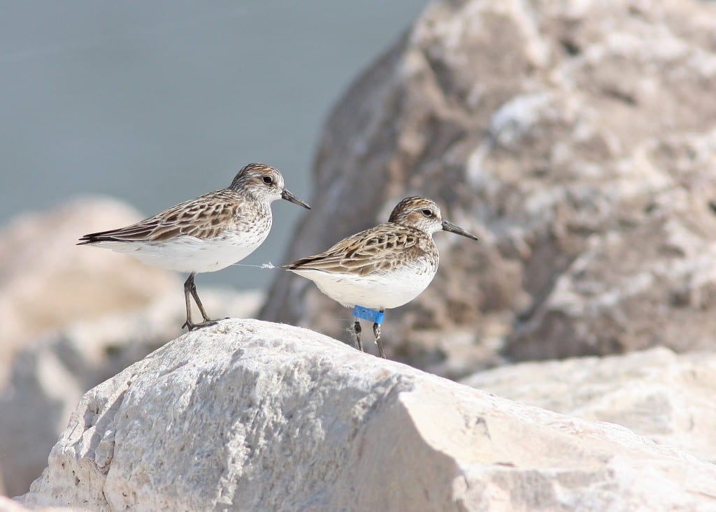
Environmental Science & Policy Master’s candidate Tom Prestby is observing shorebirds migrating along the lower Bay of Green Bay (Brown County, Wisconsin, USA) in order to provide much needed information about the importance of near shore habitat for numerous species of conservation concern including three species in high peril and 12 in high continental concern.

Semipamated Sandpiper photo by Tom Prestby
Semipalmated Sandpipers on the shore of the Bay of Green Bay.

He photographed the Semipalmated Sandpiper shown here in late May 2015 at his research site in Green Bay. The code on the blue band on the bird’s leg allowed him to discover that it was banded on January 14, 2014 in Maranhao, Brazil, and so had traveled nearly 2000 miles to get to Green Bay. Semipalmated Sandpipers, so-named because their toes are webbed for only part of their length, breed on open tundra, so it’s journey is only a little more than half finished. It still must travel another 1200 miles or more to northern Canada and Alaska to breed this summer, resting at along mudflats, sandy beaches, shores of lakes and ponds, and wet meadows. These birds make that incredible 3000 mile journey in only about two months time and rely mostly on stored fat reserves to power them through migration.  Summer is short in the arctic, so after they breed they begin their fall passage in July at a more leisurely pace and typically arrive back in their South American wintering grounds by mid-October.[1]

Unfortunately, this species is on the 2014 State of the Birds Watch List, which lists species most in danger of extinction without significant conservation action. Even though populations appear to be stable at some arctic breeding grounds in Alaska, surveys by researchers in Canada and the United States indicate that the numbers of birds reaching South America wintering grounds have declined by 80% over the last 20 years. Canadian scientist Stephen Brown who has been tracking the birds as they arrive on Coats Island in the far north of Hudson’s Bay explains, “We need to understand the migratory pathways of the species in order to know where the decline is occurring, and what can be done to reverse it.”[2]

Prestby’s observation is helping other scientists to do just that. He is continuing to monitor shorebirds at his research sites including the recently restored Cat Island Chain in person and through the use of remote cameras. He is enthusiastic about his graduate experience. “It is fascinating to be able to look into the life of one of these birds and very satisfying to contribute to a great database!” His master’s research will provide important information about shorebird migration and use of wetlands encircling the bay of Green Bay that will help scientists to better understand and conserve these trans-American travelers.

References

1. All About Birds: http://www.allaboutbirds.org/guide/Semipalmated_Sandpiper/id

2. Manumet Center for Conservation Studies:  https://www.manomet.org/newsletter/first-ever-geolocator-results-semipalmated-sandpiper-show-remarkable-year-long-odyssey


Considering a career in Environmental Science? Learn more educational opportunities for undergraduate and graduate students at the University of Wisconsin–Green Bay, the Original #EcoU!


Original Article

Biodiversity

Biodiversity

https://blog.uwgb.edu/biodiversity/2015/06/snapshots-can-help-conserve-shorebirds-in-decline/

Vicki Medland

Annual average stream temperatures in the Trout Lake watershed, Wisconsin, could increase from one to three degrees Celsius by the year 2100, which might negatively affect cold water fish like brook trout.  

The U.S. Geological Survey recently modeled the effects of climate change on stream temperatures for three recreational fishing creeks near Eagle River, Wisconsin, from years 2000-2100: Stevenson Creek, North Creek and Upper Allequash Creek. Findings suggest that daily mean stream temperatures in Stevenson Creek, the warmest of the three streams, could become too high to sustain a healthy trout population by the turn of the century. 

“A persistent increase in daily mean stream temperature can affect the diversity of fish species in northern Wisconsin,” said USGS scientist William Selbig. “This study can be used by managers to help make important conservation decisions in the Trout Lake watershed.” 

The new USGS report, authored by Selbig, is published in the journal Science of the Total Environment. 

Summer stream temperature is the most important single factor influencing distribution and production of some cold water fishes. Streams that may currently be suitable as a cold water sport fishery, like those in the new study, could become increasingly fragmented as fish seek refuge from warming water temperatures to less impacted areas. 

Brook trout populations are most stable when temperatures do not exceed 19 degrees Celsius, or about 66 degrees Fahrenheit. Selbig found that the frequency at which daily mean stream temperatures exceeded ideal ranges for brook trout increased for Stevenson Creek and North Creek during the last five years of the study period, especially in the warm summer months of July and August. 

“Some emission scenarios indicate that Stevenson Creek could become too warm to maintain its status as a Class II trout stream,” Selbig said.  

However, the coolest of the three streams, Upper Allequash Creek, appeared resilient to climate warming, with temperatures remaining suitable for cold water fish the majority of time. 

The projections showed that by 2100, annual average temperatures could increase by:

1.7 to 3.2 degrees Celsius in Stevenson Creek, 1.4 to 2.9 degrees Celsius in North Creek and 1.1 to 2.2 degrees Celsius in Upper Allequash Creek. 

For more information on water resources in Wisconsin, please visit the USGS Wisconsin Water Science Center website

Original Article

USGS.gov

USGS.gov

https://www.usgs.gov/news/projected-warming-wisconsin-streams-could-negatively-affect-trout

USGS.gov

Earth Day is April 22nd and is celebrating its 45th anniversary this year. This year we want to celebrate the month of April by showcasing our commitment to protecting the environmental health of our local communities, Wisconsin and the planet through environmentally based education, research and outreach at UW—Green Bay, the Original EcoU!

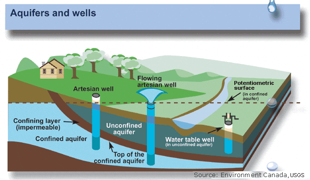
The Northeast Wisconsin Groundwater Management Area (GMA) consists of all of Brown County, as well as parts of Outagamie and Calumet Counties. The GMA has an area of around 700 square miles, lies completely within the Great Lakes drainage basin, and is home to more than 350,000 people. Millions of gallons are pumped from the confined deep aquifer in northeastern Wisconsin each day for industrial, commercial, municipal, and residential uses. Some cities now use Lake Michigan surface water for their water supply.  Green Bay switched to surface water in 1957 followed by eight surrounding municipalities  in 2007. These communities still retain many of their high capacity wells to serve as alternative sources in case of emergencies. This switch to surface water has caused a significant rise in groundwater level in the deep aquifer.

Diagram showing how water moves through underground aquifers (from water.usgs.gov).

Groundwater in sandstone in the deep aquifer is isolated or confined in the GMA by 3 different overlying stratigraphic rock layers. Some of these rock layers contain groundwater contaminated by bacteria and nitrate or contain faults or fractures that may permit contaminated water to flow into the deeper aquifer.

Amanda Hamby collecting water samples from a home in northeastern Wisconsin.
Amanda Hamby with the equipment she uses to collect water samples from wells.

UW–Green Bay Graduate student Amanda Hamby is working with Associate Professor John Luczaj from the Department of Natural & Applied Sciences to answer the following questions about water in this deep aquifer:

  1. Do regional faults have an effect on water chemistry in the confined deep aquifer in northeastern Wisconsin?
  2. How has water chemistry changed in the Northeast Wisconsin Groundwater Management Area since Green Bay and other municipalities stopped pumping water from the aquifer?

They are collecting water samples from a number of wells in the GMA to assess for alkalinity and a number of ions in the water. Samples will be radio-carbon dated to get an idea of how old the water in the deep aquifer actually is. Amanda is also collecting stable isotopes of oxygen and deuterium that can be used to follow water movement through the atmosphere, surface waters, and into the aquifer. Amanda is using the isotope data she collected in conjunction with GIS mapping to create a natural isotope landscape or “isoscape” of the Northeast GMA deep aquifer, one of very few such maps of deep aquifers.

The results of this project will increase our understanding of how local faults affect groundwater chemistry and water quality in the northeastern Wisconsin. This project will also aid in our understanding of how groundwater level increase in the confined deep aquifer has affected water quality in the Northeast GMA.

Amanda’s research is supported by a grant from the NAS Heirloom Plant Fund at UW–Green Bay.

Original Article

Biodiversity

Biodiversity

https://blog.uwgb.edu/biodiversity/2015/04/understanding-deep-water/

Vicki Medland

Earth Day is April 22nd and is celebrating its 45th anniversary this year. This year we want to celebrate the month of April by showcasing our commitment to protecting the environmental health of our local communities, Wisconsin and the planet through environmentally based education, research and outreach at UW—Green Bay, the Original EcoU!


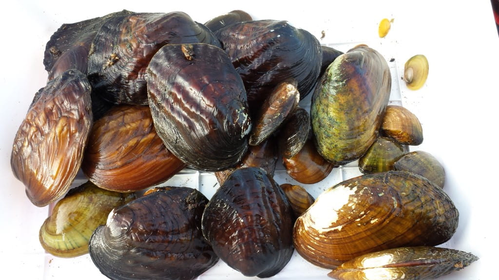
Freshwater Mussels from the Oconto River.
Freshwater Mussels from the Oconto River

North America has the highest mussel biodiversity in the world, with over 300 species, but more than 40% of those species are imperiled, especially in the Midwestern states. According to the US Fish and Wildlife Service, no other group of animals in North America is in such grave danger of extinction! The major threats that these species face are siltation, water pollution, damming or conversion of streams, and the presence of invasive mussels (zebra mussels). Wisconsin is home for 51 species of freshwater mussels and 33 of those are considered endangered, threatened or rare enough to be of special concern. Only 18 species currently have healthy populations.

Jesse Weinzinger with fellow UWGB graduate student Chelsea Gunther at the Wisconsin Wetlands Association Meeting.

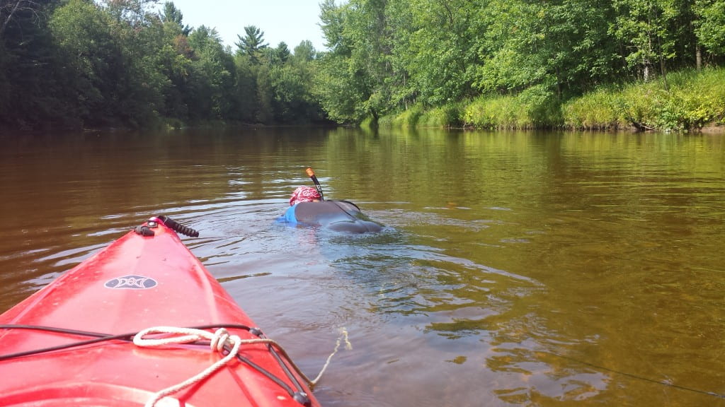
UW–Green Bay graduate student Jesse Weinzinger is on a mission to better protect Wisconsin’s freshwater mussels, one of North America’s most diverse and ecologically important aquatic species. Mussels are ecosystems engineers that filter nutrients and particles improving water quality downstream. They also stabilize stream bottoms and provide habitat and food for fish and mammals.

Jesse uses a mask and snorkel to monitor mussel populations.

The Wisconsin Department of Natural Resources, along with the help of university researchers and citizen scientist volunteers, are surveying mussels in streams to learn more about the lifecycles and population structure of these important animals. However, the current survey protocol is very labor intensive and the state lacks the funds and staff to maintain long term monitoring efforts. Jesse is investigating ways to make the monitoring of Wisconsin’s mussels faster and easier. He is working with the WI DNR to establish a rapid assessment protocol for volunteers of the Mussel Monitoring Program of Wisconsin. The end result will be an efficient, teachable, and easy-to-use protocol that will provide new volunteer opportunities and, if the method is applied successfully, results will provide rigorous quantitative data to inform the DNR as it makes management decisions.

Jesse’s research is partly supported by grants from the Heirloom Plant Sale Fund and from the WI DNR.

How can you help? Become a mussel monitoring volunteer!

Original Article

Biodiversity

Biodiversity

https://blog.uwgb.edu/biodiversity/2015/04/mussel-man/

Vicki Medland

Did you get a shamrock plant for Saint Patrick’s Day? It was most likely one of a few species in the genus Oxalis. Over 800 different species of Oxalis occur throughout most of the world, especially in Central America and South Africa. Their common name wood sorrel or in Europe wood sour refers to high concentrations of oxalic acid in the leaves and stems. Some are cultivated for their nutritious rhizomes, especially acta (O. tuberosa) in South America. Others like candycane sorrel (O. versicolor) and purple shamrock (O. triangularis), are prized by florists and gardeners because of their showy leaves and flowers and it is likely that you received one of these.

But is Oxalis “the” shamrock? According to Bess Lovejoy writing for Smithsonian.com, nobody is sure what plant species the stylized 3-leaved shamrock represents. Some, like 19th Century British botanist James Ebenezer Bicheno claimed that wood sorrel (Oxalis acetosella) was the “true” shamrock. Perhaps unconvinced that the British would best know which plant the Irish should call shamrock, Dublin native and amateur botanist Nathaniel Colgan decided to conduct a poll in 1892. He had people from different counties in Ireland send him specimens of shamrocks they had collected. Although there were no single winner based on his results, it seems that the Irish favor a few species of Clovers (Trifolium) especially white clover (Trifolium repens). Botanist E. Charles Nelson, repeated the study in 1988 and found similar results. Although most people selected among several species of clovers, about 5% of participants selected Oxalis as their shamrock.

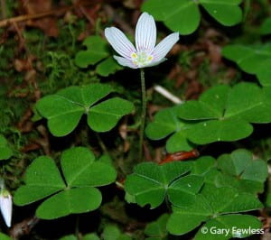
Oxalis acetosella f. montana
Wisconsin’s Shamrock (Oxalis acetosella f. montana)

White clover is common in our region especially in agricultural and other grassy open fields, however, it is not native and can be invasive, so we are choosing one of our native species of Oxalis, the northern wood sorrel (O. montana or O. acetosella f. montana), as our symbol of the season. The plants are still hunkered down as underground rhizomes, but you will be able to find these forest plants blooming throughout the western Great Lakes region in June. Look for it in boreal and mixed evergreen-deciduous forests or in northern maple beech hardwood forests.

We have several bright yellow flowered Oxalis species in WI which are somewhat associated with disturbed sites, and only two white to pale purple/rose flowered species as in O. acetosella. There is a similar species in southern WI called the violet wood sorrel (O. violacea). The two species are almost perfectly segregated geographically in the state—SW dry and sunny (violacea) versus NE moist to wet and forested (acetosella f. montana).

By Vicki Medland and Gary Fewless

Read more about the history of shamrocks in Smithsonian Magazine online: http://www.smithsonianmag.com/arts-culture/no-one-really-knows-what-shamrock-180954578/

Original Article

Biodiversity

Biodiversity

https://blog.uwgb.edu/biodiversity/2015/03/shamrocks/

Vicki Medland

Dr. Michael Draney (Natural and Applied Sciences) and James Steffen (Chicago Botanic Garden) recently published an article in the journal Great Lakes Entomologist titled “Disjunct Lake Michigan populations of two Atlantic Coast spiders, Disembolus bairdi and Grammonota pallipes (Araneae: Linyphiidae)”.

Steffen and Draney discovered two species of spiders living on the beaches of Lake Michigan that had only ever been found before living near the Atlantic Ocean. Scientists use the word “disjunct” to describe isolated populations like these that are related but widely separated from each other geographically. The discovery that the spiders also live along the shore of Lake Michigan, more than 800 miles inland raises some interesting questions, namely how did these very tiny (less than 2 mm animals) get to the Great Lakes across hundreds of miles of unsuitable habitat?

Populations can become separated from each other when the environment they live in separates into fragments due to geologic or climate events. Continents drift apart, rivers change their course or mountains rise, isolating populations on separate islands of suitable habitat. Populations also become disjunct from each other when species expand their ranges into new territories. This most often happens with species like birds or butterflies that can move long distances, or with species that hitch a ride on floating debris or on (or in) migrating animals.

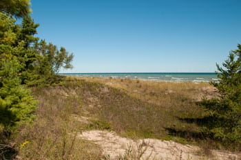
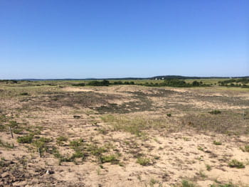
Beach habitat

Beach habitat.

Can you tell which of the photos is of a beach on Lake Michigan and which is a beach in New Hampshire?

(See the end of this post for the answer.)

While we don’t know how they got so far away from the Atlantic Ocean, the most probable explanation is that individual spiders ballooned inland by releasing long gossamer threads of silk that catch the wind and propel them along like a kite. Ballooning spiders are known to travel even thousands of miles using this technique. Those that were lucky enough to land near the shore of the Great Lakes found themselves in a hospitable and familiar habitat that they could colonize. The spiders do not care where that beach is located as long it provides what they need to survive and reproduce. Suitable habitat probably exists or existed in patches along the St. Lawrence Seaway and the Great Lakes east of Lake Michigan, and spiders may have “island hopped” by ballooning between such somewhat isolated islands of suitable habitat along the way from the Eastern Seaboard to northern Illinois.

Understanding more about disjunct populations like these helps us to understand how specialized species might fare as they become isolated. Under favorable conditions, isolated populations survive, and over time, due to mutation and natural selection, become so genetically different from their far away relatives that the population may evolve into a new species. When conditions are poor and habitats are degraded or lost to development, pollution, or climate change, small isolated populations are more likely to go extinct. By monitoring species like these we can better track the health of the Great Lakes.

Essentially all of the midwest’s plants and animals were absent from the Great Lakes thousands of years ago when the region was glaciated.   Each species has a different history of where it took refuge during those ages, and how it got from there to here.   The intersection of all these unique natural histories contributes to our complex and fascinating regional biodiversity. These Atlantic coast disjuncts are here because of the Great Lakes and the unique coastal habitats they make possible. The present study shows that not just plants (like dwarf lake iris or Pitcher’s thistle) but also animals can be dependent on special Great Lakes coastal habitats. You’ve probably never seen Disembolus bairdi and Grammonota pallipes. Still, these species are two additional (but tiny!) reasons to appreciate our Great Lakes.

The photo on the top was taken by Dr. Robert Howe at White Fish Dunes, WI and the photo on the bottom was taken by Dr. Steve Weeks of dunes in New Hampshire.

Original Article

Biodiversity

Biodiversity

https://blog.uwgb.edu/biodiversity/2014/09/disjunct-spiders/

Vicki Medland


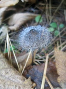
Spinellus fusiger, a mold that infects mushrooms!

Late summer and fall have been very wet and that is good for finding more mushrooms. My Door County list has grown to 598 species. The site with the most, 244 species, is Whitefish Dunes State Park. Now Toft Point is in second place with 150. New descriptions of 20 more species found at Toft Point since early September are now on the Cofrin Center for Biodiversity web site, including 68 photos to add for the new species and better pictures for some that are already in the site.

Two species found are also new to Door County. They are Agaricus cretacellus and Gomphidius glutinosus. Fortunately when I found one of these and did not have a camera, my friend Beth Bartoli had hers and was able to get good photographs.

A very different type of fungus was found on a small Mycena species growing on the ground in the woods. It is called the Pin Mold or Bonnet Mould in England. It is parasitic on several species of mushrooms. It was first discovered by a German naturalist in 1818. The Zygospores are produced in black balls at the ends of fine filaments which coat the Mycena mushroom.

Some people despair at the wet soggy autumn, but I rejoice for the welcomed moisture that will aid trees going into the winter season and help mushrooms continue their important work as nature’s recyclers.

Charlotte Lukes

Original Article

Biodiversity

Biodiversity

https://blog.uwgb.edu/biodiversity/2013/12/new-mushrooms-added-to-our-door-county-mushroom-guide/

Vicki Medland

Almost 80% of songbirds that nest in Wisconsin are migratory, many traveling vast distances every spring and fall. Songbirds typically migrate at night and seek out patches of natural habitat at daybreak where they can rest. These areas must provide shelter from storms and predators, as well as provide high quality food resources so the birds can refuel for the next leg of their journey.  Unfortunately, stopover habitats are becoming scarcer as natural habitat is converted for human use and landscapes become more fragmented.

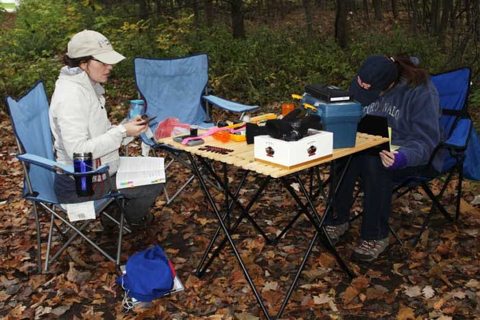
UW--Green Bay graduate student Stephanie Beilke measures a bird while undergraduate Kirsten Gullett records data.
UW–Green Bay graduate student Stephanie Beilke measures a bird while undergraduate Kirsten Gullett records data.

Stopover habitats are a critical resource for these birds, but the ecology of birds during stopover periods is not well understood. And because increasingly large numbers of birds congregate in these fragmented habitats, ecological interactions can be intense. This may because there are many species interacting under highly variable environmental conditions. Graduate student Stephanie Beilke is banding birds to learn more about how migratory birds are affected by the type of stopover habitats they choose.  Her research on migratory bird assemblages will provide insights into the resource demands and evolutionary history of migratory birds and will ultimately provide a better understanding of stopover site ecology and help guide the conservation and protection of Great Lakes coastal habitats for migratory birds.

Point au Sable offers a perfect opportunity to learn more about stopover ecology. It is a mosaic of different natural habitats including lowland and upland forest, wetlands, and Great Lakes beach.  Since the late 1990s, migrating passerines have been studied at Point au Sable Natural Area, a peninsula that juts out into the lower Green Bay, just north of the University of Wisconsin-Green Bay campus.  Through the years, Point au Sable has experienced many ecosystem changes including invading exotic vegetation, declining water-levels in the Bay of Green Bay, and ongoing habitat management and restoration. Despite these changes, point counts and mist-netting operations conducted by UW – Green Bay researchers have shown that large concentrations of avian migrants use Point au Sable during both spring and fall migration

This fall Stephanie and her group of volunteers set up nearly invisible finely-meshed mist nets in openings where birds are likely to fly through. Birds fly into the nets and become entangled. Trained technicians collect the birds, and then take measurements and either read the existing band or place a new a U.S. Geological Survey aluminum numbered band on the bird’s leg. Volunteers help to set up and take down the nets, alert the technicians to new arrivals, and help to record data collected.  In this study netted birds will be weighed and scored for visible chest fat.  Different length and width measurements are also collected.  Technicians work quickly and carefully to limit the amount of stress endured by the birds.

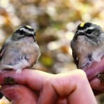
They banded birds on 25 different days at two locations at Point au Sable Natural Area. Six mist nets were set up in either coastal shrub or in upland forest. The average capture rate was 40 birds per net, but one net in the coastal area caught 79 new birds as well as 3 recaptured birds. Forty-seven different species were banded, including 100 Tennessee Warblers. They also captured large numbers of White-throated Sparrows, American Robins, Hermit Thrushes and Golden-crowned Kinglets.

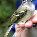
Some of the species they caught were “firsts” for the project, meaning they had never been captured before, including Black-billed Cuckoo, Blue-headed Vireo, Purple Finch, and Winter Wren. The crew also banded one Yellow-bellied Flycatcher on October 12, which, according to the Wisconsin Society for Ornithology, makes it a record late observation for the state. Most Yellow-bellied Flycatchers have migrated south by the end of September.

Stephanie will be banding again Spring 2014, stay tuned to the blog or like us on Facebook to find out how to volunteer.

Some of the birds captured in Autumn 2013

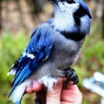
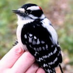
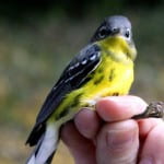
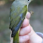
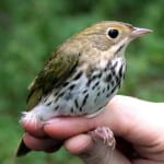
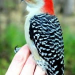
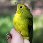
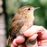
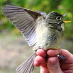
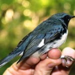
Blue-headed Vireo Blue Jay Female Northern Cardinal Brown Creeper Downy Woodpecker Golden-crowned Kinglet Magnolia Warbler Nashville Warbler Orange-crowned Warbler Ovenbird Red-bellied Woodpecker Wilson's Warbler Winter Wren Yellow-bellied Flycatcher.

Original Article

Biodiversity

Biodiversity

https://blog.uwgb.edu/biodiversity/2013/11/bird-banding-at-point-au-sable/

Vicki Medland

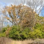
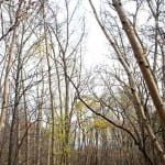
In the area around the City of Green Bay many trees have lost all or most of their leaves, especially the commonest and most abundant species such as green ash (Fraxinus pennsylvanica), box elder (Acer negundo), and cottonwood (Populus deltoides). Other species generally leafless now include: white birch (Betula papyrifera), quaking aspen (Populus tremuloides), and wild cherries (Prunus serotina and Prunus virginiana).

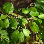
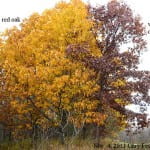
Species still holding leaves include the invasive buckthorns (Rhamnus cathartica and Frangula alnus), Norway maple (Acer platanoides) and to a lesser degree silver maple (Acer saccharinum). The oaks also tend to hang onto their leaves, even after they turn brown (see Nov. 4). The photo at left shows still-green leaves of European buckthorn under the mostly bare branches of other species. If you look carefully, you may also notice green leaves still on the branches of a crack willow (Salix fragilis, another alien species) behind the other trees, toward the right side.

Close-up of leaves of European Buckthorn (Rhamnus cathartica). European Buckthorn remains green late into Autumn. Oaks proovide late season color. Most trees are now bare of leaves.


Original Article

Biodiversity

Biodiversity

https://blog.uwgb.edu/biodiversity/2013/11/past-peak/

Vicki Medland

If birds summering in the Western Great Lakes region have a favorite fruit, it has to be the Juneberry (Amelanchier spp.). Two weeks before the fruit were ripe our resident American Robin would make a daily visit to the trees outside my office, hop from branch to branch, cocking his head to get the best eye-full of berry.  He would sample ones that had already brightened to rosy pink, sometimes dropping the fruit if it was too green. On the day the first fruit ripened, she had the tree to herself for about 3 hours before the first Cedar Waxwings arrived. At the height of the harvest on the single tree, I counted one adult Robin, three juvenile Robins, 8 Cedar Waxwings, a pair of Northern Cardinals, and one shy Grey Catbird that was immediately chased off by the Waxwings.

Cedar Waxwing and American Robin feed on Serviceberries
Cedar Waxwing and American Robin feed on Juneberries

I usually cannot help myself, and sneak out to pick a handful of the fruit for myself. The flavor is reminiscent of blueberries, but has definite plum or dark cherry flavors as well. A serving of juneberries provides 23% of  the recommended amount of iron and are high in potassium, and magnesium, vitamin C, B6, A and E.  Cooking the berries improves the sweetness and flavor of the fruit, so feel free to eat that whole juneberry pie!

There are 20 named species in the genus Amelanchier (Rosaceae). There are almost as many common names to describe these shrubs and small trees  including juneberry,  shadbush, shadwood, shadblow, serviceberry or sarvisberry, wild pear or chuckley pear, sugarplum or wild-plum, and even chuckleberry, currant-tree, or saskatoon.  In the southwest, Amelanchier denticulata is referred to as Membrillo, Membrillito, Madronillo, Cimarron, Tlaxistle, or Tlaxisqui. The common names often vary by location and many relate different phenological events together. Juneberry is obvious, and is most often used for the species that occur in the Midwest where the berries usually ripen in June, (however this year they did not ripen in Green Bay until July 2nd).  Several names refer to the flavor or shape of the fruit including membrillo, which is Spanish for quince, or to location, such as Saskatoon or Cimarron.  Names that include shad are derived from New England and eastern Canada, where the shrubs bloom in early spring at about the same time that Shad (fish in genus Alosa) return to rivers to spawn. Service or “Sarvis” supposedly relates back to the time of itinerant preachers that traveled in New England. The plants bloom in early spring shortly after the trails are clear of snow and the preachers were able to travel to the towns. I could find no source for chuckleberry, but it seems likely a corruption of the older chuckley pear, another name that I could find little history on.

Amelanchiers are important plants for native landscapes. These shrubs provide nectar for early emerging pollinators especially native bees and overwintering butterflies, fruit for birds, and are hosts for the larvae of several species of butterflies. The plants provide four season interest, including beautiful white flowers in early spring, berries in early summer, foliage that that turns to brilliant oranges to deep reds in fall, and beautiful vase shaped silver barked stems in the winter.  There are a variety of forms available to suit most areas from small shrubs to branching specimen tree that can grow to 25 feet in height. The eastern varieties are understory shrubs that are well suited to woodland or shady areas. And if you are lucky and can beat the birds to harvest, the sweet fruit can be used in almost any recipe that calls for blueberries.

Flowers, form, and berries of Amelanchier laevis, a common serviceberry in Wisconsin and the eastern United States. Other species have similar flowers and fruit.

There is at least one species of Amelanchier that is native somewhere on mainland North America and all species are edible, so it should be possible to find a variety that will thrive in your yard. Native varieties should be available at specialty nurseries and many nurseries carry the Apple Serviceberry (Amelanchier X Grandiflora), a hybrid between Amelanchier canadensis and Amelanchier laevis that grows 15 to 25 feet tall and has large showy flowers. There are several named varieties with different growth habits, fall coloration, and disease resistance.  “Autumn Brilliance” is one hybrid variety that is most readily available in the Midwest. All species are edible, although some produce more or larger fruit and new disease resistant horticultural varieties are now available that make growing these plants easy for home gardeners.


More information and Recipes

Original Article

Biodiversity

Biodiversity

https://blog.uwgb.edu/biodiversity/2013/07/juneberries/

Vicki Medland