What happens when emergency managers, tree planters and community scientists walk into a room? A discussion about rainfall, naturally.
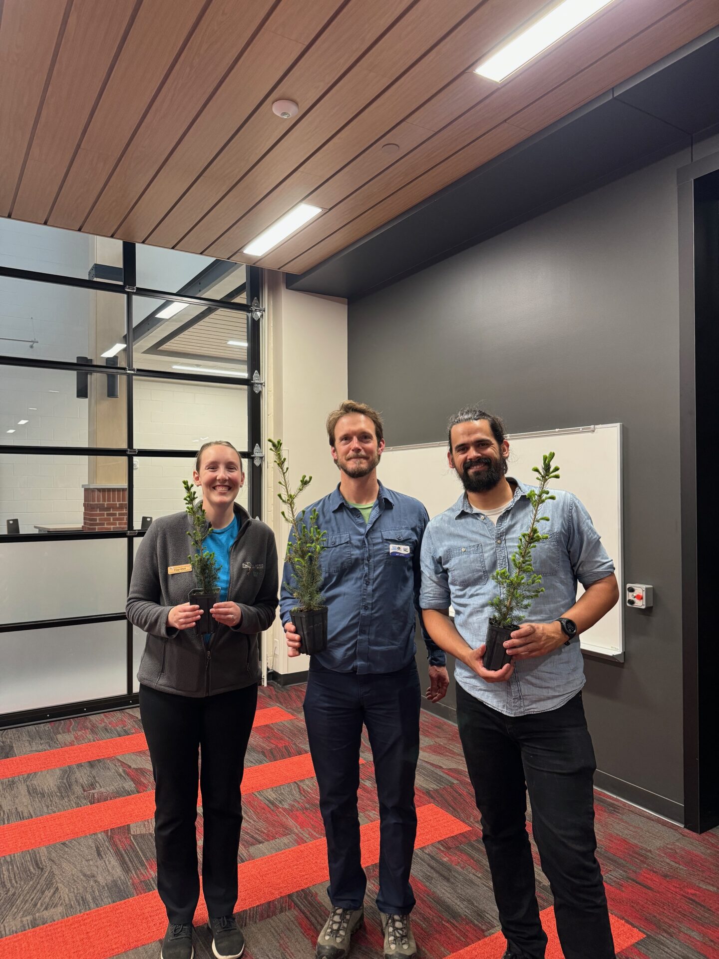
Flood resilience fellow Jackson Parr stands alongside Paige Witek of Door County Land Trust and Jeff Lutsey of the Door County Big Plant, all of whom hold tree saplings.

The hosts of the “Weather, Climate and Community” event: Paige Witek of Door County Land Trust, Jeff Lutsey and Jackson Parr.

In mid-May, Wisconsin Sea Grant Flood Resilience Fellow Jackson Parr partnered with the Door County Land Trust and the Climate Change Coalition of Door County to lead a community event about local rainfall trends and to recruit volunteers to measure precipitation in their backyards. Parr, a former Keillor Fellow, organized the talk as part of a National Sea Grant Office-funded project on disaster preparedness in northeastern Wisconsin. He said the event brought together folks with diverse environmental interests in conservation, community science and climate change.   

“In the other counties I’ve worked through with this grant, the audiences have tended to be emergency management, first responders, municipal staff — the professionals that are more frontline folks in disaster mitigation, preparedness and response,” said Parr.

“[This] was somewhat of a different audience that still had an interest in these topics — climate change, rainfall, citizen science — but otherwise probably wouldn’t have thought too much about, you know, NOAA Atlas 14 precipitation estimates.”

The “Weather, Climate and Community” event was born of a mutual desire for precipitation data and community engagement. Parr connected with Jeff Lutsey, Director of the Door County Climate Change Coalition, who organizes the Door County Big Plant, an event that gets thousands of trees into the ground each year. Lutsey wanted to know where and how much rain falls across the county to better allocate water to thirsty new trees. Parr wanted more spatial information about extreme rainfall to help municipalities plan for floods. 

The problem? Precipitation data across northeastern Wisconsin is sparse.

So, Parr and Lutsey partnered with a local conservation nonprofit, the Door County Land Trust, to recruit volunteers for the Community Collaborative Rain, Hail and Snow Network (CoCoRaHS), a national network of community scientists who measure and record precipitation. More volunteers mean more data points on the map, which means a more complete picture of rainfall across the county.
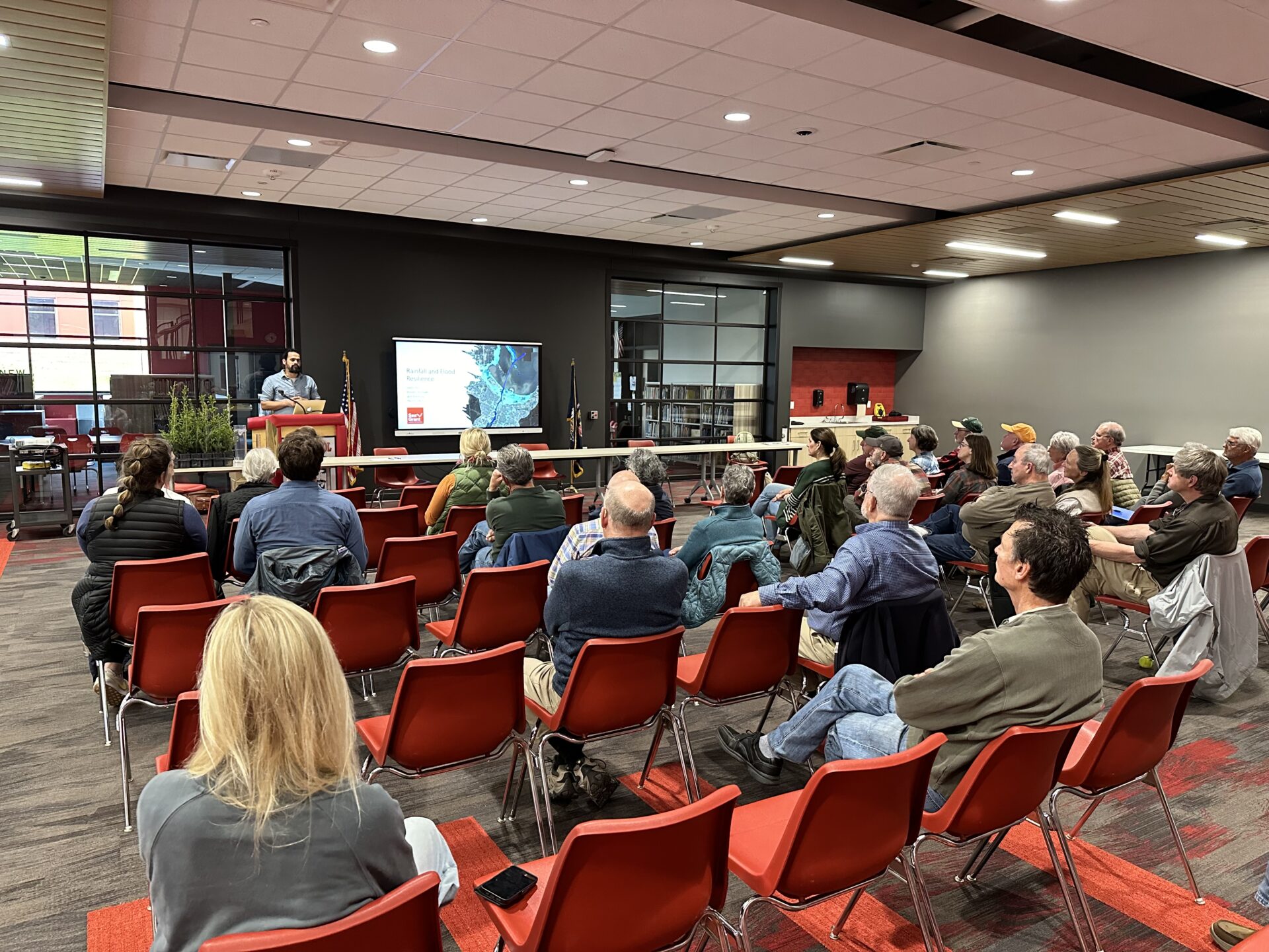
Jackson Parr delivers a talk at a podium in front of a room of people sitting in red chairs.

Jackson Parr presents findings from a rainfall and flood vulnerability analysis for Door County and Sturgeon Bay at the event. Photo: Jackson Parr

The event was successful in filling those gaps. Parr said 13 people signed up for rain gauges, more than doubling the current number of weather observers in Door County. Those are important numbers for a region experiencing more intense rainfall.

“We’re seeing the number of 2-inch rain events increase, particularly in the last decade,” said Parr.

Being prepared to handle increased rainfall and flooding is at the center of Parr’s grant-funded project. For the last two years, he’s been working with coastal communities in northeast Wisconsin on natural disaster planning, paying special attention to policy and planning documents.

“What are ways in which we can improve the policy language in those plans to better account for coastal hazards?” said Parr. He’s currently drafting recommendations and sample language for municipalities to use in updating comprehensive and hazard mitigation plans.

Parr is continuing similar work as a climate hazards planning educator with the University of Wisconsin–Madison Division of Extension’s Natural Resources Institute, where he’s helping rural communities prepare for extreme weather on a project funded by the Rural Partnerships Institute.

He’s also busy installing 13 new rain gauges across Door County. While the new volunteers may be more interested in well-watered gardens than flood resilience planning, Parr is excited to see folks getting involved, whatever the reason. The data is useful for gardeners, tree planters and emergency planners alike.

“In addition to checking your rain gauge to see how much your tomatoes got, you can log on to an app and take 10 seconds to tell us how much rainfall you see,” said Parr.


The post Gauging risk with rain gauges: Flood resilience fellow recruits volunteer weather observers at Door County event first appeared on Wisconsin Sea Grant.

Original Article

News Releases | Wisconsin Sea Grant

News Releases | Wisconsin Sea Grant

https://www.seagrant.wisc.edu/news/gauging-risk-with-rain-gauges-flood-resilience-fellow-recruits-volunteer-weather-observers-at-door-county-event/

Jenna Mertz

At 805 PM CDT, Doppler radar was tracking strong thunderstorms along a line extending from 8 miles southwest of Denmark to near Southern Lake Winnebago. Movement was east at 30 mph. HAZARD...Wind gusts up to 50 mph and half inch hail. SOURCE...Radar indicated. IMPACT...Gusty winds could knock down tree limbs and blow around unsecured objects. Minor hail damage to vegetation is possible. Strong thunderstorms will be near... Valders around 830 PM CDT. St. Nazianz around 835 PM CDT. Manitowoc around 840 PM CDT. Two Creeks and Camp Rokilio Scout Camp around 845 PM CDT. Cleveland around 900 PM CDT. Other locations impacted by these storms include Louis Corners, St Nazianz, Mishicot, Kellners Corners, Kellnersville, Maribel, Larrabee, Wayside, Morrison, and Two Rivers.

Original Article

Current watches, warnings, and advisories for Brown County (WIC009) WI

Current watches, warnings, and advisories for Brown County (WIC009) WI

https://api.weather.gov/alerts/urn:oid:2.49.0.1.840.0.375463b84c354eb6fdefbb38bcf053db885c4437.001.1.cap

NWS

* WHAT...Urban area and small stream flooding caused by excessive rainfall is expected. * WHERE...Portions of east central and northeast Wisconsin, including the following counties, in east central Wisconsin, northern Calumet and northern Winnebago. In northeast Wisconsin, southwestern Brown, southern Outagamie and southeastern Waupaca. * WHEN...Until 1030 PM CDT. * IMPACTS...Minor flooding in low-lying and poor drainage areas. Ponding of water in urban or other areas is occurring or is imminent. * ADDITIONAL DETAILS... - At 731 PM CDT, Doppler radar indicated heavy rain due to thunderstorms. This will cause urban and small stream flooding. Between 0.5 and 1 inch of rain has fallen. - Additional rainfall amounts of 0.5 to 1 inch are expected over the area. This additional rain will result in minor flooding. - Some locations that will experience flooding include... Appleton, Menasha, Kaukauna, Little Chute, New London, Kimberly, Brillion, Fremont, Northern Lake Winnebago, Darboy, Neenah, De Pere, Greenville, Combined Locks, Wrightstown, Dale, Sherwood, Hortonville, Weyauwega and Holland. - http://www.weather.gov/safety/flood

Original Article

Current watches, warnings, and advisories for Brown County (WIC009) WI

Current watches, warnings, and advisories for Brown County (WIC009) WI

https://api.weather.gov/alerts/urn:oid:2.49.0.1.840.0.495bfb6888d9586aa2c4f0329ed92d9a7bd00d68.001.1.cap

NWS

SEVERE THUNDERSTORM WATCH 523 REMAINS VALID UNTIL 10 PM CDT THIS EVENING FOR THE FOLLOWING AREAS IN WISCONSIN THIS WATCH INCLUDES 6 COUNTIES IN CENTRAL WISCONSIN WAUSHARA IN EAST CENTRAL WISCONSIN CALUMET WINNEBAGO IN NORTHEAST WISCONSIN BROWN OUTAGAMIE WAUPACA THIS INCLUDES THE CITIES OF APPLETON, AURORAVILLE, BORTH, CLINTONVILLE, DARBOY, DUNDAS, GREEN BAY, KING, LIND CENTER, MACKVILLE, MENASHA, NEENAH, NEW LONDON, NORTHERN LAKE WINNEBAGO, NORTHPORT, OSHKOSH, RURAL, SILVER LAKE, WAUPACA, WAUTOMA, WINNEBAGO, AND WITTMAN FIELD.

Original Article

Current watches, warnings, and advisories for Brown County (WIC009) WI

Current watches, warnings, and advisories for Brown County (WIC009) WI

https://api.weather.gov/alerts/urn:oid:2.49.0.1.840.0.775c442be4b35a1f1472a1a435c2e7d1f8f5dafe.003.1.cap

NWS

At 628 PM CDT, Doppler radar was tracking strong thunderstorms along a line extending from 8 miles east of Pulaski to 7 miles north of Kaukauna. Movement was east at 30 mph. HAZARD...Wind gusts up to 50 mph and penny size hail. SOURCE...Radar indicated. IMPACT...Gusty winds could knock down tree limbs and blow around unsecured objects. Minor hail damage to vegetation is possible. Strong thunderstorms will be near... Green Bay and Bellevue Town around 635 PM CDT. Bay Shore Park around 645 PM CDT. Luxemburg and Denmark around 655 PM CDT. Other locations impacted by these storms include Wayside, Morrison, Rose Lawn, Humboldt, Freedom, Ledgeview, Leo Frigo Bridge, Howard, Shirley, and Frazer Corners.

Original Article

Current watches, warnings, and advisories for Brown County (WIC009) WI

Current watches, warnings, and advisories for Brown County (WIC009) WI

https://api.weather.gov/alerts/urn:oid:2.49.0.1.840.0.9f5b17ce97f7c70c7665ae7a1da900f0057c46af.001.1.cap

NWS

THE NATIONAL WEATHER SERVICE HAS ISSUED SEVERE THUNDERSTORM WATCH 523 IN EFFECT UNTIL 10 PM CDT THIS EVENING FOR THE FOLLOWING AREAS IN WISCONSIN THIS WATCH INCLUDES 12 COUNTIES IN CENTRAL WISCONSIN MARATHON PORTAGE WAUSHARA WOOD IN EAST CENTRAL WISCONSIN CALUMET WINNEBAGO IN NORTHEAST WISCONSIN BROWN MENOMINEE OCONTO OUTAGAMIE SHAWANO WAUPACA THIS INCLUDES THE CITIES OF ANGELICA, APPLETON, ARNOTT, AURORAVILLE, BAKERVILLE, BORTH, BROOKSIDE, CLINTONVILLE, DARBOY, DUNDAS, GREEN BAY, HOFA PARK, KESHENA, KING, LIND CENTER, LITTLE SUAMICO, MACKVILLE, MARSHFIELD, MENASHA, NEENAH, NEOPIT, NEW LONDON, NORTHERN LAKE WINNEBAGO, NORTHPORT, OCONTO, OSHKOSH, PENSAUKEE, PLOVER, RURAL, SHAWANO, SILVER LAKE, SOBIESKI, STEVENS POINT, THORNTON, WAUPACA, WAUSAU, WAUTOMA, WINNEBAGO, WISCONSIN RAPIDS, AND WITTMAN FIELD.

Original Article

Current watches, warnings, and advisories for Brown County (WIC009) WI

Current watches, warnings, and advisories for Brown County (WIC009) WI

https://api.weather.gov/alerts/urn:oid:2.49.0.1.840.0.a9a3aa047b61d6631da364b97cc13735025191f4.001.1.cap

NWS

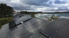
New Michigan law requires homeowners associations to allow rooftop solar

By Izzy Ross, Interlochen Public Radio

This coverage is made possible through a partnership with IPR and Grist, a nonprofit independent media organization dedicated to telling stories of climate solutions and a just future.

People who want to install solar panels on their roofs have to consider a lot: sunlight, cost, and coordinating with contractors and utilities.

Read Now at Great Lakes Now.

Original Article

Great Lakes Now

Great Lakes Now

https://www.greatlakesnow.org/2024/07/new-michigan-law-requires-homeowners-associations-to-allow-rooftop-solar/

Interlochen Public Radio

What is a liquid? Utilities sue to avoid coal ash cleanup — and lose

By Gautama Mehta, Grist

This story was originally published by Grist. Sign up for Grist’s weekly newsletter here.

Across America, millions of tons of toxic waste are sitting in pits next to coal plants. But whether they will get cleaned up has come down to a legal debate over the definitions of words.

Read Now at Great Lakes Now.

Original Article

Great Lakes Now

Great Lakes Now

https://www.greatlakesnow.org/2024/07/what-is-a-liquid-utilities-sue-to-avoid-coal-ash-cleanup-and-lose/

Grist

News

Great Lakes Commission releases user-friendly, secure Great Lakes water use database

Ann Arbor, Mich. – The Great Lakes Commission (GLC) announced today that it has released an updated Great Lakes Water Use Database website that is more secure and will make it easier for the public to access water use data. Upgrades to the site include: a streamlined, more intuitive process for water use data managers to report their jurisdictions’ data and metadata; an improved public-facing “create your own query” tool that will allow users to create charts based on their specific data selections; and enhanced security features to better protect data before it is published.

“More than 30 million people in the basin rely on the Great Lakes for drinking water, jobs, industry and more,” said Loren Wobig, Great Lakes Commissioner and Illinois Governor JB Pritzker’s alternate on the Great Lakes-St. Lawrence River Basin Water Resources Council (Compact Council) and Designee on the Great Lakes-St. Lawrence River Water Resources Regional Body (Regional Body). “This new website will help regional decision-makers better manage our water resources responsibly for all the basin’s residents.”

“One of the key goals of the Great Lakes-St. Lawrence water management compact and agreement was facilitating the exchange of data and strengthening the scientific information upon which decisions are made,” said Peter Johnson, Deputy Director of the Great Lakes St. Lawrence Governors and Premiers (GSGP), the organization that serves as secretariat to the Compact Council and Regional Body. “This upgrade to the water use database is an important step in further advancing the Governors’ and Premiers’ water management priorities.”

For nearly 40 years, as part of the historic water agreements, the eight states and two provinces in the Great Lakes-St. Lawrence River basin have provided water use data to the regional water use database. The GLC compiles and summarizes these datasets into an annual report that is submitted to the Compact Council and Regional Body, which manage the agreements to sustainably manage Great Lakes water.

To view the new website, visit waterusedata.glc.org.


The Great Lakes Commission, led by chair Mary Mertz, director of the Ohio Department of Natural Resources, is a binational government agency established in 1955 to protect the Great Lakes and the economies and ecosystems they support. Its membership includes leaders from the eight U.S. states and two Canadian provinces in the Great Lakes basin. The GLC recommends policies and practices to balance the use, development, and conservation of the water resources of the Great Lakes and brings the region together to work on issues that no single community, state, province, or nation can tackle alone. Learn more at www.glc.org.

Contact

For media inquiries, please contact Beth Wanamaker, beth@glc.org.

Recent GLC News

Upcoming GLC Events

View GLC Calendar

Archives

Original Article

Great Lakes Commission

Great Lakes Commission

https://www.glc.org/news/wudb-071224

Beth Wanamaker

Environmental and administrative lawyers say that efforts to protect Wisconsin’s water from contaminants such as PFAS could be harmed by the U.S. Supreme Court’s decision last week to overturn the 40-year-old precedent known as Chevron deference. Read the full story by the Wisconsin Examiner.

Original Article

Great Lakes Commission

Great Lakes Commission

https://www.glc.org/dailynews/20240712-court-decision-impact

James Polidori

A Wisconsin state law forbids lead pipe replacement when a private water utility is involved. Superior Water, Light & Power – the only private water utility statewide – and local officials are pushing to change the law in order to accelerate lead pipe replacement. Read the full story by the Superior Telegram.

Original Article

Great Lakes Commission

Great Lakes Commission

https://www.glc.org/dailynews/20240712-lead-removal

James Polidori

The Bad River Band of Lake Superior Chippewa has proposed a new project to mitigate the immediate risks of erosion along the Line 5 oil pipeline, a move that comes amid fraught conflict between the Band and the Canadian oil giant Enbridge. Read the full story by the Milwaukee Journal Sentinel.

Original Article

Great Lakes Commission

Great Lakes Commission

https://www.glc.org/dailynews/20240712-erosion-prevention

James Polidori

The U.S. Nuclear Regulatory Commission (NRC) has launched an environmental review of the potential impacts of repowering the Palisades Nuclear Power Plant in west Michigan’s Covert Township. Read the full story by The Detroit News.

Original Article

Great Lakes Commission

Great Lakes Commission

https://www.glc.org/dailynews/20240712-nuclear-plant-restart

James Polidori

The historic 1,000-pound anchor from the Oak Leaf, a schooner-turned-barge that sank in Wisconsin’s Sturgeon Bay in 1928, was recently moved to Bullhead Point, a small spit of land jutting into the Sturgeon Bay channel which is now on the National Register of Historic Places as a Historical and Archaeological District. Read the full story by the Green Bay Press-Gazette.

Original Article

Great Lakes Commission

Great Lakes Commission

https://www.glc.org/dailynews/20240712-anchor-relocation

James Polidori

As of Wednesday, eight Michigan beaches were closed due to high Escherichia coli, or E. coli, levels in the water within Arenac, Bay, Macomb, Oakland, Lenawee, and Allegan counties. Beach closure information is updated regularly on BeachGuard, a site run by the Department of Environment, Great Lakes and Energy. Read the full story by The Alpena News.

Original Article

Great Lakes Commission

Great Lakes Commission

https://www.glc.org/dailynews/20240712-beach-closures

James Polidori