Fox-Wolf Watershed Alliance is implementing conservation projects to protect our waters for future generations. Help us prioritize future restoration projects and strengthen funding requests by telling us how you enjoy the lakes!

Please be specific – we are interested in the areas you use the most (we are looking to improve your spots, not steal them!). The map will be made public but your name will not be tied to the points you add.

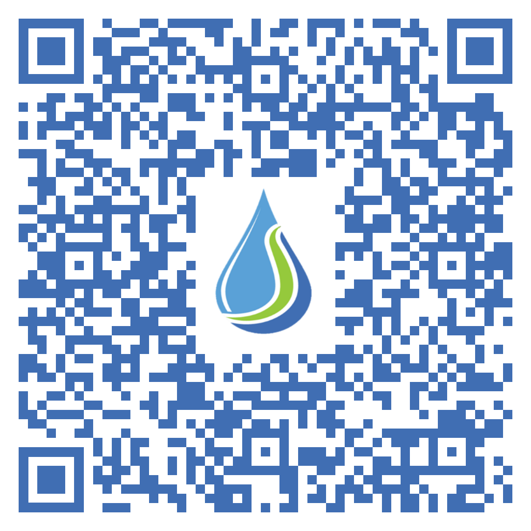
To get started, please click the button “Take the Survey Now!” or use the QR Code on the right.

Once on the map, click the “Edit” icon located on the upper left corner underneath the search bar. The icon looks like a list with a pencil. Select the type of activity that you would like to add, then click on the map where you do this activity to add it.

Add as many points as you’d like, keeping in mind we are interested in the areas most important to YOU. Adding an area that covers a whole lake is not as helpful as adding three points of the areas you fish the most and the boat launch you use to access it.

If you enjoy our waters in a way not listed, please select the most similar activity or select “other”, and add a description of the activity in the notes.

Thank you for your help and participation!

Contact Katie R with any questions or concerns at katherine@fwwa.org

Winnebago Waterways is a Fox-Wolf Watershed Alliance recovery initiative. Contact us at wwinfo@fwwa.org

The post Tell us where and how you use the waterways! appeared first on Fox-Wolf Watershed Alliance.

Original Article

Fox-Wolf Watershed Alliance

Fox-Wolf Watershed Alliance

https://fwwa.org/2024/01/15/recreationsurvey/?utm_source=rss&utm_medium=rss&utm_campaign=recreationsurvey

Katie Reed

Project Overview

In 2020, the Wisconsin Department of Natural Resources (WDNR) developed a Total Maximum Daily Load (TMDL) for the Upper Fox and Wolf River (UFW).  A TMDL is a calculation of the maximum amount of a pollutant that a body of water can absorb and still meet water quality.  The TMDL was utilized in the creation of the EPA’s Nine Key Elements (9KE). Within the 9KE there is a requirement for reductions in pollution to meet water quality goals.  The goals within this plan are to reduce Total Phosphorus (TP) which also relates to the reduction of Total Suspended Solids (TSS) such as erosion and flooding.

Approximately 34% of the reduction from the TMDL needs to come from the Winnebago Waterways Recovery Area with 51% of that reduction assigned to agriculture.  Alteration in farming practices and structural changes will help make reductions.

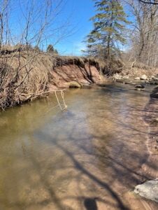
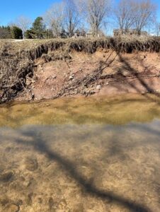
Currently, a missing piece in the TMDL and draft 9KE plan is streambank erosion. Streambank erosion is lumped in with agricultural loading estimates and required reductions in the TMDL. In some watersheds, we anticipate streambank erosion being a significant contributor to the total TMDL agricultural load. We need to inventory the streambanks in each HUC12 so that we can estimate potential TP/TSS reductions that could come from stabilizing streambanks to stop streambank erosion and to prioritize project locations. Stabilizing streambanks would be paired with efforts to increase infiltration on the land to reduce the volume and rate of flow that damages streambanks during storm events.

For this project, we will begin by completing streambank inventories in the four highest loading HUC12s located within the WWRA. The pollutant load from these HUC12s significantly contributes to water quality impairments of the streams within each HUC12, the Winnebago Lakes, and Lake Michigan. In addition to providing loading estimates from streambank erosion, this project also seeks to identify and prioritize potential locations for future restoration projects to help reduce nutrient loading and protect or enhance existing habitat. Going forward, this project will serve as a template for completing future streambank inventories for the remaining 28 HUC12s located in the WWRA.

Target HUC12 Subwatersheds in the 2023 Streambank Erosion Inventory

HUC12 to be Inventoried                                HUC12 Code                                Stream Miles

Town of Dale-Rat River                                      040202022102                                         60

Eldorado Marsh-Fond Du Lac River                 040302020204                                         63

Lake Poygan – Willow Creek                             040302022006                                          88

Pipe Creek – Frontal Lake Winnebago            040302020303                                          91

Project Timeline

In the Spring of 2023, a method was developed using GIS to determine streambanks to be physically inventoried as they are representative of the HUC12 they are located in. The method developed has been recorded in SOP#1: Streambank Erosion Inventory Desktop Review so it can be duplicated.

Fieldwork was accomplished in the summer of 2023. Streambank information from the desktop review was utilized to complete a physical inventory of these sections.

December 2023 – February 2024: Streambank Inventory Data Analysis was developed along with the extrapolation. These tools will allow an estimation of sediment loss and load & phosphorus loss and load for an entire watershed.

Project Funding & Partners

Winnebago Waterways is a Fox-Wolf Watershed Alliance recovery initiative. Contact us at wwinfo@fwwa.org

The post Prioritizing stabilization projects using streambank erosion inventories in the Fox-Wolf River Basin appeared first on Fox-Wolf Watershed Alliance.

Original Article

Fox-Wolf Watershed Alliance

Fox-Wolf Watershed Alliance

https://fwwa.org/2024/01/11/streambank-inventory/?utm_source=rss&utm_medium=rss&utm_campaign=streambank-inventory

Katie Reed

Visitors to Marble Park in Winneconne, Winnebago County can soon stop by three native plant beds to enjoy beautiful native plants! Installation is scheduled to start on August 22, 2023. We anticipate needing volunteers to help the remainder of the week (Aug 22-23). If you are interested in volunteering to help install and plant these beds, please fill out the following form and select “Shoreline Planting/Work Crew”. We look forward to seeing you at the park!

Fox-Wolf Watershed Alliance partnered with the Village of Winneconne to install the native plant beds. The goal of this project is to increase the adoption and installation of native shoreline plantings around the Winnebago System. We are excited to see the project come together and watch the plants grow!

Shoreline property owners are eligible to receive reimbursement of up to $1000 to install this type of best management practice through a Wisconsin DNR Healthy Lakes and Rivers grant by partnering with Fox-Wolf Watershed Alliance.

Come check out what this shoreline best management practice looks like, what the requirements are for the Healthy Lakes and Rivers Grant, and what shoreline property owners can expect from the process of planning, installing, and maintaining the native plant beds.

Under a Healthy Lakes and Rivers grant, native plantings must:

  • Total 350 contiguous square feet,
  • Be at least 10 feet wide in any direction,
  • Be adjacent to the shore,
  • Follow the Healthy Lakes requirement for number of native plants and species.

A Healthy Lakes native planting project can augment an existing area of shoreline vegetation under certain circumstances.

The demonstration site at Marble Park will meet all of these requirements, and is intended to give shoreline property owners a good idea of what to expect from their native plantings, while also educating visitors about how native plantings can improve wildlife habitat, natural beauty, and decrease runoff into the Wolf River.

The Demonstration Site will showcase three different plant lists: a low-growing bed showcasing species that grow <5 ft tall, a shoreline edge bed with species that thrive close to the water and a pollinator bed which will showcase species specifically intended to attract pollinators.

If you have any questions or are interested in installing a Healthy Lakes native plant bed on your shoreline property, please contact Katie Reed at katherine@fwwa.org or 920-851-6472.

Funding for this project was provided by the Winnebago Waterways Program at Fox-Wolf Watershed Alliance and the WI Department of Natural Resources. Project partners include the Winnebago Waterways Program at Fox-Wolf Watershed Alliance and the Village of Winneconne.

Winnebago Waterways is a Fox-Wolf Watershed Alliance recovery initiative. Contact us at wwinfo@fwwa.org

The post Volunteers Needed! Shoreline Buffer Demonstration Site Set To Be Installed at Marble Park, Winneconne appeared first on Fox-Wolf Watershed Alliance.

Original Article

Fox-Wolf Watershed Alliance

Fox-Wolf Watershed Alliance

https://fwwa.org/2023/08/09/marble-park-demo-site/?utm_source=rss&utm_medium=rss&utm_campaign=marble-park-demo-site

Katie Reed

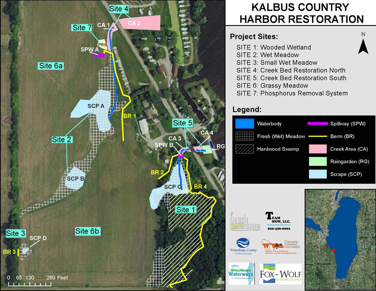
We are looking for 10-15 volunteers to help plant 2,720 plant plugs for a wetland restoration on the west side of Lake Winnebago.

Volunteers are needed May 5th, 6th, and possibly 7th at Kalbus Country Harbor in Oshkosh. Each day will start at 9:00 am. Volunteers are welcome to volunteer as much or as little as available.

To sign up, please contact John by May 1st at: 920-426-0062 (via text or call) or email kalbuscamping@gmail.com

We will have some tools available, but recommend bringing what you prefer to use with you, dress for the weather, and be prepared to get dirty. For those who sign-up, John will follow  up with additional details.

Read more about the Kalbus restoration project: CLICK HERE

Project site map

Project funding and partners:

Winnebago Waterways is a Fox-Wolf Watershed Alliance recovery initiative. Contact us at wwinfo@fwwa.org

The post Volunteers needed – Wetland Restoration Planting appeared first on Fox-Wolf Watershed Alliance.

Original Article

Fox-Wolf Watershed Alliance

Fox-Wolf Watershed Alliance

https://fwwa.org/2023/04/19/kalbus-wetland-project-volunteers/?utm_source=rss&utm_medium=rss&utm_campaign=kalbus-wetland-project-volunteers

Korin Doering