Fox-Wolf Watershed Alliance is implementing conservation projects to protect our waters for future generations. Help us prioritize future restoration projects and strengthen funding requests by telling us how you enjoy the lakes!

Please be specific – we are interested in the areas you use the most (we are looking to improve your spots, not steal them!). The map will be made public but your name will not be tied to the points you add.

To get started, please click the button “Take the Survey Now!” or use the QR Code on the right.

Once on the map, click the “Edit” icon located on the upper left corner underneath the search bar. The icon looks like a list with a pencil. Select the type of activity that you would like to add, then click on the map where you do this activity to add it.

Add as many points as you’d like, keeping in mind we are interested in the areas most important to YOU. Adding an area that covers a whole lake is not as helpful as adding three points of the areas you fish the most and the boat launch you use to access it.

If you enjoy our waters in a way not listed, please select the most similar activity or select “other”, and add a description of the activity in the notes.

Thank you for your help and participation!

Contact Katie R with any questions or concerns at katherine@fwwa.org

Winnebago Waterways is a Fox-Wolf Watershed Alliance recovery initiative. Contact us at wwinfo@fwwa.org

The post Tell us where and how you use the waterways! appeared first on Fox-Wolf Watershed Alliance.

Original Article

Fox-Wolf Watershed Alliance

Fox-Wolf Watershed Alliance

https://fwwa.org/2024/01/15/recreationsurvey/?utm_source=rss&utm_medium=rss&utm_campaign=recreationsurvey

Katie Reed

Project Overview

In 2020, the Wisconsin Department of Natural Resources (WDNR) developed a Total Maximum Daily Load (TMDL) for the Upper Fox and Wolf River (UFW).  A TMDL is a calculation of the maximum amount of a pollutant that a body of water can absorb and still meet water quality.  The TMDL was utilized in the creation of the EPA’s Nine Key Elements (9KE). Within the 9KE there is a requirement for reductions in pollution to meet water quality goals.  The goals within this plan are to reduce Total Phosphorus (TP) which also relates to the reduction of Total Suspended Solids (TSS) such as erosion and flooding.

Approximately 34% of the reduction from the TMDL needs to come from the Winnebago Waterways Recovery Area with 51% of that reduction assigned to agriculture.  Alteration in farming practices and structural changes will help make reductions.

Currently, a missing piece in the TMDL and draft 9KE plan is streambank erosion. Streambank erosion is lumped in with agricultural loading estimates and required reductions in the TMDL. In some watersheds, we anticipate streambank erosion being a significant contributor to the total TMDL agricultural load. We need to inventory the streambanks in each HUC12 so that we can estimate potential TP/TSS reductions that could come from stabilizing streambanks to stop streambank erosion and to prioritize project locations. Stabilizing streambanks would be paired with efforts to increase infiltration on the land to reduce the volume and rate of flow that damages streambanks during storm events.

For this project, we will begin by completing streambank inventories in the four highest loading HUC12s located within the WWRA. The pollutant load from these HUC12s significantly contributes to water quality impairments of the streams within each HUC12, the Winnebago Lakes, and Lake Michigan. In addition to providing loading estimates from streambank erosion, this project also seeks to identify and prioritize potential locations for future restoration projects to help reduce nutrient loading and protect or enhance existing habitat. Going forward, this project will serve as a template for completing future streambank inventories for the remaining 28 HUC12s located in the WWRA.

Target HUC12 Subwatersheds in the 2023 Streambank Erosion Inventory

HUC12 to be Inventoried                                HUC12 Code                                Stream Miles

Town of Dale-Rat River                                      040202022102                                         60

Eldorado Marsh-Fond Du Lac River                 040302020204                                         63

Lake Poygan – Willow Creek                             040302022006                                          88

Pipe Creek – Frontal Lake Winnebago            040302020303                                          91

Project Timeline

In the Spring of 2023, a method was developed using GIS to determine streambanks to be physically inventoried as they are representative of the HUC12 they are located in. The method developed has been recorded in SOP#1: Streambank Erosion Inventory Desktop Review so it can be duplicated.

Fieldwork was accomplished in the summer of 2023. Streambank information from the desktop review was utilized to complete a physical inventory of these sections.

December 2023 – February 2024: Streambank Inventory Data Analysis was developed along with the extrapolation. These tools will allow an estimation of sediment loss and load & phosphorus loss and load for an entire watershed.

Project Funding & Partners

Winnebago Waterways is a Fox-Wolf Watershed Alliance recovery initiative. Contact us at wwinfo@fwwa.org

The post Prioritizing stabilization projects using streambank erosion inventories in the Fox-Wolf River Basin appeared first on Fox-Wolf Watershed Alliance.

Original Article

Fox-Wolf Watershed Alliance

Fox-Wolf Watershed Alliance

https://fwwa.org/2024/01/11/streambank-inventory/?utm_source=rss&utm_medium=rss&utm_campaign=streambank-inventory

Katie Reed

Thanks to a generous shoreline property owner, we will be touring a shoreline planting on his property in Menasha on September 9, 2023 starting at 9am. Interested in attending? Click here to learn more and sign-up! Please provide your contact info if you plan on joining us so we can keep you updated on any changes due to weather. Thank you!

Tom Mace, longtime supporter of the Winnebago Waterways Program and of Fox-Wolf Watershed Alliance, has generously offered his property for a tour for interested visitors to learn about native shoreline plantings! Meet us at the property to learn about a shoreline planting seeded with native plants in fall, with growth seen in the following spring. The property also features an upland prairie planting that is very effective at attracting all sorts of pollinators. The property combines the native plantings with a more formal garden and a few orchard trees. Learn about the process of preparing, installing and maintaining these plantings and about the benefits to the property and water quality!

We expect the tour will last about an hour. If you plan on joining us, please dress for the weather and let us know to expect you by clicking the image below!

The post Shoreline Planting Tour in Menasha on Sept. 9, 2023 at 9am! appeared first on Fox-Wolf Watershed Alliance.

Original Article

Fox-Wolf Watershed Alliance

Fox-Wolf Watershed Alliance

https://fwwa.org/2023/08/28/shoreline-tour-sept_9_2023/?utm_source=rss&utm_medium=rss&utm_campaign=shoreline-tour-sept_9_2023

Katie Reed

Boulders in place to protect lakefront at Indiana Dunes Park

PORTAGE, Ind. (AP) — The National Park Service says the Portage Lakefront at Indiana Dunes National Park has reopened after a project to install boulders to protect the pavilion and assure safer access to the shoreline.

It says the joint effort by the City of Portage and the Park Service involved the installation of more than 1,000 tons of boulders needed to protect the lakefront and the Riverwalk from erosion.

Read Now at Great Lakes Now.

Original Article

Great Lakes Now

Great Lakes Now

https://www.greatlakesnow.org/2021/06/ap-boulders-lakefront-indiana-dunes-lake-michigan/

The Associated Press

Duluth mayor presses Army corps on beach erosion

DULUTH, Minn. (AP) — Duluth’s mayor is pressing the U.S. Army Corps of Engineers to investigate whether the agency is responsible for erosion along a six-mile stretch of Lake Superior beach.

The Minneapolis Star Tribune reported that Mayor Emily Larson sent a letter March 12 to the corps to investigate whether its maintenance work on shipping channels has caused erosion on Park Point.

Read Now at Great Lakes Now.

Original Article

Great Lakes Now

Great Lakes Now

https://www.greatlakesnow.org/2021/04/ap-duluth-mayor-army-corps-beach-erosion/

The Associated Press

Big Benefits from Experimental Watersheds

By Terri Cook, Eos

This story originally appeared in Eos and is republished here as part of Covering Climate Now, a global journalism collaboration strengthening coverage of the climate story.


During the mid-1930s, in the wake of devastating Dust Bowl–era storms, the U.S.

Read Now at Great Lakes Now.

Original Article

Great Lakes Now

Great Lakes Now

https://www.greatlakesnow.org/2021/02/big-benefits-from-experimental-watersheds/

Eos

European Colonists Dramatically Increased North American Erosion Rates

By Rachel Fritts, Eos

This story originally appeared in Eos and is republished here as part of Covering Climate Now, a global journalism collaboration strengthening coverage of the climate story.

Everything wears away in time, but human activities like farming can dramatically accelerate natural erosion rates.

Read Now at Great Lakes Now.

Original Article

Great Lakes Now

Great Lakes Now

https://www.greatlakesnow.org/2021/01/european-colonists-dramatically-increased-north-american-erosion-rates/

Eos

Indiana Dunes starts beach parking information line

PORTER, Ind. (AP) — Indiana Dunes National Park has started an information line to help visitors find an open beach with available parking amid severe shoreline erosion along Lake Michigan and the need for social distancing.

Beginning Saturday morning, visitors can call 219-395-1003 to hear recorded information on available parking at Indiana Dunes National Park beaches and nearby Indiana Dunes State Park.

Read Now at Great Lakes Now.

Original Article

Great Lakes Now

Great Lakes Now

https://www.greatlakesnow.org/2020/05/ap-indiana-dunes-covid-19-beach-parking/

The Associated Press

Wisconsin Sea Grant’s outreach specialists are used to traversing the state, sharing information of relevance directly with impacted communities. In this year marked by a global pandemic, however, it hasn’t been so easy—yet staff are finding ways to get the job done.

In mid-March, Coastal Engineering Outreach Specialist Adam Bechle had planned, along with a variety of partners, to deliver three nights of back-to-back information on high Great Lakes water levels in three Lake Michigan coastal communities: Manitowoc, Somers and Mequon. Yet, due to the rapidly evolving COVID-19 situation, those in-person sessions were replaced by a single online one on March 18.

The Zoom session featured Bechle along with speakers from the U.S. Army Corps of Engineers—Detroit District, National Weather Service Forecast Office in Milwaukee/Sullivan and the Wisconsin Department of Natural Resources. The Wisconsin Coastal Management Program and local governments also played a role in putting the session together. About 112 participants watched it live.

The archived, two-hour webinar may be viewed on Wisconsin Sea Grant’s YouTube channel. “People in our Lake Michigan coastal communities have been hungry for information about what’s in store for water levels and what options they may have for dealing with some of the negative impacts,” said Bechle. “If people missed the live webinar, they can still get this information online, where they can hear directly from a variety of experts all in one place.”

Topics covered include forecasts for water levels through the summer, emergency management activities being undertaken by the Army Corps of Engineers, the local impacts of recent storms, how coastal processes in the water affect what’s happening on land, and the permitting process for constructing erosion control structures.

Listen and watch on YouTube.

Further questions may be directed to Bechle at bechle@aqua.wisc.edu.

Original Article

News Releases – Wisconsin Sea Grant

News Releases – Wisconsin Sea Grant

https://www.seagrant.wisc.edu/news/whats-in-store-for-great-lakes-water-levels-find-out-online/

Jennifer Smith

Part of trail collapses due to erosion near Lake Michigan

PETOSKEY, Mich. (AP) — A portion of a popular paved trail along a Lake Michigan bay has collapsed due to erosion from high water.

The trail, called the Little Traverse Wheelway, is “falling into the lake as the wind continues and is very dangerous,” Petoskey Parks and Recreation Department said Monday on Facebook.

Read Now at Great Lakes Now.

Original Article

Great Lakes Now

Great Lakes Now

https://www.greatlakesnow.org/2020/04/ap-trail-collapse-erosion-lake-michigan/

The Associated Press

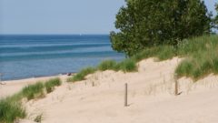
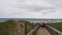
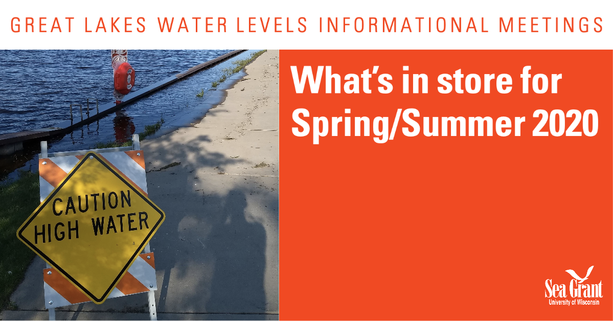
Great Lakes water levels have been at or near record highs in recent months, prompting concern among many Wisconsin residents.

Those interested in learning what’s in store for Great Lakes water levels through spring and summer 2020 are invited to attend one of three upcoming informational meetings in communities along Lake Michigan.

At each session, attendees will hear from experts from Wisconsin Sea Grant, the U.S. Army Corps of Engineers, the National Weather Service and the Wisconsin Department of Natural Resources. There will also be time for attendees to ask questions. Seating at all sessions is available on a first-come, first-served basis.

The three sessions are:

Manitowoc: Tuesday, March 17, 6 to 8 p.m.
UW-Green Bay, Manitowoc Campus
University Theater
705 Viebahn St.
Manitowoc, WI 54420

Somers/Kenosha: Wednesday, March 18, 6 to 8 p.m.
UW-Parkside
Student Center Cinema
900 Wood Rd.
Somers, WI 53133

Mequon: Thursday, March 19, 6 to 8 p.m.
MATC Mequon Campus
Lecture Hall, Room A289
5555 W. Highland Rd.
Mequon, WI 53092

Dr. Adam Bechle, a coastal engineering outreach specialist with Wisconsin Sea Grant, will speak at all three panels. Said Bechle, “We have worked with federal, state and local partners to host a couple of these meetings in the past few months, and they have been quite well attended. With Great Lakes water levels already breaking records this year, demand for information continues to grow. These meetings will help folks understand the current water level situation, as well as possible steps forward to address the impacts of these high water levels.”

Those who are unable to attend the events in person may attend virtually through Zoom.

Additionally, a recording will be posted on Wisconsin Sea Grant’s YouTube channel after the events.

View or print an event flyer here.

View or print a list of resources for Great Lakes property owners here.

Questions about the events may be directed to Bechle at (608) 263-5133.

Original Article

News Releases – Wisconsin Sea Grant

News Releases – Wisconsin Sea Grant

https://www.seagrant.wisc.edu/news/experts-host-additional-panels-about-great-lakes-water-levels-and-their-impact/

Jennifer Smith