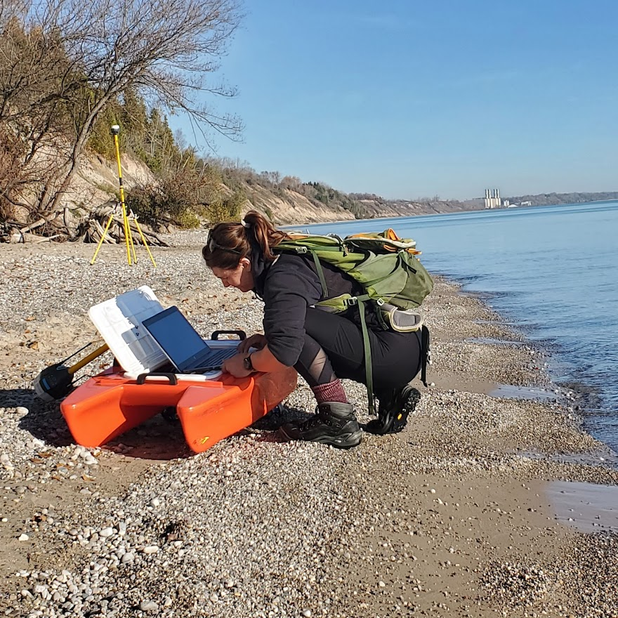
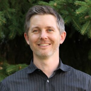
Chelsea Volpano works with a remote-controlled boat used to research erosion along Lake Michigan. Image credit: Chelsea Volpano, University of Wisconsin-Madison

High water levels in Lake Michigan since 2013 have caused erosion rates that are faster than usual, especially in 2020, when lake levels set records. This has created an urgent need to know more about erosion processes along and in the lake.

Lucas Zoet with the University of Wisconsin-Madison Department of Geoscience and his research team are looking at bluff erosion and sediment movement at two Wisconsin sites along Lake Michigan in a holistic way to better understand erosion rates and where the eroding sediment goes. This information will help guide shore protection and bluff stabilization processes and preserve beaches for recreation.

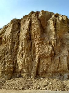
The two study sites are located just south of Port Washington and at Point Beach State Forest, which is farther north, near Two Rivers. The researchers chose those sites because they offer good representations of different erosion processes. The Port Washington site sits on a bluff, the Point Beach State Forest site is composed of sand dunes.

Lucas Zoet, University of Wisconsin-Madison. Submitted image

“The processes on these sites can be applied all over the place in Wisconsin,” Zoet said. “Lots of the bluffs we have are generally similar to those at the Port Washington site, composed of a mix of glacial tills and various lake deposits that are interbedded. So just understanding these processes at a base level, they should be generally applicable to more or less everywhere.”

The project’s holistic approach is unique. “The real strength of this project is that it doesn’t break the whole system up into little chunks, like we study this part and then we don’t know how it works because it’s in isolation from this other part. Instead, we’re trying to look at the whole continuous system, from what’s happening onshore, to what’s happening on the beach, to what’s happening in the nearshore over multiple years. We can study this on a representative timescale. Not just in a week or a month, but over seasons, which we know is such a big player in the Great Lakes region,” Zoet said.

Compared to the well-studied processes that happen on marine coastlines, winter is the season that makes erosion issues in the Great Lakes distinctive. Zoet said that cold weather impacts erosion differently.

“We have this season where the bluffs freeze solid, the shore ice forms – all these different components that drastically alter sediment transport. You don’t see that if you’re looking at beaches in North Carolina or Oregon,” Zoet said.

To study the onshore section, Zoet, J. Elmo Rawling with the Wisconsin Geological and Natural History Survey and Ph.D. student Chelsea Volpano, use drones and trail cams to gather data. To study the beach, Volpano conducts wading surveys. For these, Zoet said Volpano carries a staff with a GPS unit on it to measure lakebed elevation.

“She walks out into the water up to about her waist, about a meter deep and just does that over and over. So, with that, she can connect the onshore component to the offshore component for this continuous map that’s called topo-bathy,” Zoet said. This type of field work is uncommon. “She might be one of the only people to do these wading surveys in near-freezing waters, repeatedly throughout the years,” Zoet added.

To study the nearshore area, the team uses a medium-sized remote-controlled boat that contains an instrument that measures the elevation of the lakebed for a full 3D map of the system. By repeating these measurements over time, the team can assess how the lakebed is changing and where the sediment is going.

(Drone footage by the research team of a landslide area along Lake Michigan.)

One aspect of communicating the project involves Great Lakes Quests. These are story maps compiled by Justin Hougham, University of Wisconsin-Madison, and Sea Grant. The Port Washington site is already part of the Quest database, but the Point Beach State Forest isn’t, and will be added.

The project will also be communicated through public workshops for educators and property owners along Lake Michigan who are concerned about coastal erosion. “We’ll do a walk of the terrain with them and we’ll probably bring a couple of the instruments we use, like the drone and the remote-controlled boat,” Zoet said. The first workshop is planned for September 2024.

Zoet has a long-standing working relationship with the College of Menominee Nation in Wisconsin. He’s currently helping design the college’s new geoscience program. Faculty members at the college plan to recommend students who could help work on the story maps for the project and computer mapping.

Summing up this multifaceted project, Zoet said, “In the end, I think we’ll learn a lot about the processes, but we’ll also learn a lot about how to better advise coastal managers, county managers and parks managers.”

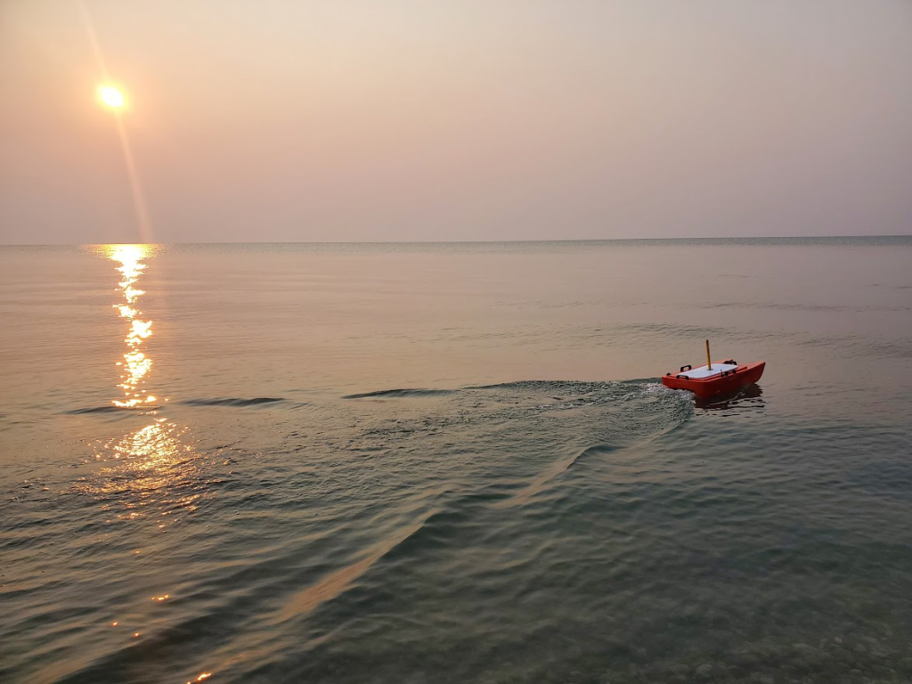
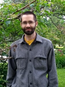
The research team uses a remote-controlled boat to measure the elevation of the lakebed along Lake Michigan. Image credit: Chelsea Volpano, University of Wisconsin-Madison

The post Gaining a big picture of bluff erosion and sand movement along Lake Michigan first appeared on Wisconsin Sea Grant.

Original Article

News Releases | Wisconsin Sea Grant

News Releases | Wisconsin Sea Grant

https://www.seagrant.wisc.edu/news/gaining-a-big-picture-of-bluff-erosion-and-sand-movement-along-lake-michigan/?utm_source=rss&utm_medium=rss&utm_campaign=gaining-a-big-picture-of-bluff-erosion-and-sand-movement-along-lake-michigan

Marie Zhuikov

As one of the longest running and most successful American Water Resources Association (AWRA) chapters in the country, the Wisconsin chapter provides a structure for water professionals and those studying to enter the discipline to learn from each other and a broader, national water community about the latest in research and management. The chapter is made up of those in private industry, scientists, students and water managers at the local, state and federal level.


A hallmark of the Wisconsin chapter’s educational commitment to professional development and informational exchange is an annual conference, conducted in the state continuously since 1977. Each year, the University of Wisconsin Water Resources Institute (WRI) is a co-sponsor of the event.


Recently, to preserve and share 45 years of Wisconsin’s water resources legacy, Mike Parsen and Brad Gottschalk of the Wisconsin Geological and Natural History Survey (WGNHS) assembled the collection of conference proceedings. The pair collaborated with Anne Moser and Maya Reinfeldt of the Wisconsin Water Library, which is housed at WRI, to create a permanent digital repository.

Smiling man, head and shoulders.
Mike Parsen, hydrogeologist at the Wisconsin Geological and Natural History Survey (contributed photo).


Smiling man with beard, wearing glasses.
Brad Gottschalk, archivist at the Wisconsin Geological and Natural History Survey (contributed photo).

Maureen Muldoon, a hydrogeologist at WGNHS, generously donated her hard-copy programs as a starting point and the team filled in historical gaps where needed.


The collection now resides at MINDS@UW and includes digital copies of the proceedings from 1978 to today. It is accessible through the University of Wisconsin-Madison’s online library catalog.


The post Decades of proceedings from annual water meetings now available first appeared on WRI.

Original Article

News Release | WRI

News Release | WRI

https://www.wri.wisc.edu/news/decades-of-proceedings-from-annual-water-meetings-now-available/

Moira Harrington

Eric Stewart. Submitted photo

October 21, 2020

By Marie Zhuikov

Low levels of arsenic  have been detected in nearly half of the wells in Fond du Lac and Dodge counties in east central Wisconsin. Arsenic is a naturally occurring toxin. It’s been found in every county in Wisconsin and is released from both bedrock and glacial sources. Long-term exposure to high levels of arsenic in drinking water is known to increase risks of skin, bladder, lung, liver, colon and kidney cancer. Arsenic gets dissolved into well water when the rock minerals are exposed to oxygen. This can happen when air in a well shaft breaks down minerals such as sulfides, or even from microbe communities within the shaft (or borehole), which can change water chemistry enough to release arsenic from other sources.

A research project funded by the University of Wisconsin Water Resources Institute is attempting to understand why arsenic is an issue in wells in Fond du Lac and Dodge counties and improve the probability of identifying where arsenic is likely to be a problem for new wells drilled in those counties.

Geologist Eric Stewart is leading the team from the Wisconsin Geological and Natural History Survey who are conducting the one-year project, which began in 2020. They are using 3-D mapping to detect subtle folds in the bedrock surface that could contribute to the chemical reactions that release arsenic into groundwater. They already have some findings.

This shows the kind of large vertical fractures that tend to form in the vicinity of mapped bedrock folds. In Dodge and Fond du Lac counties, researchers think these large vertical fractures cause deeper oxidation fronts to develop, which changes the arsenic detection probability. The photo is from the Galena Formation in Grant County (where the rocks are exposed at land surface). Image credit: Eric Stewart

“What we’ve been learning is that it’s a switch in the bedrock host of arsenic from sulfide minerals to iron hydroxide minerals,” said Stewart. “The fractured rock associated with the folds are creating conditions where the rocks are oxidizing a bit deeper beneath the bedrock surface. Now you have arsenic adsorbed on the surfaces of iron hydroxides rather than within sulfides and that might contribute to an increased probability of it being released.”

Stewart said past studies have suggested microbial life inside well boreholes may create conditions that make the iron hydroxides unstable, which releases the arsenic. Another variable is the difference between the well casing depth and the depth of the bedrock.

“If the well is open to the top of the bedrock surface, those rocks tend to be more oxidized than deeper down. So, you’d be drawing more water from oxidized rock. If you case the well really deep and the difference is large – if you case it 300 feet down from the bedrock surface, then the rocks probably aren’t going to be oxidized. Both the fracturing from folding and how the well’s constructed seem to be influencing whether the well is drawing water from oxidized rock, and that influences the probability of arsenic being released,” Stewart said.

Results of the mapping project could be used to help determine good places for new wells in the two counties. “The model can provide probabilities for detecting arsenic over our cutoff value, which is 2 micrograms per liter,” Stewart said. “Its probabilities are based on location, local geology and well construction practices. That’s the kind of information we could provide to well-drillers.”

The post Arsenic in 3-D: Researchers assess risk for eastern Wisconsin groundwater wells first appeared on WRI.

Original Article

News Release – WRI

News Release – WRI

https://www.wri.wisc.edu/news/arsenic-in-3-d-researchers-assess-risk-for-eastern-wisconsin-groundwater-wells/

mzhuikov