Gaining a big picture of bluff erosion and sand movement along Lake Michigan
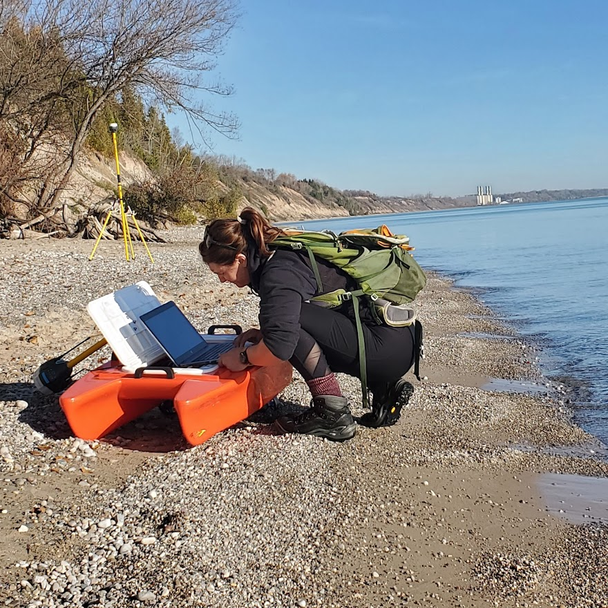
Chelsea Volpano works with a remote-controlled boat used to research erosion along Lake Michigan. Image credit: Chelsea Volpano, University of Wisconsin-Madison
High water levels in Lake Michigan since 2013 have caused erosion rates that are faster than usual, especially in 2020, when lake levels set records. This has created an urgent need to know more about erosion processes along and in the lake.
Lucas Zoet with the University of Wisconsin-Madison Department of Geoscience and his research team are looking at bluff erosion and sediment movement at two Wisconsin sites along Lake Michigan in a holistic way to better understand erosion rates and where the eroding sediment goes. This information will help guide shore protection and bluff stabilization processes and preserve beaches for recreation.
The two study sites are located just south of Port Washington and at Point Beach State Forest, which is farther north, near Two Rivers. The researchers chose those sites because they offer good representations of different erosion processes. The Port Washington site sits on a bluff, the Point Beach State Forest site is composed of sand dunes.

Lucas Zoet, University of Wisconsin-Madison. Submitted image
“The processes on these sites can be applied all over the place in Wisconsin,” Zoet said. “Lots of the bluffs we have are generally similar to those at the Port Washington site, composed of a mix of glacial tills and various lake deposits that are interbedded. So just understanding these processes at a base level, they should be generally applicable to more or less everywhere.”
The project’s holistic approach is unique. “The real strength of this project is that it doesn’t break the whole system up into little chunks, like we study this part and then we don’t know how it works because it’s in isolation from this other part. Instead, we’re trying to look at the whole continuous system, from what’s happening onshore, to what’s happening on the beach, to what’s happening in the nearshore over multiple years. We can study this on a representative timescale. Not just in a week or a month, but over seasons, which we know is such a big player in the Great Lakes region,” Zoet said.
Compared to the well-studied processes that happen on marine coastlines, winter is the season that makes erosion issues in the Great Lakes distinctive. Zoet said that cold weather impacts erosion differently.
“We have this season where the bluffs freeze solid, the shore ice forms – all these different components that drastically alter sediment transport. You don’t see that if you’re looking at beaches in North Carolina or Oregon,” Zoet said.
To study the onshore section, Zoet, J. Elmo Rawling with the Wisconsin Geological and Natural History Survey and Ph.D. student Chelsea Volpano, use drones and trail cams to gather data. To study the beach, Volpano conducts wading surveys. For these, Zoet said Volpano carries a staff with a GPS unit on it to measure lakebed elevation.
“She walks out into the water up to about her waist, about a meter deep and just does that over and over. So, with that, she can connect the onshore component to the offshore component for this continuous map that’s called topo-bathy,” Zoet said. This type of field work is uncommon. “She might be one of the only people to do these wading surveys in near-freezing waters, repeatedly throughout the years,” Zoet added.
To study the nearshore area, the team uses a medium-sized remote-controlled boat that contains an instrument that measures the elevation of the lakebed for a full 3D map of the system. By repeating these measurements over time, the team can assess how the lakebed is changing and where the sediment is going.
(Drone footage by the research team of a landslide area along Lake Michigan.)
One aspect of communicating the project involves Great Lakes Quests. These are story maps compiled by Justin Hougham, University of Wisconsin-Madison, and Sea Grant. The Port Washington site is already part of the Quest database, but the Point Beach State Forest isn’t, and will be added.
The project will also be communicated through public workshops for educators and property owners along Lake Michigan who are concerned about coastal erosion. “We’ll do a walk of the terrain with them and we’ll probably bring a couple of the instruments we use, like the drone and the remote-controlled boat,” Zoet said. The first workshop is planned for September 2024.
Zoet has a long-standing working relationship with the College of Menominee Nation in Wisconsin. He’s currently helping design the college’s new geoscience program. Faculty members at the college plan to recommend students who could help work on the story maps for the project and computer mapping.
Summing up this multifaceted project, Zoet said, “In the end, I think we’ll learn a lot about the processes, but we’ll also learn a lot about how to better advise coastal managers, county managers and parks managers.”
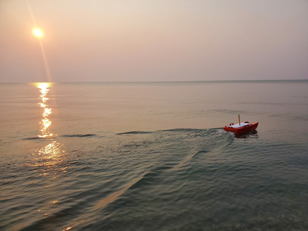
The research team uses a remote-controlled boat to measure the elevation of the lakebed along Lake Michigan. Image credit: Chelsea Volpano, University of Wisconsin-Madison
News Releases | Wisconsin Sea Grant
News Releases | Wisconsin Sea Grant
https://www.seagrant.wisc.edu/news/gaining-a-big-picture-of-bluff-erosion-and-sand-movement-along-lake-michigan/?utm_source=rss&utm_medium=rss&utm_campaign=gaining-a-big-picture-of-bluff-erosion-and-sand-movement-along-lake-michigan

