
How people connect to the St. Louis River Estuary
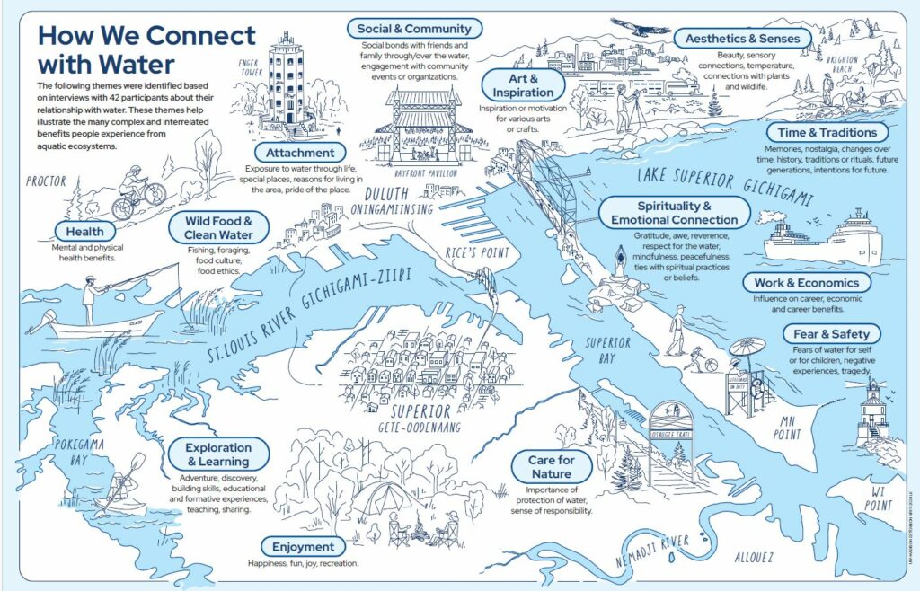
The U.S. Environmental Protection Agency has published the results and recommendations that came from a 2021-22 Waterway Benefits Study of the St. Louis River Estuary. The study was conducted to explore the estuary community’s deep connections to the St. Louis River, Lake Superior, and local streams to help increase access and guide decision-making.
During the study, 532 residents were surveyed about their experiences with Lake Superior, the Estuary, and local streams in the previous year. Follow-up interviews were conducted later with 42 survey participants about their relationships with water. This fact sheet offers an overview of the study’s findings.
Other project partners include the Lake Superior National Estuarine Research Reserve and the University of Minnesota Duluth.
The post How people connect to the St. Louis River Estuary first appeared on Wisconsin Sea Grant.Blog | Wisconsin Sea Grant
https://www.seagrant.wisc.edu/blog/how-people-connect-to-the-st-louis-river-estuary/


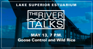 The River Talk series is changing format for the final talk for this academic year. At 7 p.m. on Wednesday, May 13, via Zoom, Sam Hansen, former undergraduate research fellow with the Lake Superior National Estuarine Research Reserve, will present, “Deterring Geese on the St. Louis River to Protect Wild Rice.”