It’s not often that a Sea Grant research project proposal contains the word “forgiveness.” However, that’s one of the missions of a multi-Sea-Grant-program endeavor taking place in three communities along the Lake Michigan coast.

Record-high water levels, severe storm surges and shoreline armoring have caused significant erosion to the bluffs and beaches in many areas along the 1,460-mile Lake Michigan shoreline. The ground beneath houses and garages on the shore is washing away, causing some structures to topple into the lake.

Along with this physical breakage comes emotional breakage, with neighbors blaming neighbors and community organizations for these problems.

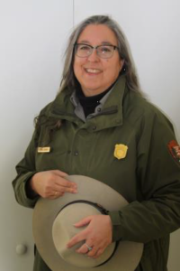
Project lead Chin Wu, a professor of civil and environmental engineering at the University of Wisconsin-Madison, said he is working to strengthen broken relationships and soothe anxiety. For example, tensions have run high in Mequon, Wisconsin, following Concordia University’s 2008 bluff stabilization project, including a lawsuit against the school brought by neighbors.

“There are people mad about every different aspect [of erosion],” Wu said. “But instead of blaming each other when natural forces take place, it’s the high-water levels that we need to cope with.”

The two-year joint project that began in 2020 is co-led by Wu, Guy Meadows with Michigan Technological University and Cary Troy with Purdue University. With funding by Sea Grant programs in Illinois-Indiana, Michigan and Wisconsin, the project seeks to address complex erosion issues through an integrated physical, social and community approach.

Although their joint project has the capacity to impact the whole of the lake and lakeshore communities, the research team is concentrating on three locations that are all experiencing erosion: Mequon, Wisconsin; the dunes at Beverly Shores, Indiana; and the shoreline of South Haven, Michigan.

For the physical aspect, they are working to identify coastal areas with high erosion potential, characterize areas where sediment is trapped or diverted by using historical aerial photos, and compile an inventory of coastal sediment budgets in Lake Michigan – how much sediment is coming into the lake, how much is going out, and how much is being stored. The team will also assess the cumulative impacts of shoreline protection structures through historical aerial images and different computer model scenarios of varying lake levels and storm events.

For the social aspect, the team will assess public attitudes and perceptions about different shore protection options and examine variables that affect community relationships.

For the community aspect, the team will develop a community of practice to guide decision-making for what coastal stabilization measures to use and communicate the information learned through the project back to the communities. A community of practice is a group of people who share a common concern, a set of problems, or an interest in a topic and who come together to fulfill both individual and group goals.

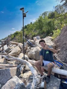
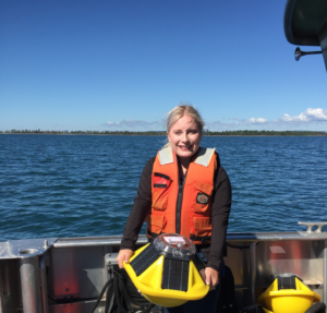
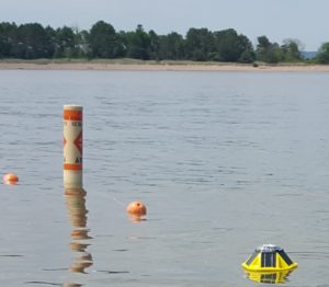
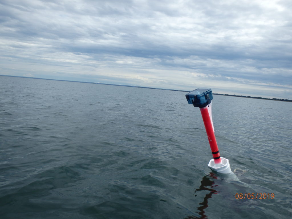
Ph.D. student, Miles Tryon-Petith, installs a real-time camera to track erosion on the Lake Michigan shoreline in Mequon, Wisconsin. Submitted photo.

Miles Tryon-Petith, Wu’s civil and environmental engineering Ph.D. student from UW-Madison, said the community of practice will include local and regional organizations, such as the Department of Natural Resources as well as community leaders.

The forgiveness aspect of the project enters with factors that affect community relationships. Robert Enright, psychology professor, and his Ph.D. student, Lai Wong, at UW-Madison will employ social justice circles, a scientifically verified program that works to address issues about which people feel strongly. This method convenes opposing parties in a dialogue with the goals of fostering understanding and mutual problem-solving.

“Developing strong community relationships and introducing the social justice circles seemed very important because people’s homes and livelihoods are threatened by this ongoing problem. These are people living through the situation,” said Tryon-Petith.

The hope is that after working through the understanding and forgiveness exercises, communities can move on to discussing erosion-control solutions.

Wu emphasized that solutions lie with shoreline protection structures that employ engineering principles, which work with natural processes. He calls these nature-based solutions. These may include features that are completely natural, such as planting native vegetation on dunes, and those that are “hard,” such as concrete structures like seawalls. Multiple types of nature-based features are often combined within a project. Wu said the features would also be attractive to wildlife.

Adam Bechle, coastal engineering outreach specialist for Wisconsin Sea Grant and project team member, said, “There is growing interest in nature-based shorelines in the Great Lakes. We are eager to explore what types of these features can work at these sites and hopefully bolster their use in the region.”

Tryon-Petith said the project team met recently with community members in Mequon and Concordia University. “People were excited about moving forward – about what they could do or how we could work with each other, rather than lingering on what happened in the past. So, I’m optimistic about that.”

The goal of this project is not to actually build erosion-control structures but to identify which ones would work in different locations along the lake. Then, communities could seek funding for building them and implementing other erosion control measures.

“The dream is that we’re able to approach changing shorelines better,” said Tryon-Petith. “Erosion is such a behemoth of an issue. I’m starting to feel very excited working to find ways to tackle shoreline erosion around the lake. It’s not going to be the same solution everywhere . . . It’s very special to work on this issue with colleagues from Michigan and Illinois-Indiana. You can tell this isn’t a chore for them. This is clearly a passion for everyone involved.”

Read more details about the work going on in Illinois, Indiana and Michigan by following the links.

Other project personnel include Todd Breiby and Kate Angel with the Wisconsin Coastal Management Program; Pengfei Xue, Michigan Technological University; Sean Vitousek, United States Geological Survey; Stuart Carlton and Aaron Thompson, Purdue University; Mark Breederland, Michigan Sea Grant; and Sarah Peterson, Boyuan Lu, Yuli Liu and Josh Anderson with the University of Wisconsin-Madison.

Additional funding is being provided by the Michigan Coastal Management Program and a NOAA Coastal Resilience grant.

The post Project tackles broken coastlines by strengthening community relationships on Lake Michigan first appeared on Wisconsin Sea Grant.

Original Article

News Releases | Wisconsin Sea Grant

News Releases | Wisconsin Sea Grant

https://www.seagrant.wisc.edu/news/project-tackles-broken-coastlines-by-strengthening-community-relationships-on-lake-michigan/?utm_source=rss&utm_medium=rss&utm_campaign=project-tackles-broken-coastlines-by-strengthening-community-relationships-on-lake-michigan

Marie Zhuikov

The brains behind the SeaCavesWatch.org website have developed a new website that offers real-time wave condition information for the Apostle Islands National Lakeshore in Lake Superior. Before venturing onto the lake, paddlers and boaters should check WISC-Watch (https://go.wisc.edu/7y2x4o), which stands for Water Information for a Safe Coast Watch. The WISC-Watch site provides information from seven spotter buoys recently deployed throughout the islands, plus Chequamegon Bay near Ashland and Siskiwit Bay near Cornucopia. The buoys monitor wave height, water temperature and wind information.

Lynne Dominy. Image credit: National Park Service

“Apostle Islands National Lakeshore offers world-class sea kayaking and sailing in a remote environment,” said Lynne Dominy, park superintendent. “But treacherous waves and frigid water temperatures can imperil boaters. We hope boaters will use this system to assess current conditions and to make good decisions before venturing out on Lake Superior.”

The site was developed as part of a yearlong project by the Department of Civil and Environmental Engineering at the University of Wisconsin-Madison and Wisconsin Sea Grant with advice from the National Park Service and the Wisconsin Coastal Management Program.

Chin Wu, project leader and a professor in the UW-Madison Department of Civil and Environmental Engineering, said spotter buoys were deployed in mid-June at the mainland sea caves, Sand Island, Devil’s Island, Stockton Island and southeast of Madeline Island, in addition to Chequamegon Bay and Siskiwit Bay.

“Besides the mainland sea caves, real-time measurements of wave heights and water temperatures have never been provided at these locations before,” Wu said. “The data we collect will also help us make nearshore wave and current forecast models operational.”

Next summer, a team led by Natalie Chin, Wisconsin Sea Grant climate and tourism outreach specialist, and Todd Breiby with the Wisconsin Coastal Management Program, will conduct a public survey to assess and evaluate the best ways to communicate real-time wave information. This could lead to refinements to the website and buoy locations.

Sarah Peterson, a Ph.D. student at UW-Madison, holds one of the spotter sensors deployed in the Apostle Islands for the WISC-Watch Project. Image credit: Chin Wu

Water conditions around the 22 Apostle Islands vary dramatically due to sheltering effects from the archipelago and rapidly changing winds and fast-moving storms. Recent boating accidents are an unpleasant reminder of the dangers. Under certain conditions, freak waves, which can tower more than 10-feet tall, or unexpected dangerous currents can also occur.

The WISC-Watch Project was funded by the Wisconsin Coastal Management Program, Wisconsin Sea Grant and the UW-Madison Department of Civil and Environmental Engineering. Other project partners include the National Park Service, the National Weather Service in Duluth, the Red Cliff Band of Lake Superior Chippewa, the Wisconsin Department of Natural Resources, the Wisconsin Department of Tourism, the cities of Bayfield and Ashland, Northland College, the Lake Superior Nearshore Working Group, the Friends of the Apostle Islands and local outfitters.

Additional team members include Mike Friis with the Wisconsin Coastal Management Program, Jim Hurley and Marie Zhuikov with Wisconsin Sea Grant, Julie Van Stappen and Karl Carlson with the National Park Service, Josh Anderson with UW-Madison, and Mary Monroe Brown and Julieann Fox with Travel Wisconsin.

The post Real-time wave information expands for paddlers and boaters in the Apostle Islands first appeared on Wisconsin Sea Grant.

Original Article

News Releases | Wisconsin Sea Grant

News Releases | Wisconsin Sea Grant

https://www.seagrant.wisc.edu/news/real-time-wave-information-expands-for-paddlers-and-boaters-in-the-apostle-islands/?utm_source=rss&utm_medium=rss&utm_campaign=real-time-wave-information-expands-for-paddlers-and-boaters-in-the-apostle-islands

Marie Zhuikov

Dangerous currents can be caused by winds and waves on beaches and often form around islands or piers, as well. They are a hidden but lethal hazard. Across the Great Lakes, an average of 11 drownings and 23 rescues happen related to dangerous currents every year.

This is the spotter sensor (right) that was deployed off Park Point recently for the Dangerous Currents Project. Image credit: Jerry Henneck, Natural Resources Research Institute

Local water researchers studying dangerous currents want the public to know they’ll be active on the Lake Superior beaches of Park Point this summer. One of their activities in July will turn the lake water a fluorescent yellow green with a nontoxic dye to trace water currents as part of a safety project to predict dangerous currents. Research equipment will also be deployed into swimming waters off the shore. A spotter sensor (a buoy that measures waves and temperature) was deployed last week off Park Point, and a GPS drifter tracker will go in the water in July.

Chin Wu, one of the lead researchers with the project and a professor of civil and environmental engineering at the University of Wisconsin-Madison, explains what the research activities will entail. “The spotter sensor is a basketball-sized, solar-powered yellow buoy that will be anchored. The GPS drifter tracker looks rather like a red post floating upright in the water. It will be drifting with the current. We’d appreciate it if the public would allow the equipment to operate. We plan to release the dye after a storm. It’s the same type used by the military to spot downed pilots in the ocean or track leaks in sewer pipes. It’s nontoxic and disperses within 45 minutes.”

The project involves a team of personnel in Wisconsin and Minnesota who are working to better understand and characterize dangerous currents along Lake Superior’s South Shore, improve the ability to predict when and where they will form, and develop a framework for public safety warnings and education programs. The project is focusing on six locations: three on Park Point, and one each in Port Wing, the Apostle Islands and Chequamegon Bay.

While on the beach this summer, Park Point beachgoers might also notice signs requesting them to take a survey. Results of this survey will be used to guide water safety efforts in the future.

Funding for the project is provided by the Wisconsin and Minnesota Sea Grant programs. Other partners include the National Oceanic and Atmospheric Administration’s National Weather Service, the Wisconsin Coastal Management Program, the Great Lakes Environmental Research Laboratory; the University of Minnesota and the University of Minnesota Duluth, the Natural Resources Research Institute and the University of Wisconsin-Madison.

A GPS drifter tracker in Lake Superior. Image credit: Jerry Henneck, Natural Resources Research Institute

The post If you see bright yellow-green water off Park Point this summer, it’s OK first appeared on Wisconsin Sea Grant.

Original Article

News Releases | Wisconsin Sea Grant

News Releases | Wisconsin Sea Grant

https://www.seagrant.wisc.edu/news/if-you-see-bright-yellow-green-water-off-park-point-this-summer-its-ok/?utm_source=rss&utm_medium=rss&utm_campaign=if-you-see-bright-yellow-green-water-off-park-point-this-summer-its-ok

Marie Zhuikov